
ALOS-2/PALSAR-2 observation result of hazardous damages by Hurricane Irma
Posted: Sep. 12, 2017, 9:00 (UTC)
Updated: Sep. 14, 2017, 8:00 (UTC)
Overview
- Hurricanes provided serious damages on the U.S. and Caribbean countries since the end of August, 2017.
- JAXA observed the affected areas with ALOS-2 for hazard response.
- Flooded areas were estimated in Dominican Republic by PALSAR-2 imagery analysis.
- Flooded areas were estimated in a west coast of Florida, the U.S., by PALSAR-2 imagery analysis.
Corresponding to emergency requests from the International Charter of Space and Major Disasters, related to a series of hurricanes affecting the U.S. and Caribbean countries, the Japan Aerospace Exploration Agency (JAXA) performed emergency observations by means of the Phased Array type L-band Synthetic Aperture Radar-2 (PALSAR-2) aboard the Advanced Land Observing Satellite-2 (ALOS-2, "DAICHI-2"). A part of the observation coverages is shown in Figure 1.
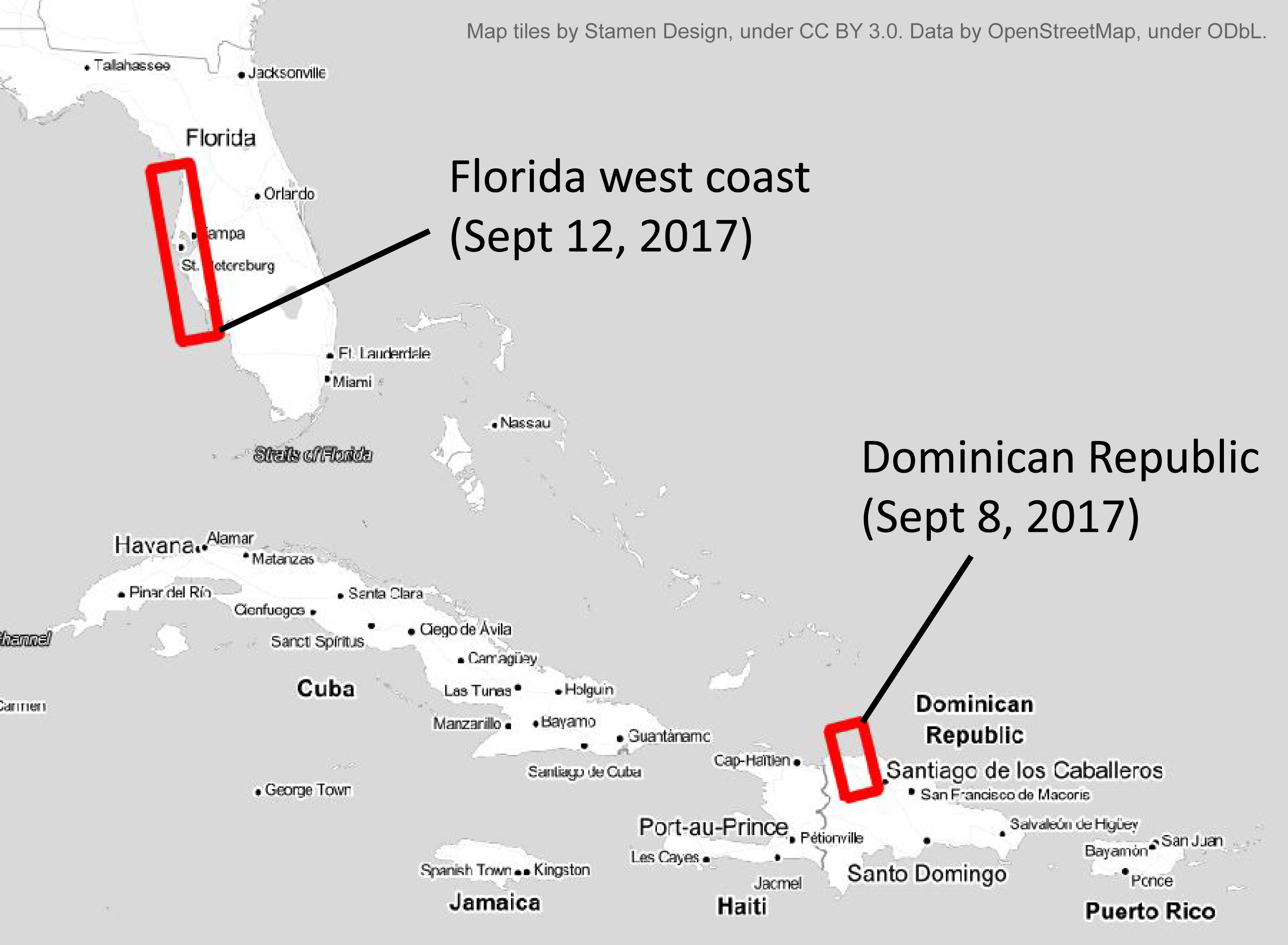 Fig.1 Coverage of PALSAR-2 observation
Dominican Republic | Sept. 8, 2017 (GMT)
Figure 2 shows a PALSAR-2 image observing a northern part of Dominican Republic on Sept. 8, 2017 with the Stripmap/high-resolution mode (10-m resolution; 70-km swath). Blue areas denote estimated flooding surfaces. To remove seasonal surface changes as much as possible, a series of previously-acquired PALSAR-2 images (Oct. 10, 2014; Mar. 1, Aug. 30, 2015; Feb. 28, Oct. 9, 2016; Feb. 26, 2017)were used. Close-up pre-and-post images (Fig. 3) show many flooded areas on likely cultivated lands along the rivers. This observation suggests that flooding hazard is mainly caused on inland cultivated lands rather than the coast areas.
 Fig.2 Whole view of PALSAR-2 image in Dominican Republic (Sept. 8, 2017)
 Fig.3 Close-up views of PALSAR-2 image in Dominican Republic (Feb. 26 and Sept. 8, 2017)
KML file(available to open in Google Earth)
1.Flood area (2017/9/8, Dominican Republic)
2.PALSAR-2 coverage (2017/9/8, Dominican Republic)
West coast of Florida, the U.S. | Sept. 12, 2017 (GMT)
Figure 4 shows a PALSAR-2 image observing a west coast of Florida, the U.S. on Sept. 12, 2017 with the Stripmap/high-resolution mode (10-m resolution; 70-km swath). Blue areas denote estimated flooding surfaces. To remove seasonal surface changes as much as possible, a series of previously-acquired PALSAR-2 images (Jan. 20, Sept. 1, 2015; Jan 19, Aug. 30, 2016) were used. A couple of close-up pre-and-post images shows that broad coastal zones around the Chassahowitzka River are estimated to be flooded (Fig. 5; (A) in Fig. 4). Another couple shows that new flooding areas were formed in Myakka River State Park (Fig. 6; (B) in Fig. 4). This observation suggests that numerous flooding surfaces have been caused by the Hurricane Irma.
 Fig.4 Whole view of PALSAR-2 image in a west coast of Florida, the U.S. (Sept. 12, 2017)
 Fig.5 Close-up views of PALSAR-2 image around the Chassahowitzka River ((A) in Fig. 4)
 Fig.6 Close-up views of PALSAR-2 image around Myakka River State Park ((B) in Fig. 4)
KML file(available to open in Google Earth)
1.Flood area (2017/9/12, Florida west coast)
2.PALSAR-2 coverage (2017/9/12, Florida west coast)
© JAXA EORC
© Copyright 1997- All Rights Reserved.