
ALOS-2/PALSAR-2 Observation Results of Mt. Shindake Volcano,
Kuchinoerabu-jima Island
- SAR Interferometry -
The Japan Aerospace Exploration Agency (JAXA) observed Mt. Shindake volcano, Kuchinoerabu-jima Island with
the Advanced Land Observing Satellite-2 "DAICHI-2" (ALOS-2)/ the Phased Array Type L-band Synthetic Aperture Radar type 2 (PALSAR-2) on August 21, 2014, 0:38(JST) as shown in Fig.1. This observation was done 14 days after the previous August 7, 2014 observation with the same orbital path. From these two images, we processed Differential SAR Interferometry (DInSAR).
As shown in Fig.2, it is difficult to figure out the small deformation of the landscape including the vent from those images taken in 14 days. However, DInSAR can measure the change of the distance between the satellite and the ground in centimeter order. This process can detect the slight deformation.
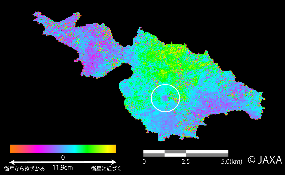
Fig.3 shows the result of DInSAR which represents the deformation of the whole island between 14 days*. In Fig.3, the vent of the Mt. Shindake (white circled part, approx. 350m in diameter) is colored with purple which means approximately 2cm extension of the distance between the ground and the satellite has happened. As the incidence angle of the radar pulse was 60degree, the vent may have sunk about 4cm if there was no horizontal movement.
* (The change of the distance in Fig.3 corresponds to the color of the scale bar. The maximum scale of the range is 11.9cm, the half of the wavelength of PALSAR-2)
This process has been done with the orbital estimation with GPS data and 50m resolution National Land Numerical Information, but without compensation of the atmospheric effects.
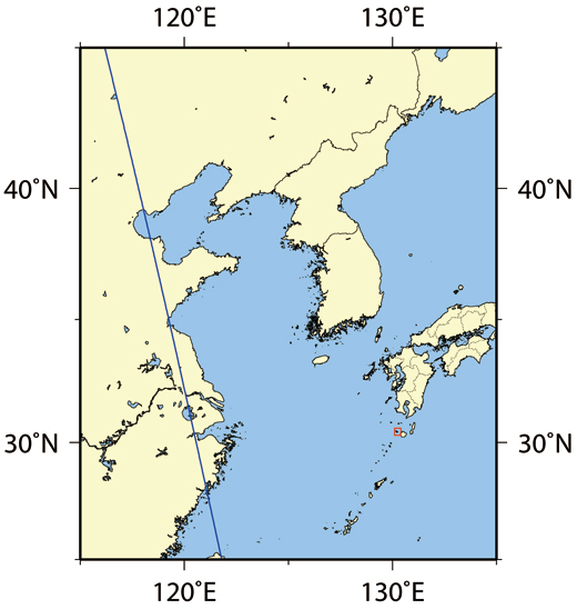 Fig.1: Observation area (Kuchinoerabu-jima island, Kagoshima) and the satellite path
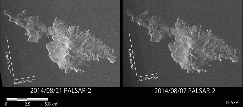
Left: Observed in 21 Aug. 2014. Right: Observed in 7 Aug. 2014.
(Click to view enlarged image)
(Click to view enlarged image)
JAXA has provided those observed PALSAR-2 images to the municipal agencies. JAXA will continue the observation and analysis at this area.
© JAXA EORC
© Copyright 1997- All Rights Reserved.