2021
July 21, 2021
EORC/JAXA
JAXA's Automated Satellite Image Stacking Tool (ASIST) is now available for educational and research users
1. Abouts ASIST
1.1. Overview
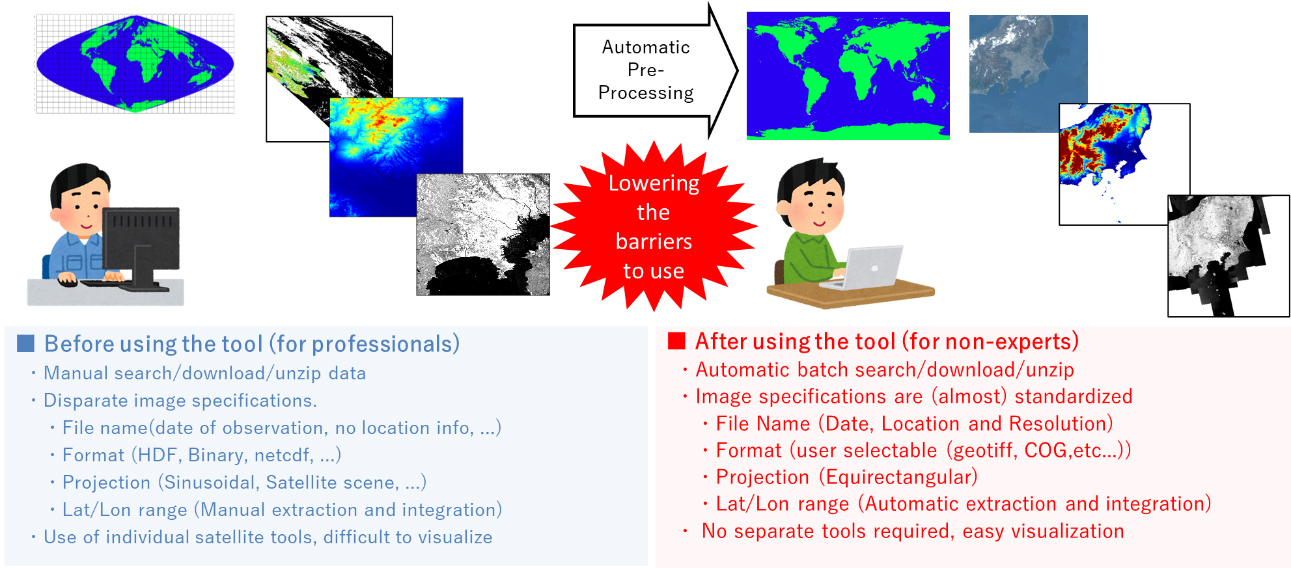
JAXA operates a wide variety of satellite data distribution sites. Typical distribution sites include G-portal (GCOM-C (Shikisai), GCOM-W (Shizuku) data, etc.), AW3D (elevation data), and GSMaP (precipitation data). However, the data format and specifications of these satellite data vary depending on the distribution site and sensor type, and it is time-consuming to combine multiple data sets for use.
Therefore, in order to reduce the time and effort required for data processing and to promote the use of JAXA satellite data, JAXA/EORC has been developing interdisciplinary satellite data preprocessing tool (Automated Satellite Image Stacking Tool: ASIST). As shown in Figure 1, ASIST makes it possible to acquire, pre-process, and output data in batches without regard for differences in distribution sites or satellite data specifications.
1.2. Main function
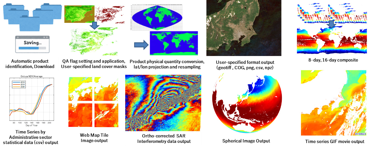
ASIST has the functions shown in Figure 2. However, please note that some functions are not supported by types of satellite products and some functions are specific to them. (e.g., automatic download is not available for ALOS-2 products, and automatic pair search and interference processing functions are available for ALOS-2 products (unique functions).
1.3. Processable products
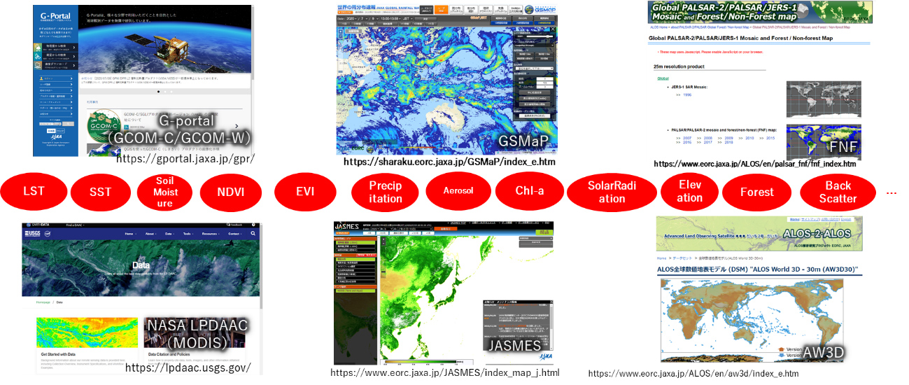
ASIST supports a total of more than 200 types of products, including land surface temperature, sea surface temperature, vegetation index, precipitation, elevation, and others, regardless of the fields such as atmosphere, ocean or land, as shown in Figure 3. Note that user registration is required beforehand for the data distribution site of the source data to be used.
2. ASIST and user manual
ASIST can be downloaded from the zip file [1][2][3] in this page and used for education and research. For other details, please refer to the manual [4].
[1] ASIST (for Windows users)
[2] ASIST (for Linux(Ubuntu) users)
[3] ASIST setup files
[4] ASIST user manual (English)
3. ASIST Secretariat and Contact information
If you have any questions about ASIST or if you would like to present your research results, please send an e-mail to the following address. In order to continue the development of ASIST, we would appreciate it if you could provide us with examples of your use of ASIST to the extent possible.
(ASIST Secretariat)
4. Reference
4.1. JAXA data distribution sites supported by ASIST (excerpt)
[1] JAXA G-portal
[2] ALOS Global Digital Surface Model "ALOS World 3D - 30m (AW3D30)"
[3] Global Satellite Mapping of Precipitation (GSMaP)


