Seen from Space 2014
Climate Change and Forest
- Decreasing Forest Resources and Illegal Logging -
|
The 18th session of the Conference of the Parties to the United Nations Framework Convention on Climate Change (UNFCCC/COP18) was held from November 26 to December 8, 2012, with the term extended for one day, in Doha, the capital city of Qatar. In 2012, at the end of the first commitment period of the Kyoto Protocol, 2008~2012, discussions had taken place on the commencement of the second commitment period, the construction of new framework after 2020, and the technical cooperation and grant aid from advanced to developing countries under Green Climate Fund management. 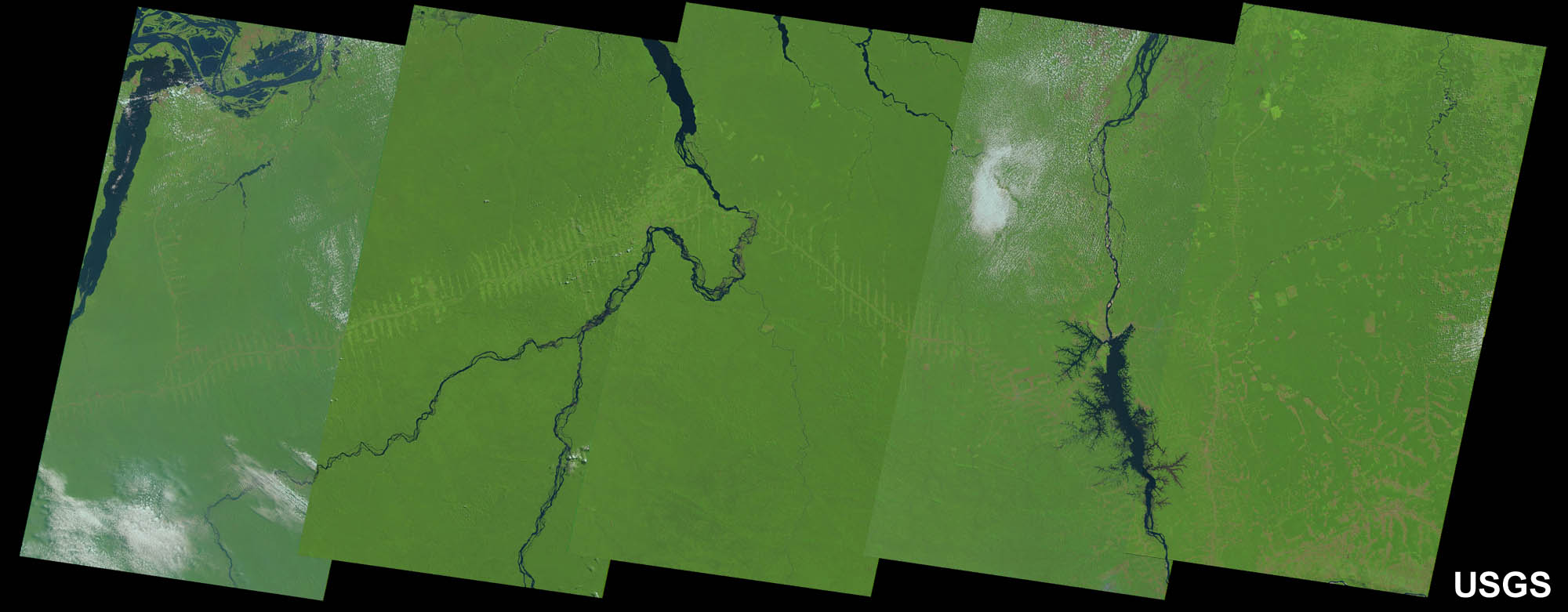 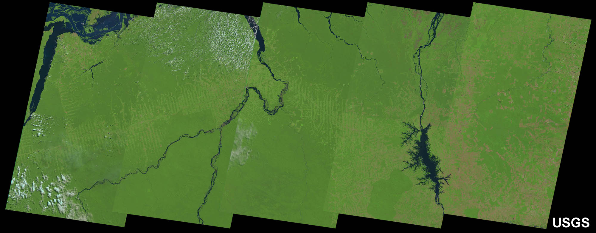
The Japanese Earth Resources Satellite (JERS-1), which was launched in 1992, is equipped with two sensors -optical (OPS) and L-band synthetic aperture radar (SAR)- that were developed in and operated from Japan. L-band SAR transmits radar signal with wavelength of 23.6 cm, which can penetrate tree leaves and branches, and retunes to the SAR receiver after double-bounce scattering on the trunks. The ground surface then returns the back-scattering wave to include information about the cross section of tree trunks for the estimation of forest biomass. Phased array-type L-band synthetic aperture radar (PALSAR) image data agrees well in both radiometric and geometric accuracy; thus, a global mosaic image was successfully produced. The Japan Aerospace Exploration Agency (JAXA) has produced global mosaic images within spatial resolutions of 10 m, 25 m, and 50 m by using observed data from the years 1995, 2007, 2008, 2009, and 2010. By using these images, the evaluation of the accuracy of forest/non-forest classification is ongoing, as shown in the 10 m resolution image obtained in 2009 (Fig. 2). 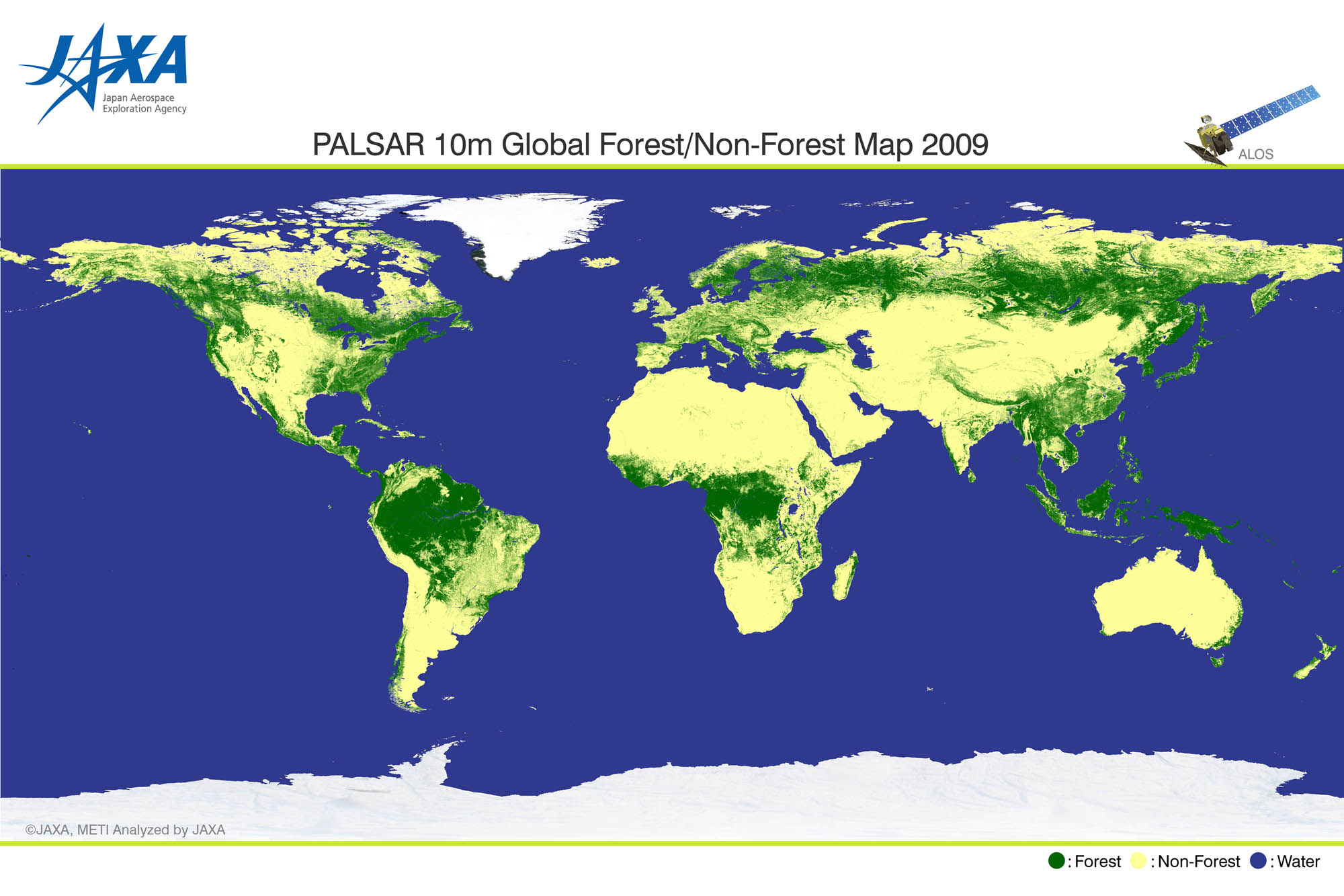
The actual lifespan of JERS-1 was six years and eight months during the period from February 1992 to October 1998, which is longer than that of the designed lifespan, and the archived data is available for users. Furthermore, an Advanced Land Observation Satellite (ALOS) was operated for five years and three months during the period January 2006 to April 2011, and the data archive is available. 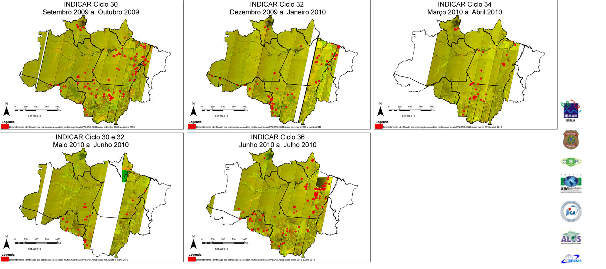
Forest-based carbon fixation estimation methods include the use of regional or national statistical data, remote-sensing data analysis, and transportation and biological models. More widespread accessibility of Earth observation satellite data has led to improvements in how remote sensing information is obtained for information such as forest-cover distribution, above-ground biomass, and species type. In accordance with forthcoming guidelines from the Intergovernmental Panel on Climate Change (IPCC), the UNFCCC will request reports on greenhouse gas absorption and emission data from each participating nation. This international cooperation is vital in the ongoing examination and improvement of satellite data applications, in addition to practical planning by which to adapt to changing research requirements. Footnotes*1 During the 16th session of the Conference of Parties (COP16), held from November 29 to December 10, 2010, in Cancún, Mexico, a plan was adopted to grant $100 billion in aid to developing countries by 2020, as part of the post-2013 framework; the Green Climate Fund was launched to manage the grant. *2 On Nov. 28, 2012, according to National Institute for Space Research (INPE) data, the area of deforestation in the Amazon region during August 2011–July 2012 was 4,656㎢, which is a decrease of approximately 27%, compared with that of the previous year. It is the minimum record in the period since the beginning of investigation in 1988, and the record breaks have continued for 4 years. The investigation area shown in Fig. 3 includes forest region covering nine states in northern Brazil and includes approximately 60% of the Amazon rainforest, which is the world’s largest. The area lost to deforestation documented by the INPE data, caused mainly due to logging, was approximately 16% from that of the Amazon’s maximum acreage of 1994~95. Armed with this most recent advanced data analysis from Earth observation satellites, the Brazilian government continues its battle against illegal logging. Reference sites
Explanation of the Images:
The image data in Figure 1 is downloaded free of charge from the U.S. Geological Survey’s (USGS) Global Visualization Viewer (GLOVIS).
Related Sites |


