Seen from Space 2011
Miyazaki and Aoshima, Japan
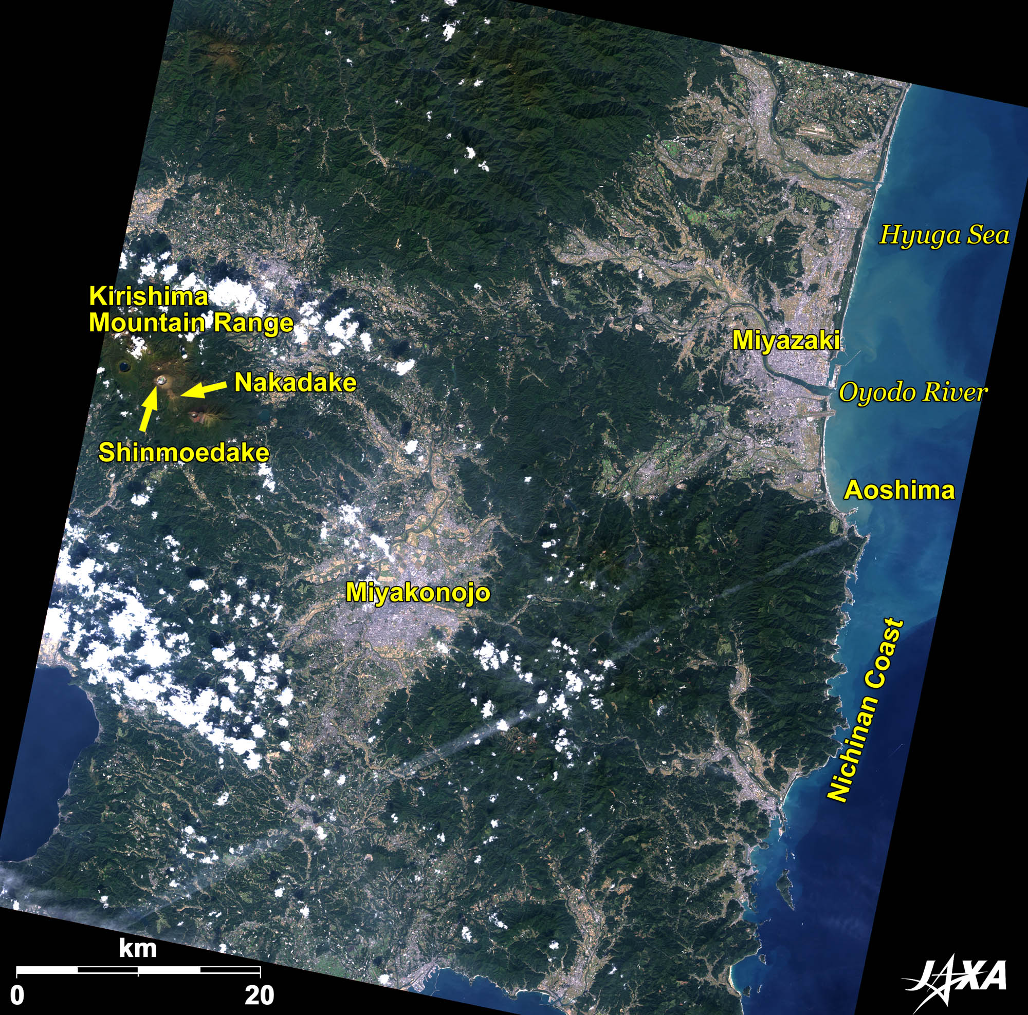 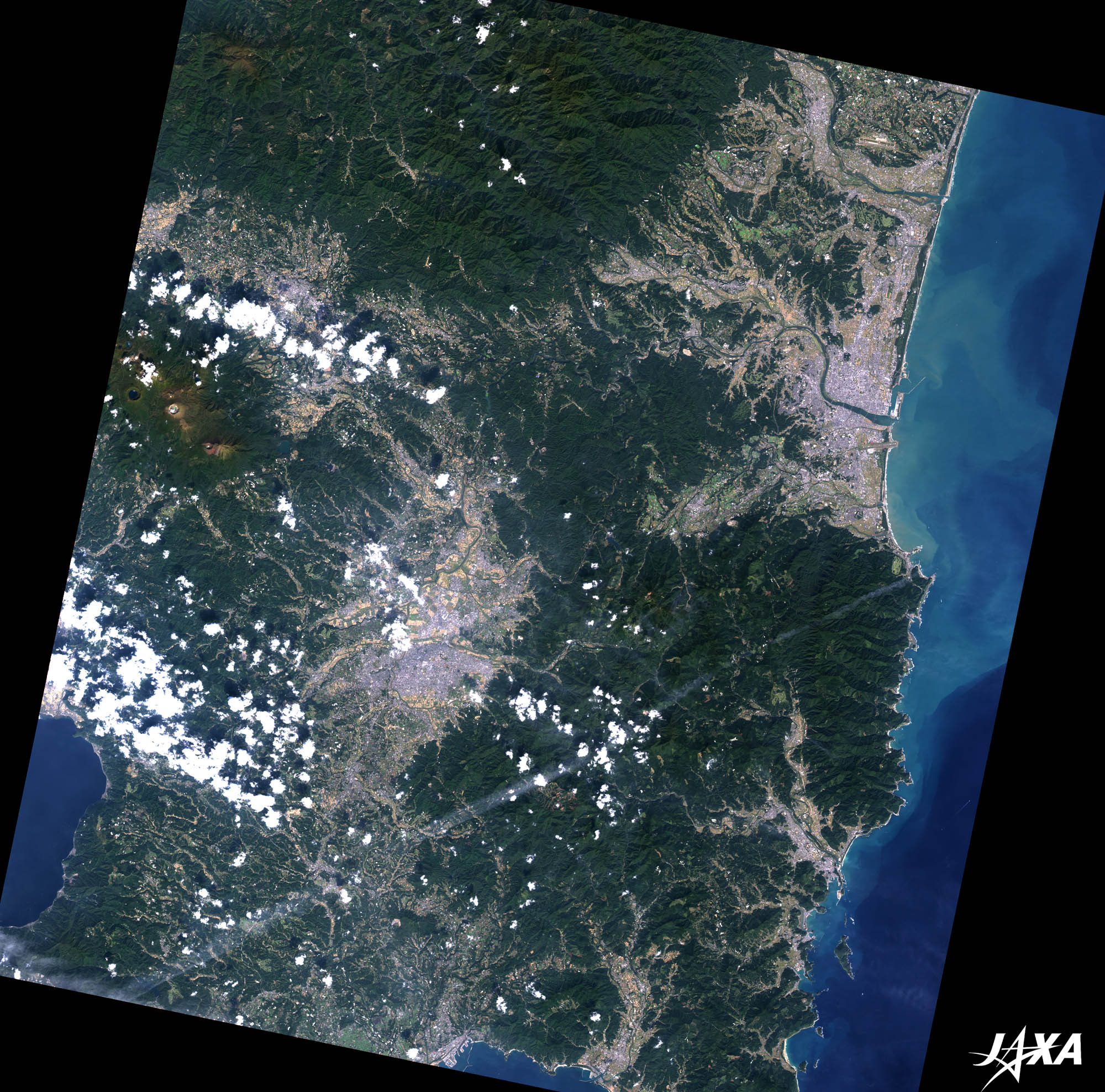 Fig. 1. Southern Part of Miyazaki
Figure 1 is an image of southern Miyazaki Prefecture, Japan, as observed by ALOS (“Daichi”) in November 2010. The city visible at the upper right is Miyazaki, the capital of Miyazaki Prefecture. Since Miyazaki faces the Pacific Ocean (the Hyuga Sea) where the Black Current flows, its climate is rather mild with rich precipitation and sunshine. The warm climate helps the forcing culture of tomatoes, green peppers, and cucumbers in the Miyazaki Plain extending south of the Oyodo River. Mt. Shinmoedake in the Kirishima Mountain Range, visible at the left of the image, has recently erupted repeatedly. 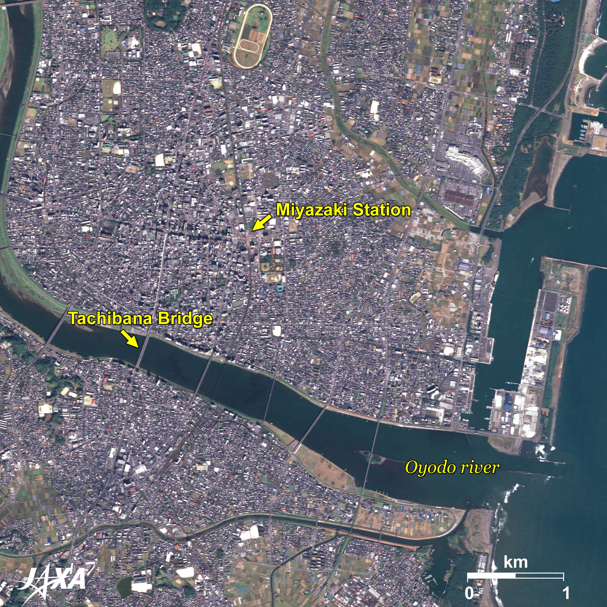
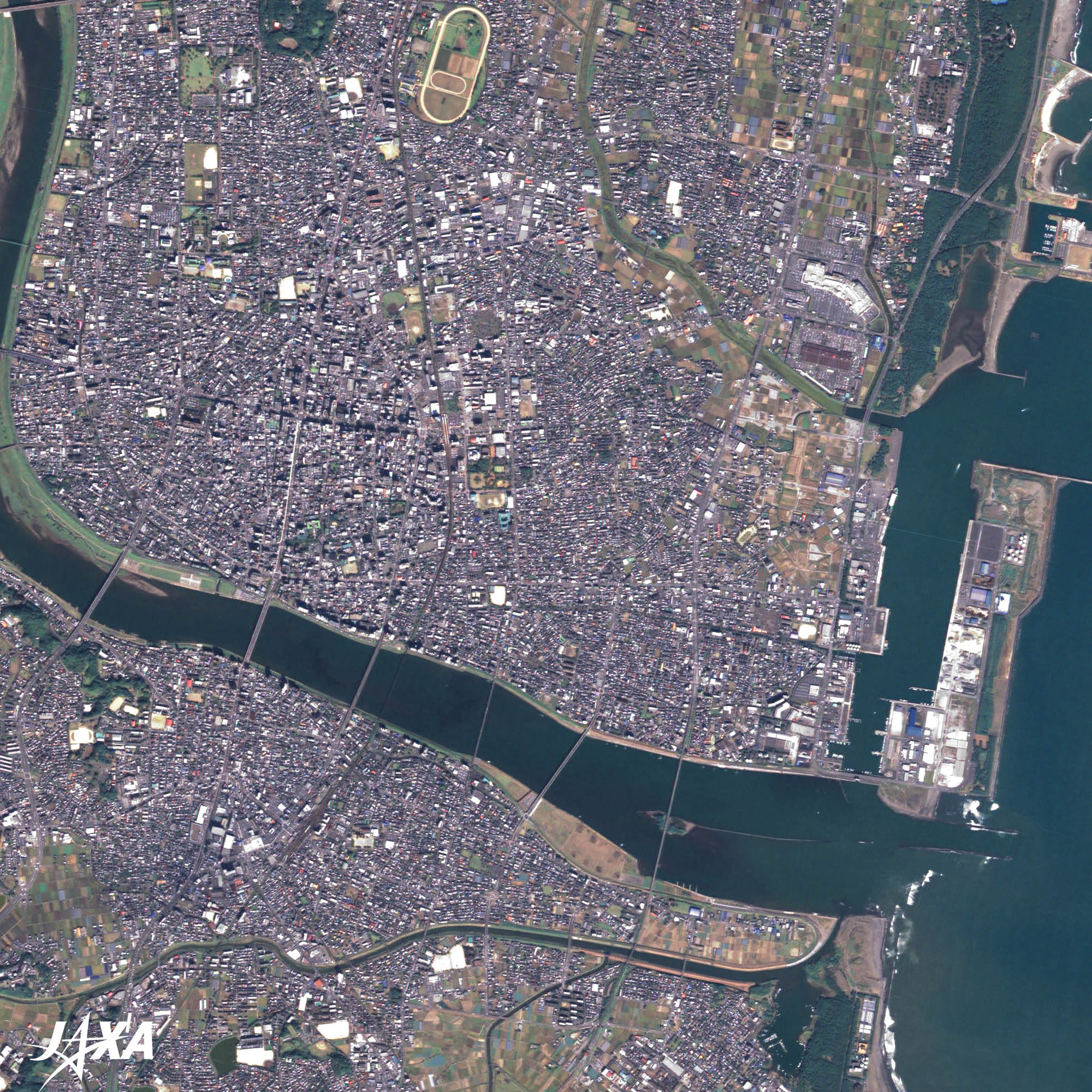
Fig. 2. Enlarged Image of Miyazaki
Miyazaki (kmz, 5.47 MB, Low Resolution) as seen on Google Earth. Figure 2 is an enlarged image of Miyazaki. Miyazaki, with a population of 400,000, has developed since the prefectural office was placed there in the Meiji period (1868-1912) and became the largest city in the prefecture. Miyazaki Prefecture was called Hyuga Province, where small domains such as Nobeoka, Obi, and the feudalities of Satsuma and the Shogunate were complexly located. During the Meiji Restoration, abolition of the domain system and establishment of the prefectural system took place, and Mimitsu Prefecture and Miyakonojo Prefecture were established on both sides of the Oyodo River. The two prefectures were consolidated later becoming Miyazaki Prefecture with the capital placed in the middle. Without having a historical core, the capital developed rapidly as a center of politics and commerce, and was promoted to Miyazaki City at its municipalization in 1924. 
Aoshima and the Nichinan CoastThe island jutting out into the Hyuga Sea southeast of the Oyodo River is a well-known resort island called Aoshima. Smooth coast line to the south from the river draws a complex pattern. The coast from Aoshima to Cape Toi at the southernmost part of the prefecture is the Nichinan Coast. 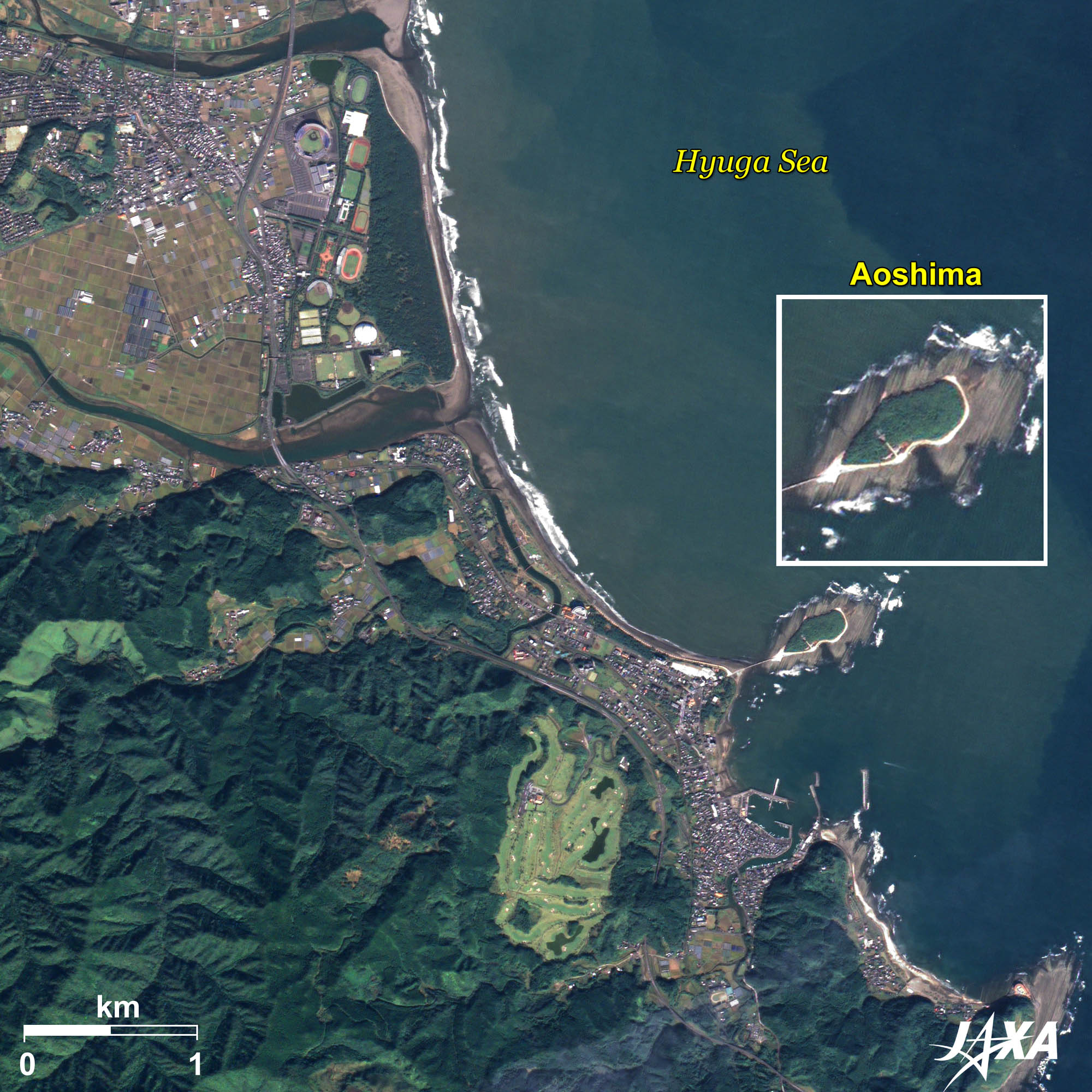 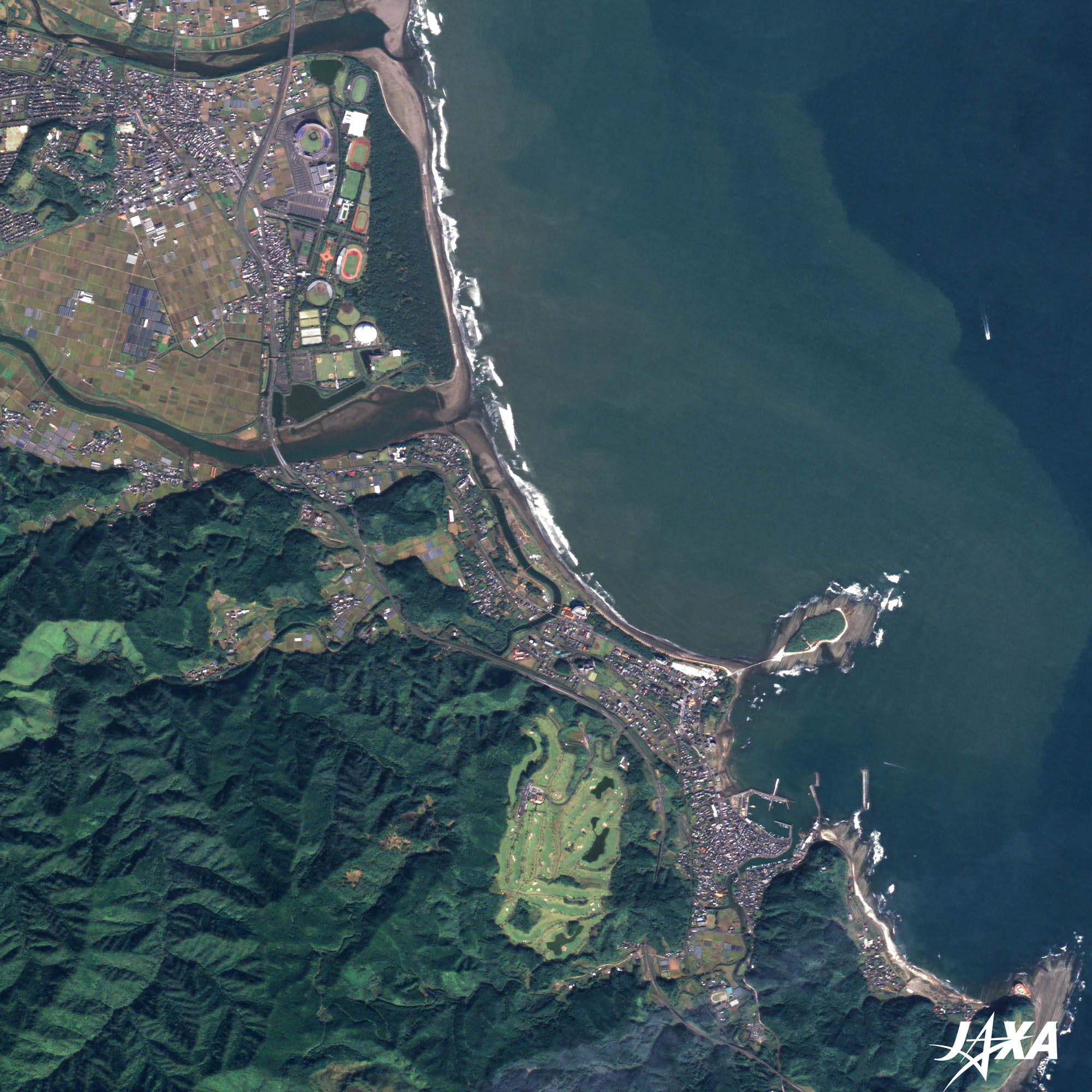 Fig. 3. Aoshima and Its Vicinity
Aoshima and Its Vicinity (kmz, 4.52 MB, Low Resolution) as seen on Google Earth. Figure 3 is an enlarged image of Aoshima and its vicinity. Aoshima is 1.5 kilometers around and 6 meters above the sea at its highest. It is connected by a bridge and now by a sandbar on the opposite coast. A unique rock formation around the island was created by strata, with sandstone and mudstone overlapping in turns, and rose to the surface through the erosion of crashing waves. Due to its resemblance to a washboard, the landform is referred to as “the Devil’s Washboard” and was designated a national Natural Monument as “Aoshima Upheaval from the Sea Floor and Wave-shaped Rocks.” Subtropical plant communities of Chinese fan palms (Livistona chinensis palm) and orchid trees (Bauhinia scandens) on the island are also designated national Special Natural Treasures. Explanation of the Images:
AVNIR-2 has four observation bands. The color composite images are produced by assigning red to Band 3 (610 to 690 nm), green to Band 2 (520 to 600 nm), and blue to Band 1 (420 to 500 nm). The resulting images have natural coloring as if seen by the naked eye. Each color indicates the following ground objects:
(Fig. 2 and 3) |