Seen from Space 2011
Fire Country: Kumamoto, Japan
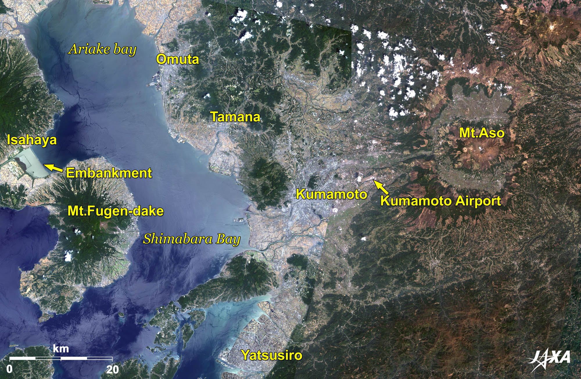 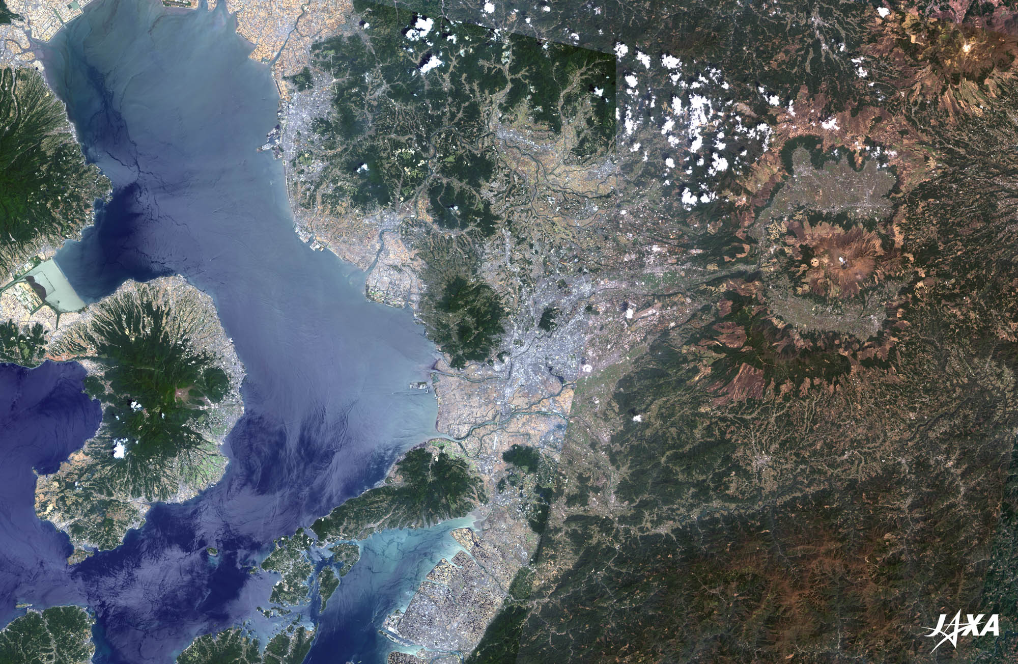 Fig. 1. Kumamoto and Its Vicinity
Figure 1 is a composite image of Kumamoto, Japan and its vicinity as observed by ALOS (“Daichi”) in April 2010 (right-hand side) and June 2010 (left-hand side). The bluish-gray area in the center of the image is Kumamoto. Two active volcanoes, Mt. Aso in the east and Mt. Fugen-dake at Unzen in the west, look like they are converging on the city, giving Kumamoto the name “Fire Country.” The Kyushu Shinkansen (bullet train) connects Yatsushiro (seen at the bottom), Tamana, Omuta, and Hakata further north (not visible). 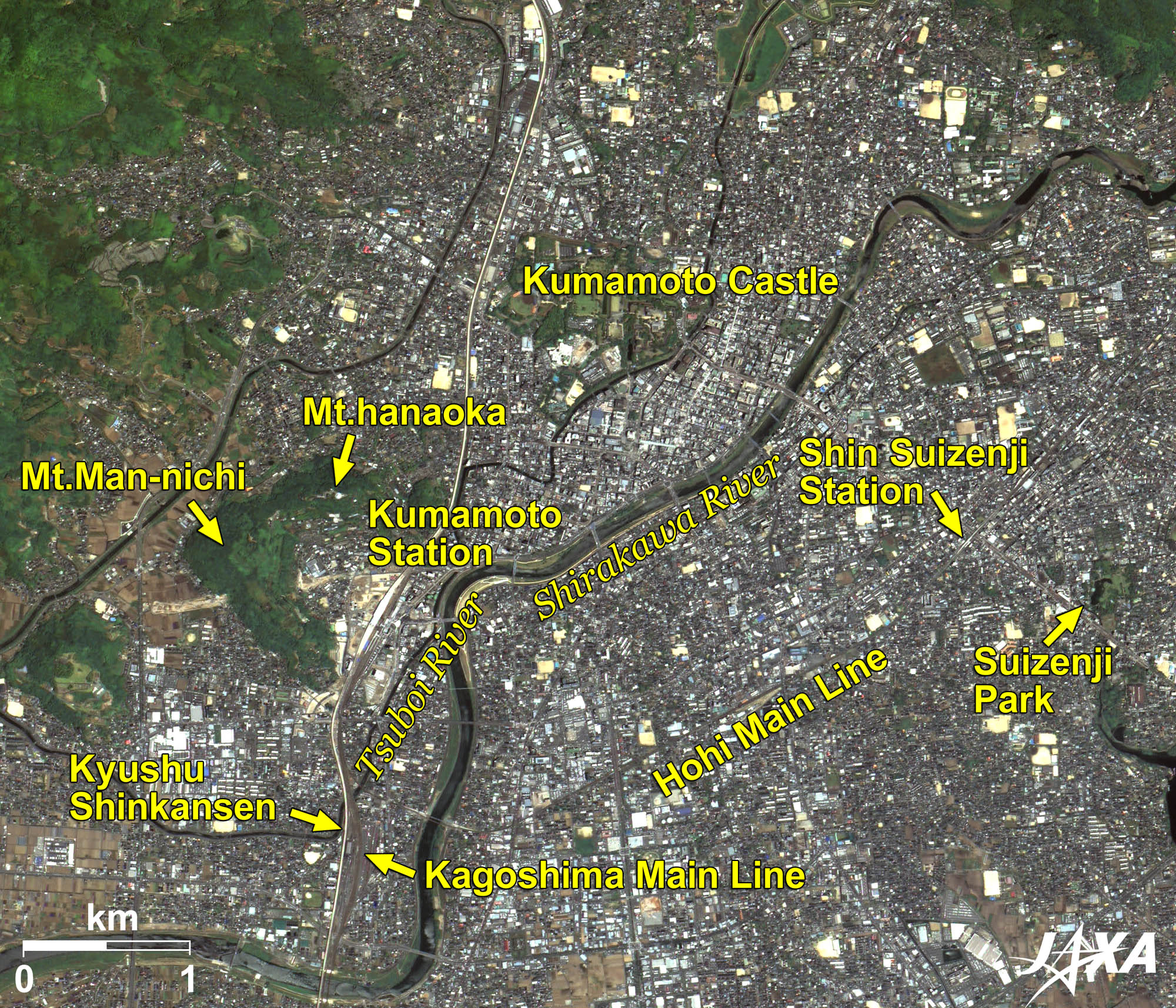
Fig. 2. Enlarged Image of Kumamoto
Kumamoto (kmz, 5.02 MB, Low Resolution) as seen on Google Earth. Figure 2 is an enlarged image of the urban area of Kumamoto. The railway track of the Kyushu Shinkansen, which opened for service on March 12, is visible as a white vertical line. The conventional JR (Japan Railways) Kagoshima Main Line runs beside the Kyushu Shinkansen. Mountains (Mt. Hanaoka and Mt. Man-nichi) and rivers (Shirakawa River and Tsuboi River) surround Kumamoto Station. The area is under development in accordance with the opening of the Kyushu Shinkansen. 
The Kyushu ShinkansenThe Kyushu Shinkansen was already in service between Kagoshima Central Station and Shin Yachiyo Station in Kumamoto. With service opening between Shin Yachiyo and Hakata (130 km total) as of March 12, development of the Kyushu Shinkansen (Kagoshima route) between Kagoshima Central Station and Hakata Station is complete. As a result, the Kyushu Shinkansen now carries out service across the entire line, which connects Kumamoto to Hakata in 33 minutes and to Kagoshima in 44 minutes at its swiftest. Mutual roll up of trains between the Kyushu Shinkansen and the Sanyo (mid-western area of Japan’s main island) Shinkansen is also planned.
Kumamoto CastleFamous warlord Kiyomasa Kato completed Kumamoto Castle in 1607 after 7 years of labor. It is one of three renowned castles in Japan. After the banning of the second lord, Tadahiro Kato, Tadatoshi Hosokawa entered the castle as the first local lord of the Higo-Kumamoto Domain. Kumamoto then became the center of the domain and Hosokawa’s family flourished for 239 years and 11 generations, occupying a 540,000-goku* feudality. * Goku (or Koku) is a unit to measure the weight of rice grains. One goku is about 143 kg, which is equivalent to the amount of rice that one man eats per year, and requires a rice field area of 990 m2 to produce it. Thus, the goku unit is also used to express the extent of the feudality that produces that amount of rice.
Suizenji ParkWhile Tadatoshi Hosokawa was on a falconry excursion, he was charmed by a place where clear water was upwelling, and he built a teahouse there. A large-scale garden was landscaped by the third lord Tsunatoshi, and a graceful circuit-style garden of the Momoyama period was completed. With a pond made from the spring water of Aso at its center and representing 53 stations along the Tokaido (the route between Edo (Tokyo) and Kyoto), the garden has been designated as a national scenic and historic place. 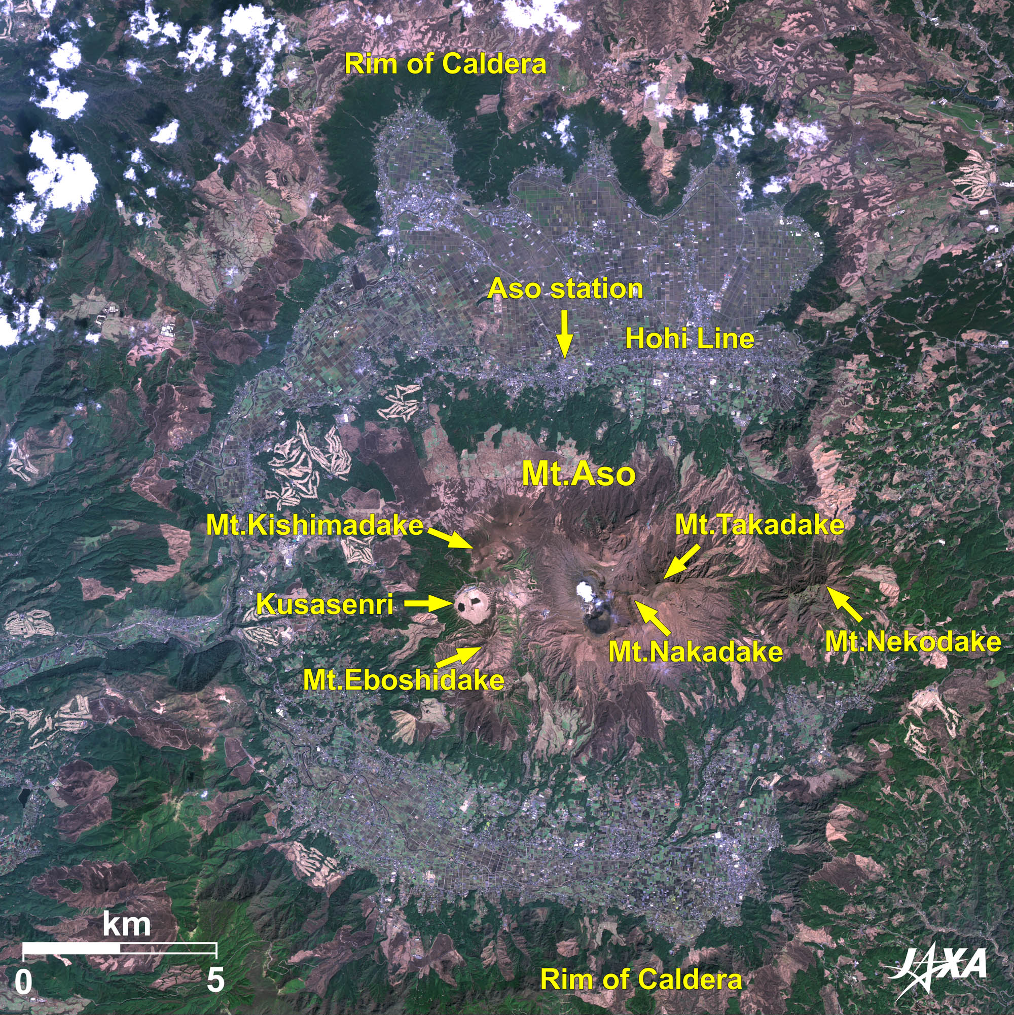  Fig. 3. Enlarged Image of Mt. Aso
Mt. Aso (kmz, 4.73 MB, Low Resolution) as seen on Google Earth. Figure 3 is an enlarged image of Mt. Aso, the rim of the caldera spreading across the whole area of the image. This is one of the largest calderas in the world (17 km east to west, 25 km north to south, with an area of 350 km2). The five central peaks of Aso**, including Mt. Nakadake, are visible inside. The crater (400 m east to west and 1,100 m north to south) west of Mt. Nakadake is still smoking. An aerial tramway service is available to the crater’s rim, where passengers can watch a smoking fumarole up close. **The five central peaks are Mt. Nakadake (1,506 m), Mt. Takadake (1,592 m), Mt. Nekodake (1,408 m), Mt. Kishimadake (1,321 m), and Mt. Eboshidake (1,337 m). With full-service operation of the Kyushu Shinkansen, access to Kumamoto becomes much easier than before. An increasing number of visitors to the great castle and wild nature are expected. Reference Sites:Explanation of the Images:
AVNIR-2 has four observation bands. The color composite images are produced by assigning red to Band 3 (610 to 690 nm), green to Band 2 (520 to 600 nm), and blue to Band 1 (420 to 500 nm). The resulting images have natural coloring as if seen by the naked eye. Each color indicates the following ground objects:
(Fig. 2 and 3) |