Seen from Space 2011
Shin Aomori Station: A New Terminal of the Tohoku Shinkansen
|
The Tohoku Shinkansen (Bullet Train), formerly in commercial operation between Tokyo and Hachinohe, Aomori Prefecture, opened a new service between Hachinohe and Shin Aomori (extended distance about 80 km) on December 4, 2010. The East Japan Railway Company will introduce new cars and operate at the highest speed of 320 km per hour, equivalent to the TGV of the French National Railway. It will connect Tokyo and Shin Aomori (about 675 km) in 3 hours and 5 minutes. 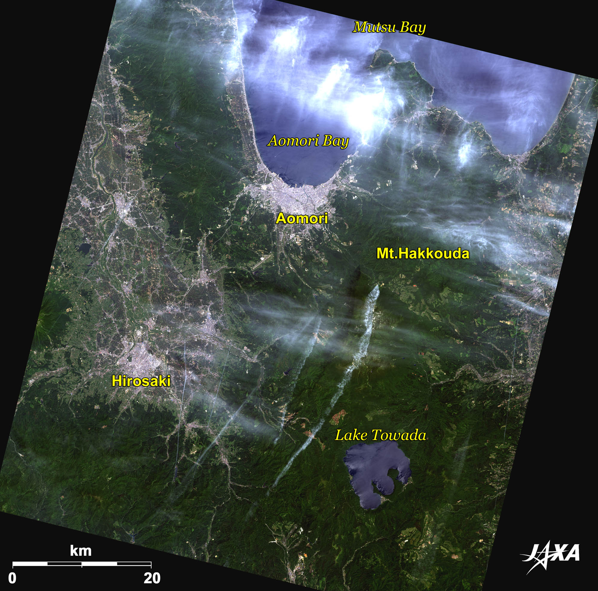 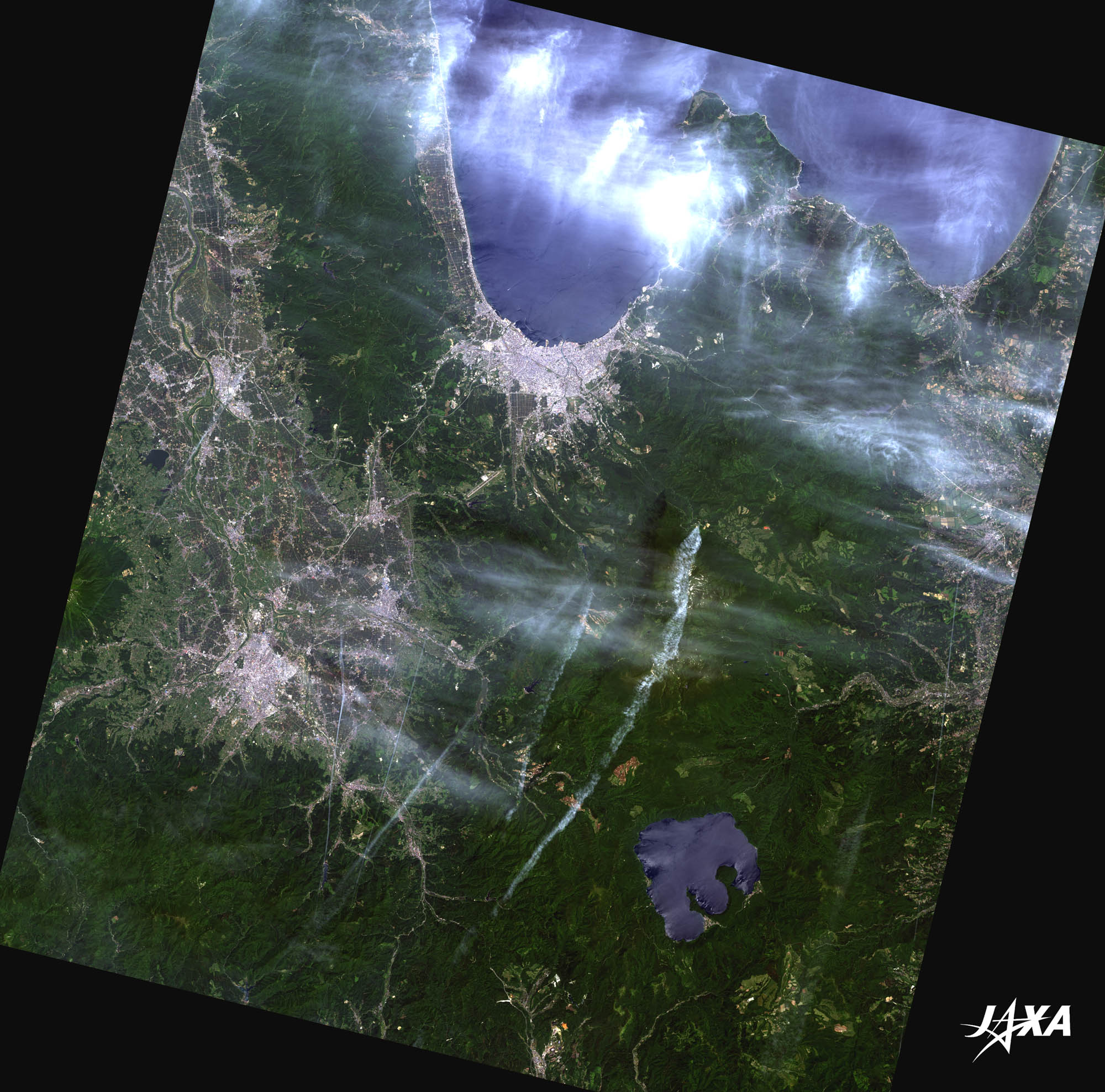 Fig. 1. Aomori City and Its Surroundings
Figure 1 shows Aomori City and its surroundings taken by ALOS (“Daichi”) in June 2010. Aomori City faces Aomori Bay, the southernmost inlet of Mutsu Bay. Since a local harbor was built at Aomori in the Edo period (1603-1868), Aomori has developed into the next largest city to Hirosaki, a castle town seen at the left bottom of the image. The prefectural office was established in Aomori in the Meiji period (1868-1912), making Aomori a central city in the prefecture. Aomori is also a terminal city of the Tohoku Main (conventional) Line between Tokyo and Aomori, the Ōu Main Line between Fukushima and Aomori via Yamagata and Akita, and the Tohoku Expressway. 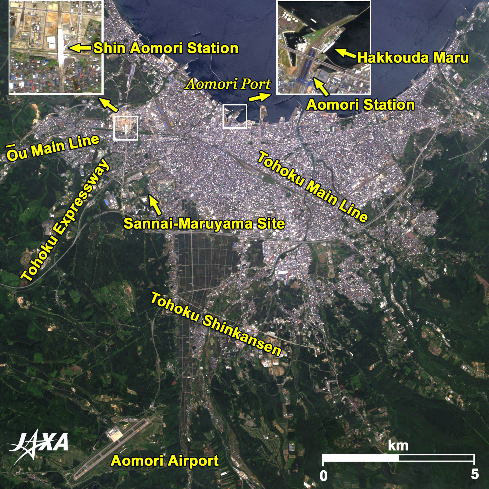
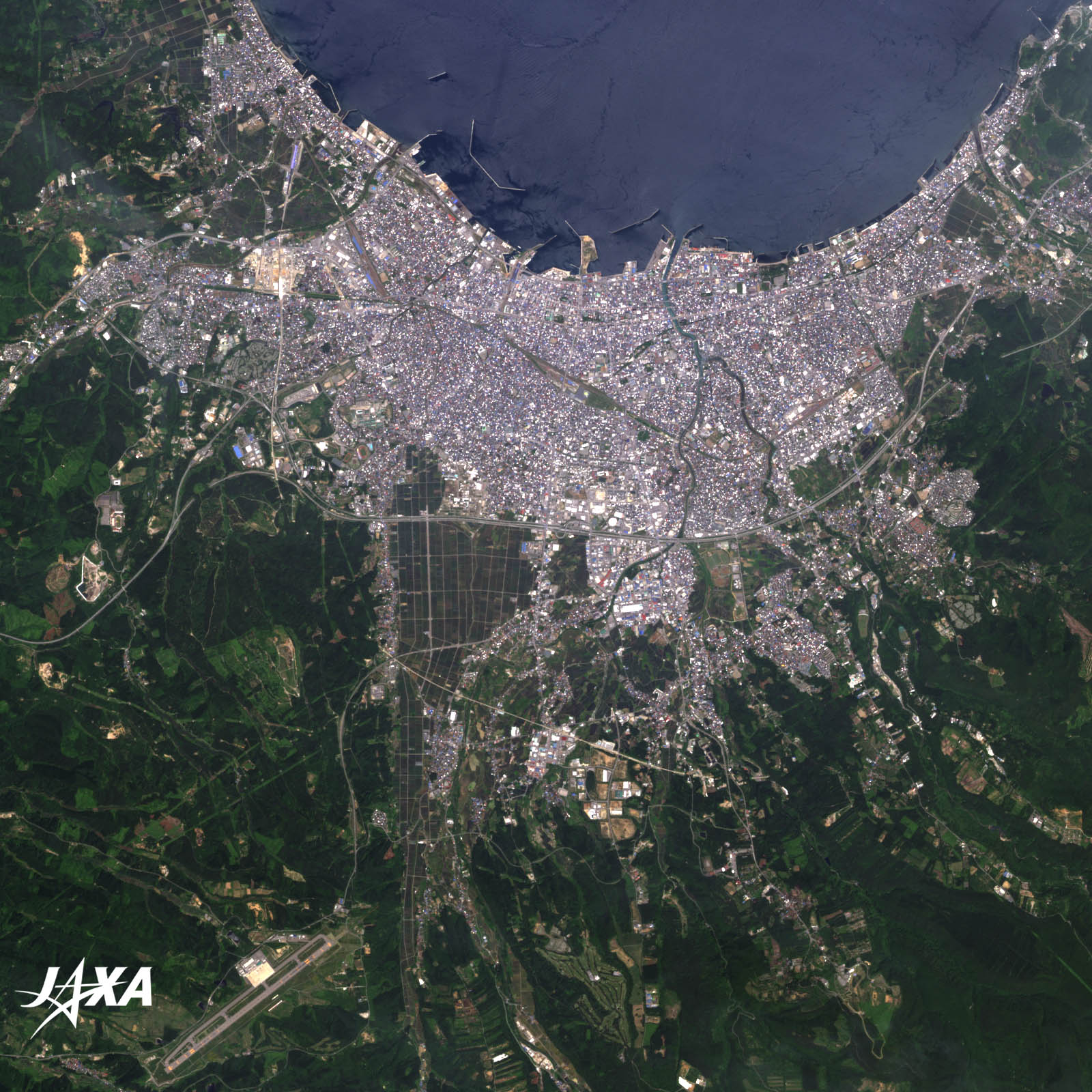
Fig. 2. Enlarged Image of Aomori City
Figure 2 shows an enlarged image of Aomori City. A ferryboat service was the main traffic route between Hokkaido (the northernmost island of Japan) and Honshu (the main island) about 20 years ago, connecting Hakodate Port in Hokkaido and Aomori Port in Honshu. The pier used as a ferry terminal is visible in the figure. The pier became crowded with many passengers at the peak period. The ferryboat service closed with the opening of the undersea tunnel between Aomori and Hakodate in March 1988. The last ferryboat, Hakkouda Maru, is moored at the pier as a memorial. Shin Aomori Station of the Tohoku Shinkansen was constructed at a point that crosses the Ōu Main Line. The Ōu Main Line runs west from Aomori Station, then changes direction to the southwest and goes to Akita via Hirosaki. The Tohoku Shinkansen passes the north side of Mt. Hakkouda and enters Aomori City from the south. The Tohoku Shinkansen is planned to connect to the Hokkaido Shinkansen at the end of the 2015 fiscal year. 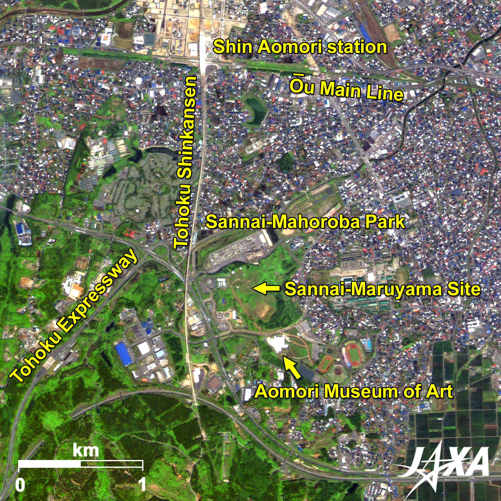 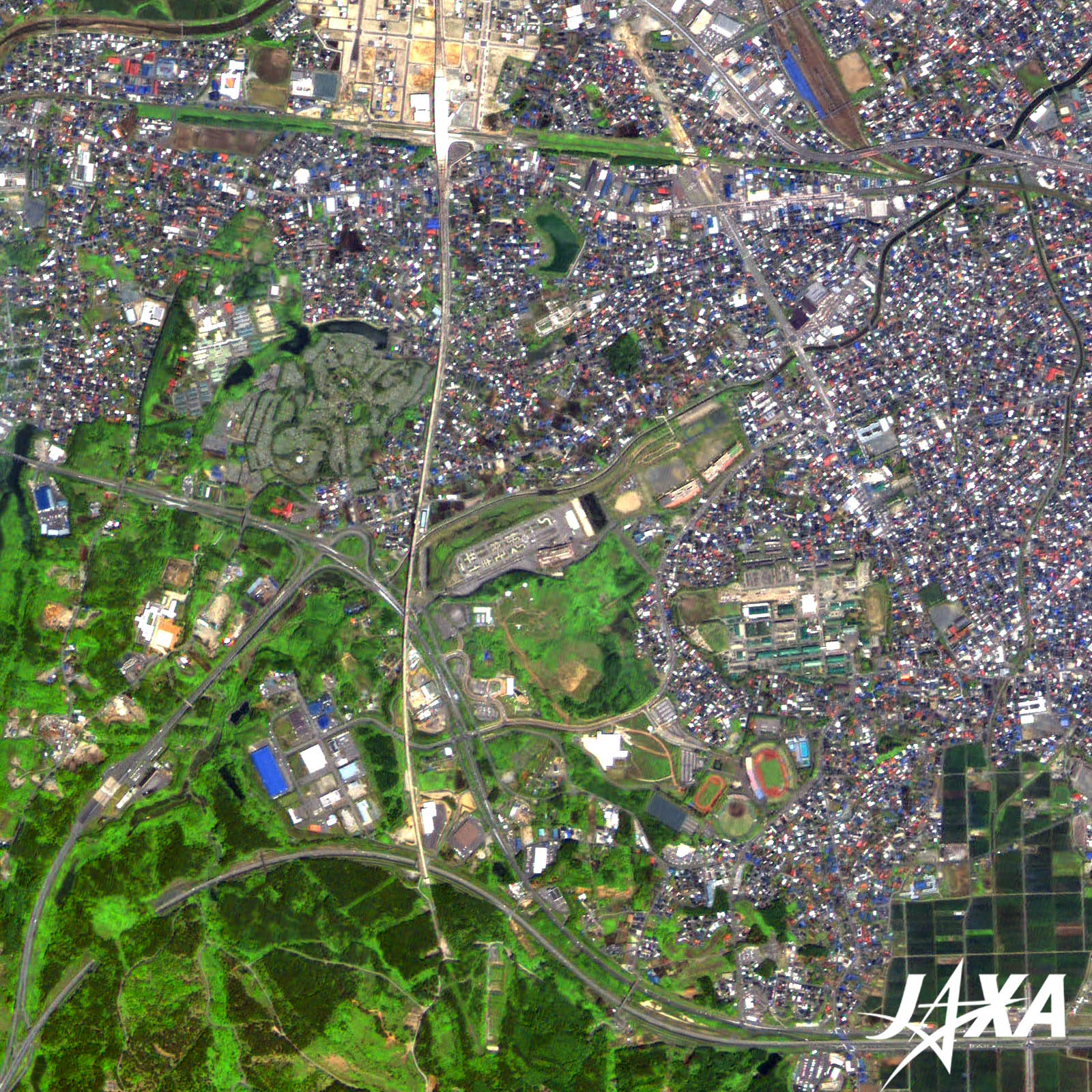 Fig. 3. Enlarged Image of the Area around Shin Aomori Station
Vicinity of Shin Aomori Station (kmz, 4.85 MB, Low Resolution) seen on Google Earth. Figure 3 is an enlarged image of the area around Shin Aomori Station. The Ōu Main Line runs from east to west and the Tohoku Shinkansen intersects perpendicularly at Shin Aomori Station. The Sannai-Maruyama Site in Sannai-Mahoroba Park is located along the Tohoku Shinkansen line, south of Shin Aomori Station. 
The Sannai-Maruyama SiteThe Sannai-Maruyama Site is the large-scale remains of settlements of the Jomon (prehistoric) period in Japan. The site was designated a Special Historical Site in 2000. The site was occupied continuously for a long time around 5,500-4,000 years ago. The remains have been widely known and many have been excavated from the area. The remains excavated since 1992 reveal the characteristics of the settlement and the natural environment of the period. DNA analysis has also revealed traces of chestnut cultivation. These findings have changed the image of the Jomon culture. Reference Sites:Explanation of the Images:(Click the imaged twice to enlarge)
AVNIR-2 has four observation bands. The color composite images are produced by assigning red to Band 3 (610 to 690 nm), green to Band 2 (520 to 600 nm), and blue to Band 1 (420 to 500 nm). The resulting images have natural coloring as if seen by the naked eye. Each color indicates the following ground objects:
(Fig. 3) |