Seen from Space 2010
The Big Volcano and Solar Power Generation Plant in Tenerife, Spain
|
Tenerife is the largest island of the Canary Islands in Spain. The Canary Islands are located about 100 kilometers off the west coast of Morocco and Western Sahara in northwestern Africa. The Canary Islands consist of seven islands formed by volcanic activities. Since the islands are isolated from the African continent, rich varieties of endemic (local) species have developed and live there. These islands, as well as the Hawaiian Islands and the Galapagos, are very important areas from an environmental conservation perspective. Historically, the islands had been prosperous as transit ports to the American continents; however, today, the islands have become world-class resorts. The highest peak in Spain, Mt. Teide at 3,718 meters, is in Tenerife. La Palma, the island northwest of Tenerife, is home to the Gran Canary Telescope, which is 10.4 meters in diameter, and Gran Canaria, the eastern neighbor of Tenerife, has a ground station of the Spanish National Institute for Aerospace Technology (INTA) for satellites together with a co-located JAXA’s antenna. for satellites together with a co-located JAXA’s antenna. 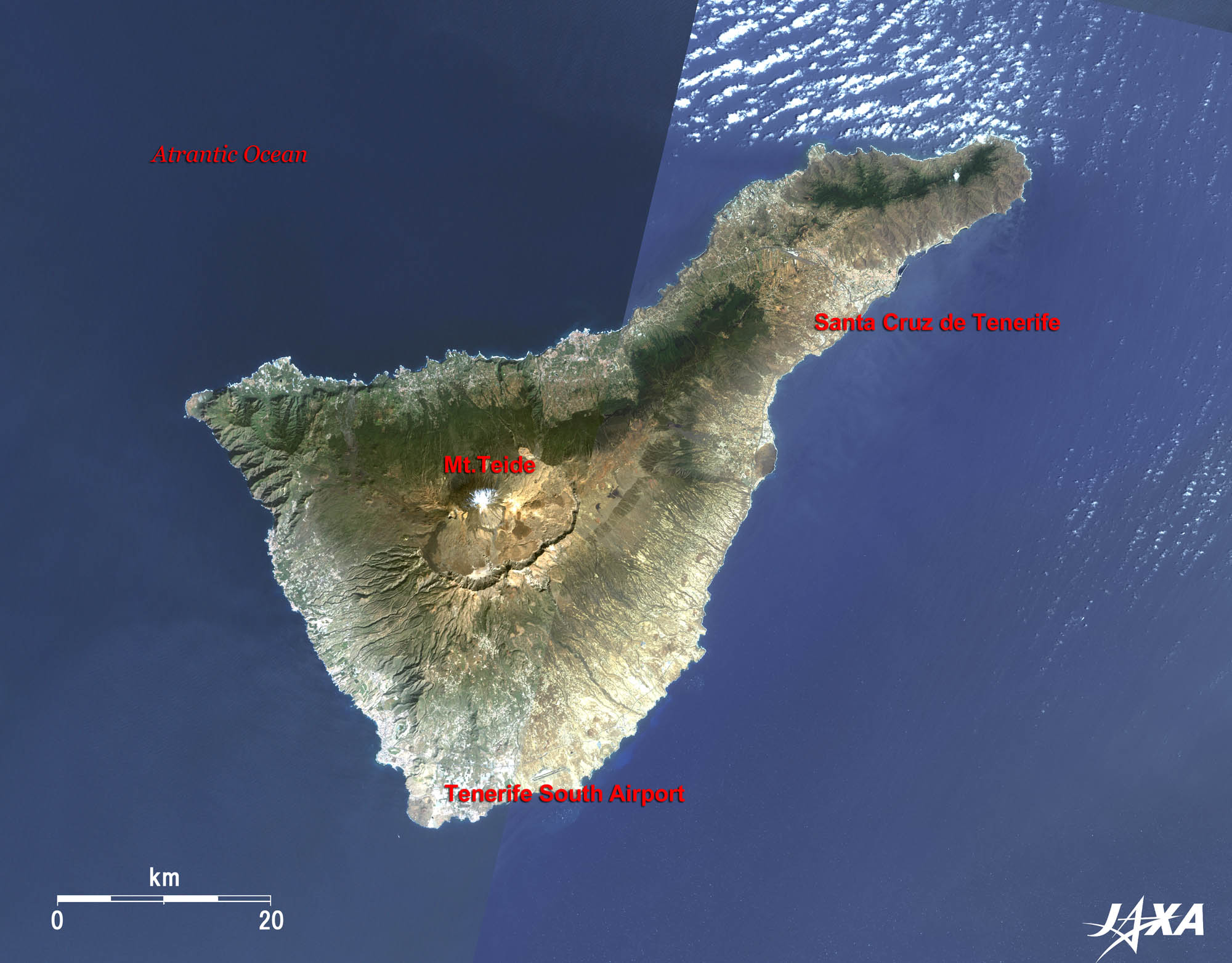 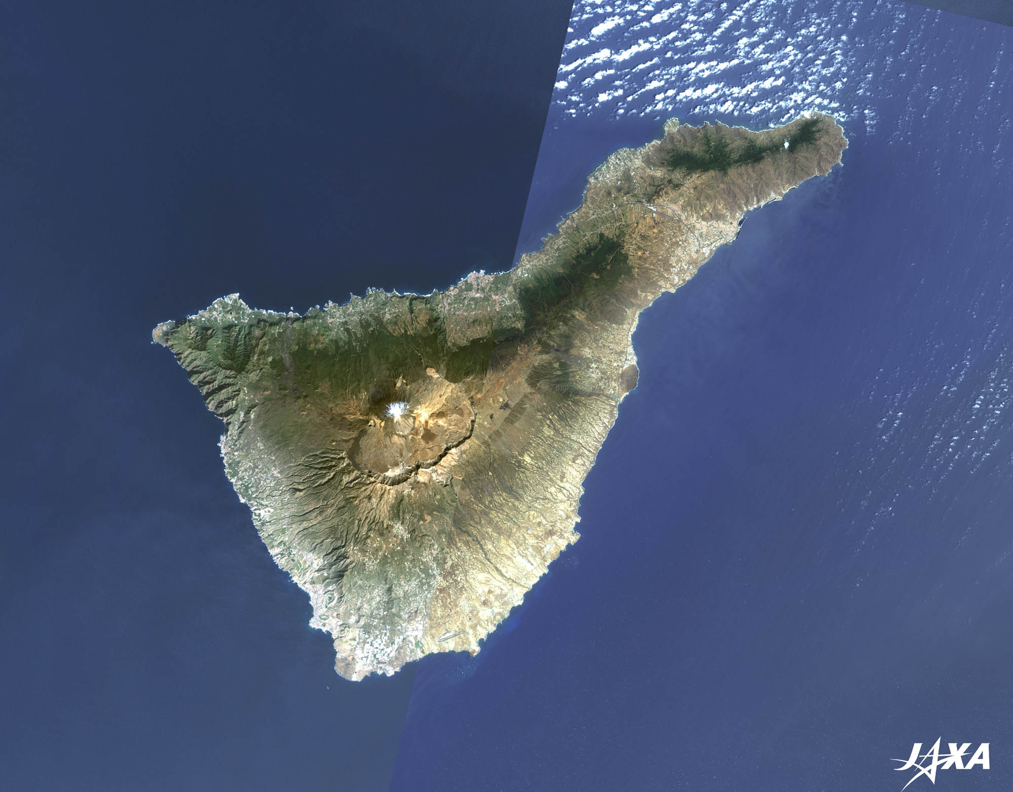 Fig. 1. A Complete View of Tenerife
Figure 1 shows the entire island of Tenerife. The left half of the image was taken by Landsat-7 in February 2002 and the right half of the image was taken by ALOS (“Daichi”) in July 2009. The total area of the island is 2,034 km2. The volcano with a big caldera at the center of the image is Mt. Teide. The volcano is now dormant, but damages caused by eruptions in the eighteenth century were disastrous. A cable car carries tourists close to the top (3,555 meters). You can see Santa Cruz de Tenerife, the capital of the islands, along the sea coast in the upper right. 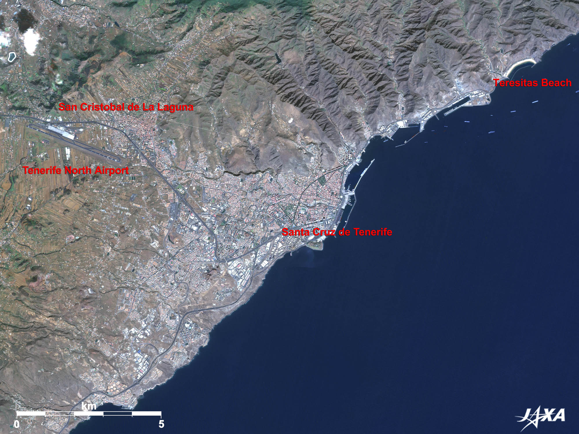 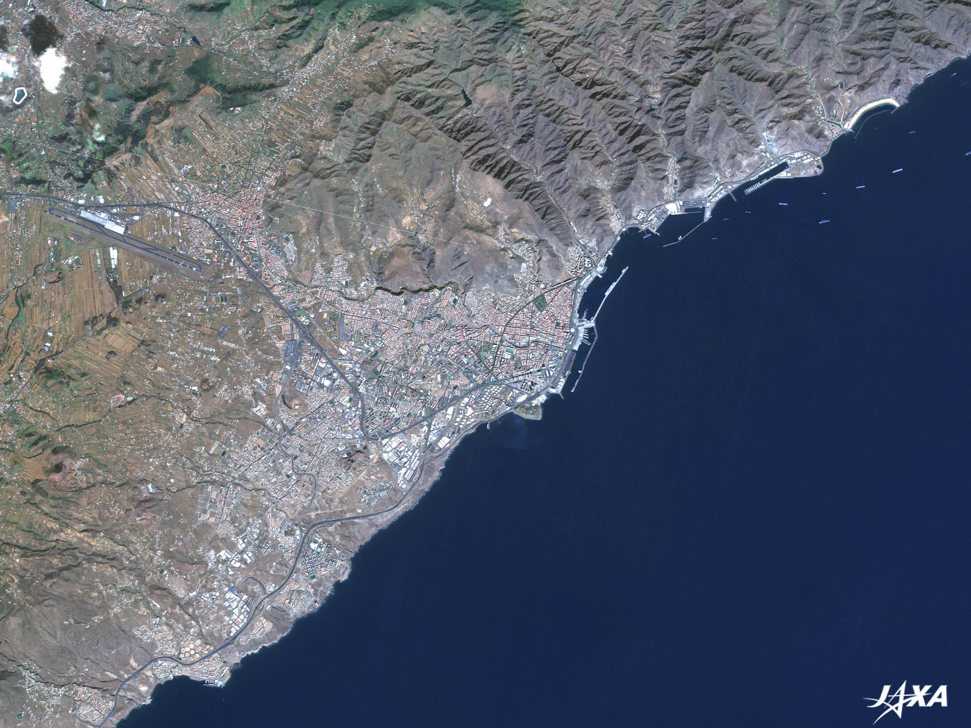 Fig. 2. Enlarged Image of Santa Cruz de Tenerife
Figure 2 is an enlarged image of Santa Cruz de Tenerife. Spain conquered this place to make transit ports to the American continents in the fifteenth century. They erected a cross to commemorate the victory, and thus, the city was named after this historical event. The British fleet also invaded this island in the seventeenth to eighteenth centuries, but was repelled. Admiral Nelson lost his right arm during this attack. Teresitas Beach, about 8 kilometers north of Santa Cruz de Tenerife, is an artificial beach made of sand imported from the Sahara. A tragic collision of two Boeing 747s, caused by fog, occurred at Tenerife Airport, also about 8 kilometers west of the city, in March 1977. Consequently, Tenerife South Airport was inaugurated in the south of the island, where thick fog conditions are unlikely to appear. San Cristobal de la Laguna, an old town located in the upper left of the image, was added as a World Heritage Site in 1999. 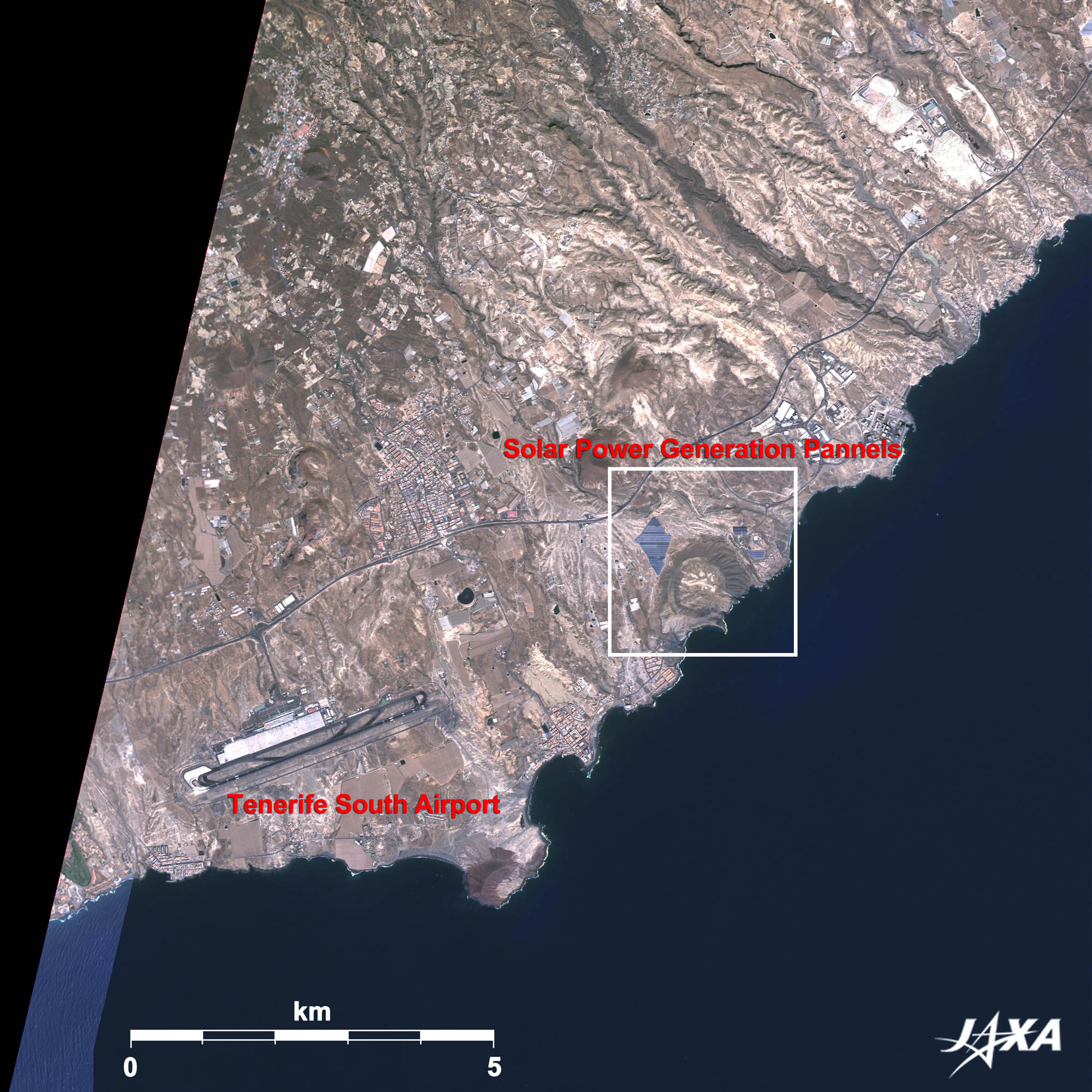 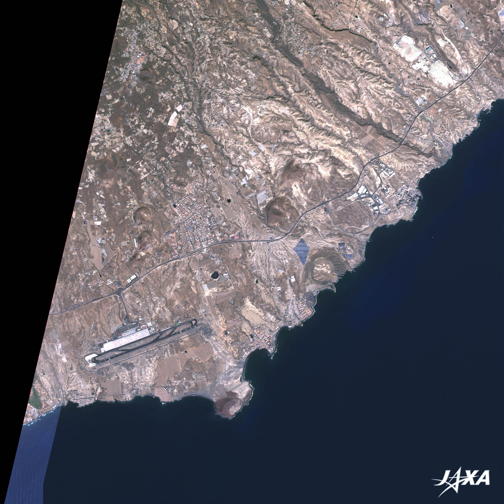 Fig. 3. Tenerife South Airport and Solar Power Generation Panels
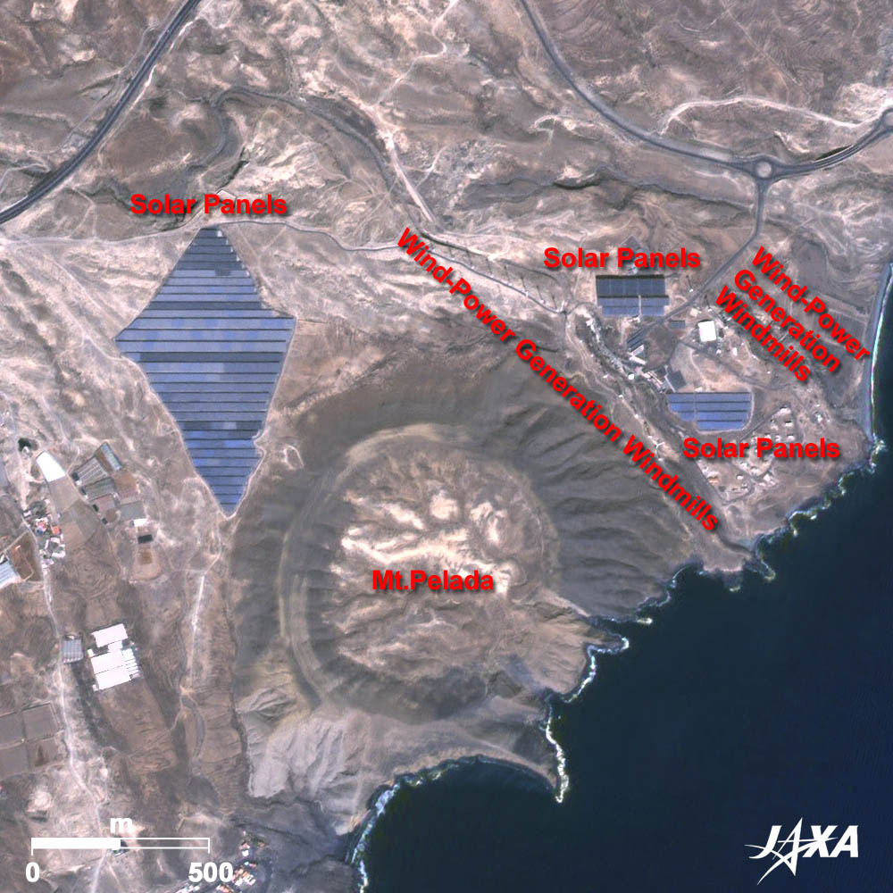 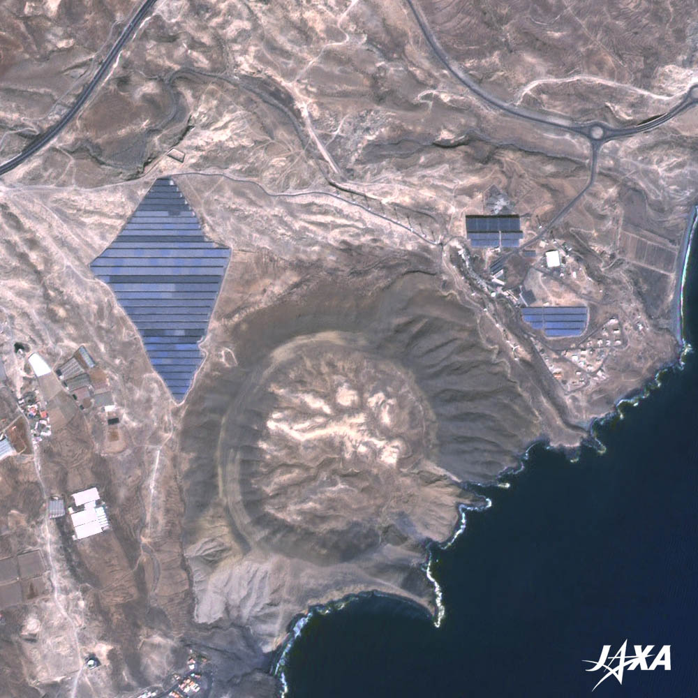 Fig. 4. Solar Power Generation Panels and Wind-Power Generation Windmills
Tenerife (kmz, 1.68 MB, Low Resolution) as seen on Google Earth Figure 3 is an enlarged image of the southeastern part of the island. You can see Tenerife South Airport at the bottom left. The diamond-shaped artificial structure at the foot of Mt. Pelada, about 5 kilometers east from the airport, is the solar panels used to generate electricity. Figure 4 shows an enlarged image of this facility. You can see three groups of solar panels and 26 wind-power generation windmills to generate electricity at both sides of the panels northeast of Mt. Pelada. Spain, as well as Germany, has been enthusiastically developing a solar power generation system. The policies and achievements of those countries in trying to reduce carbon dioxide emissions are good models for Japan. 
Solar Power Generation in TenerifeA Japanese company led the construction of the solar power generation plant in Tenerife. The plant began operation in the second half of 2008, just 2 years after the start of the project. This huge plant can generate 12.6 mega watts (MW) of electricity, and is planned to provide service for the next 25 years. Each year, it will produce 7,200 tons less of CO2 than a thermal power plant. Explanation of the Images: (Fig. 1 and 2)
AVNIR-2 has four observation bands. The color composite images are usually produced by assigning red to Band 3 (610 to 690 nm), green to Band 2 (520 to 600 nm) and blue to Band 1 (420 to 500 nm). The resulting images have natural coloring as if seen by the naked eye. Each color indicates the following ground objects:
PRISM is an optical sensor for observing ground surfaces with visible and near-infrared signals in the 520- to 770-nanometer (one-billionth of a meter) band. The image is monochromatic but has a higher resolution. PRISM has three independent optical systems to acquire images in the view of nadir, forward, and backward simultaneously. Only the nadir images are used in these figures. The above AVNIR-2 color composite image is decomposed into, hue, saturation, and intensity. The intensity portion is replaced by PRISM data. The hue, saturation, and intensity data are then reversed into a color image. This color image has a virtual 2.5-m resolution. A color image composed by combining a higher resolution monochromatic image and a lower resolution color image is called a pan-sharpened image.
This image data was downloaded free of charge from the USGS Global Visualization Viewer (Glovis). The color composite image is produced by assigning red to Band 3 (630 to 690 nm), green to Band 2 (520 to 600 nm) and blue to Band 1 (450 to 520 nm). The resulting image has natural coloring as if seen by the naked eye. |


