Seen from Space 2007
Confirmed record minimum Arctic sea ice
| |
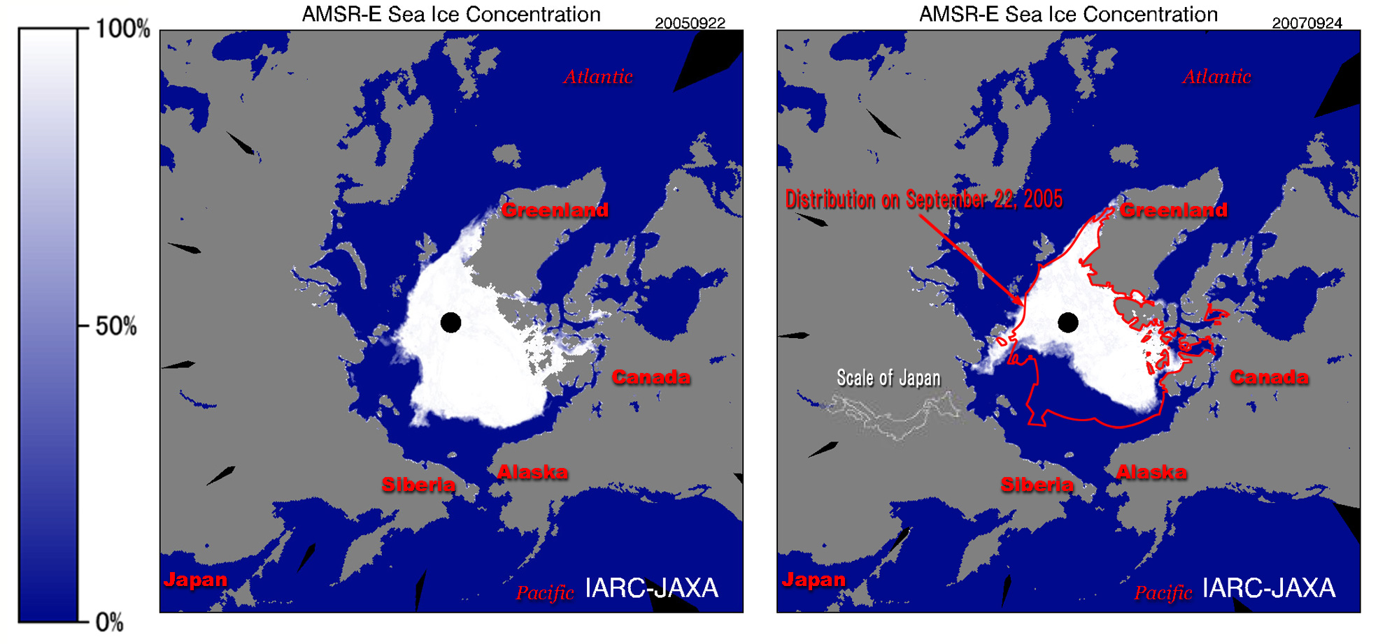
The ice covering the Arctic sea shrank at an exceptional rate this year and set a record minimum. At the end of summer, a record minimum sea-ice coverage of 4.255 million sq km was observed by satellite on 24 September 2007. A sea-ice area 2.8 times the area of the Japanese Archipelago was lost compared with the previous record low of 5.3 million sq km measured in 2005.
 |
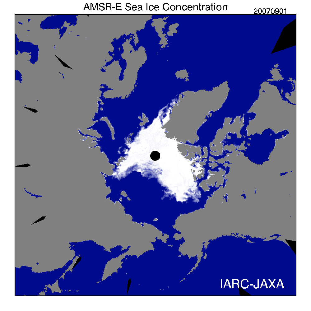
| Fig. 1 Transition of Arctic sea ice in September 2007 acquired by AMSR-E |
Figure 1 presents a movie of the transition of sea ice covering the Arctic sea this September. The central black hole and slots indicate areas for which data was not acquired by satellite.
 |
| Fig. 2 Distribution of Arctic sea ice in 2005 and 2007 acquired by AMSR-E |
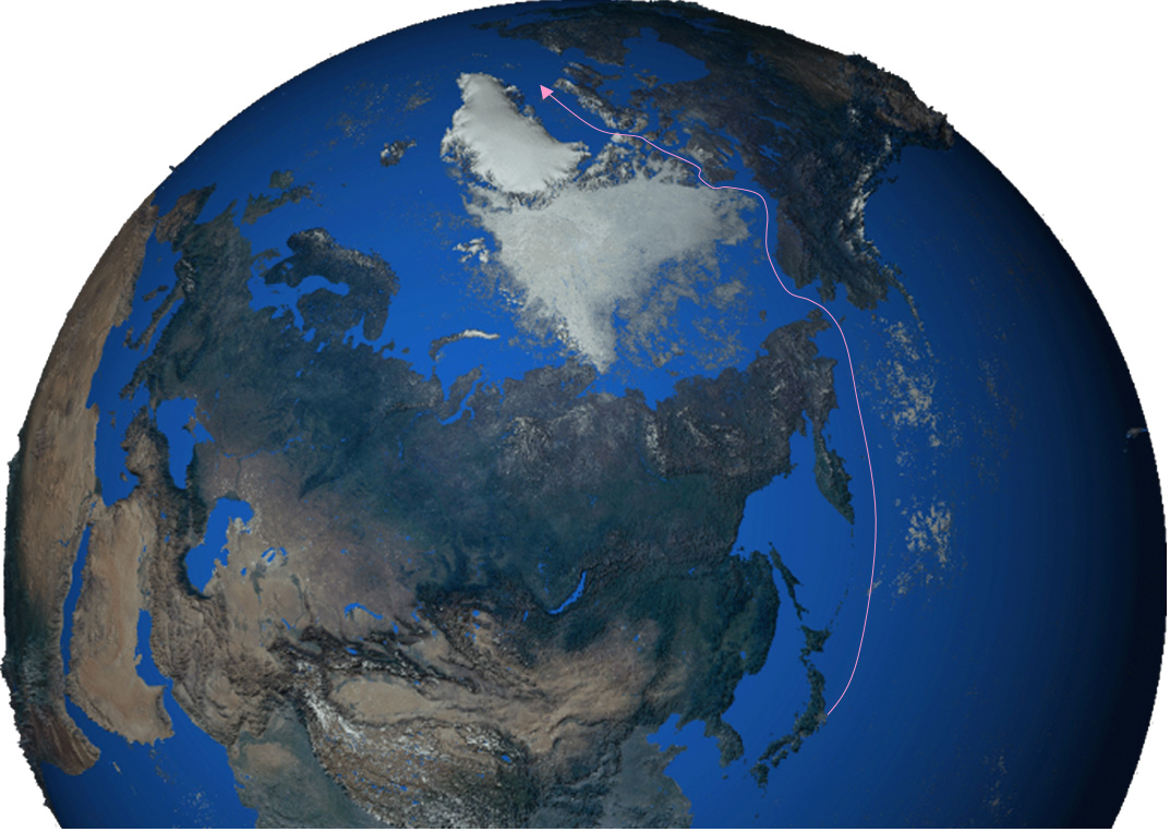
Figure 2 depicts the distribution of Arctic sea ice in 2005 and 2007. This year is characterised by significantly decreasing ice offshore of Siberia and Alaska. The Arctic passage between the Atlantic Ocean and the Pacific Ocean was open for a long time this summer, due to the loss of the normally frozen sea ice in the Archipelago in northern Canada (Fig. 3). This is the first time this has occurred in the history of satellite records.
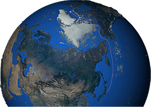 |
| Fig. 3 Arctic sea in summer 2007 as acquired by MODIS |
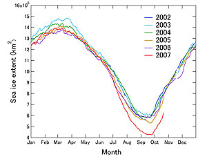 |
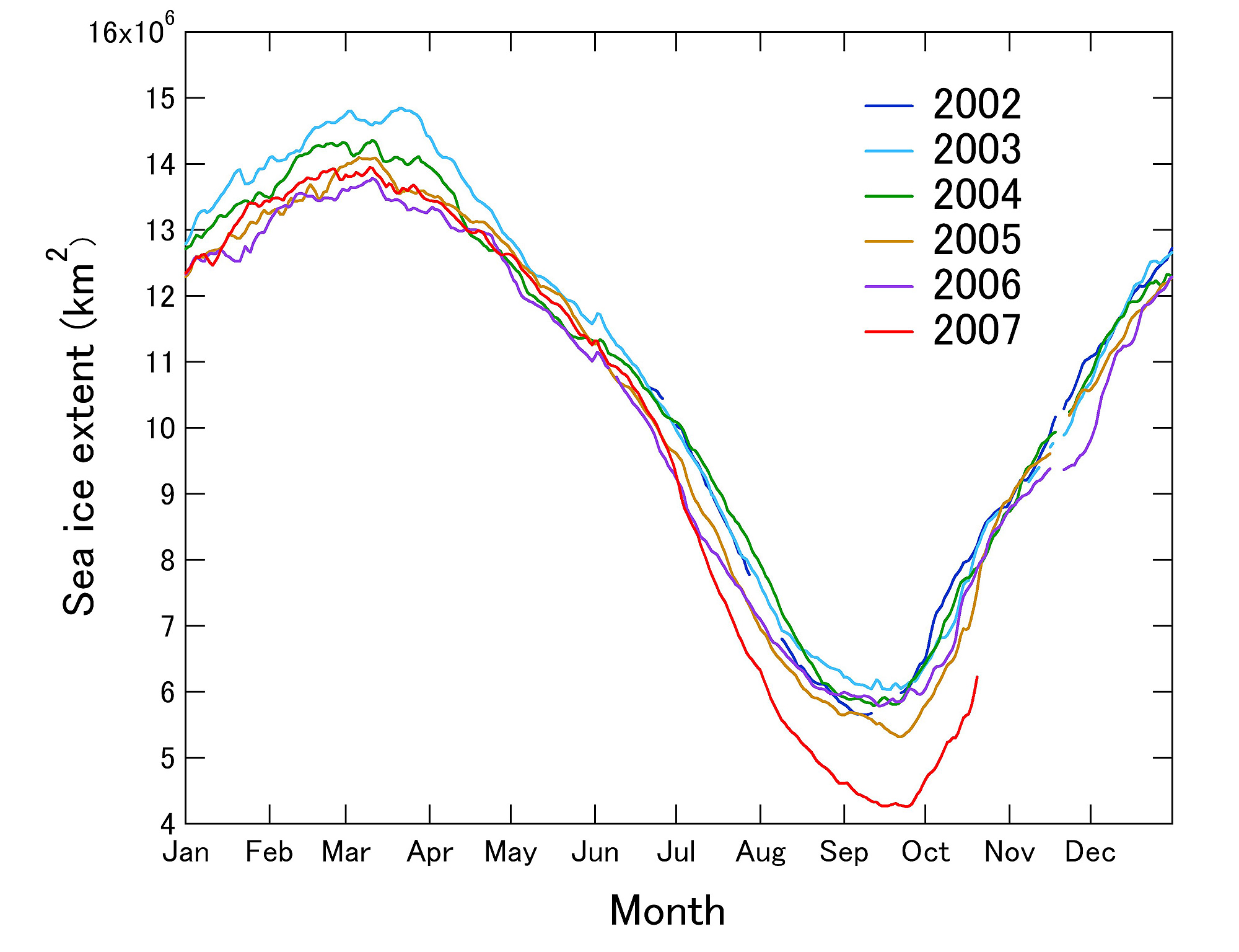
| Fig.4 Seasonal variation of the Arctic sea-ice concentration captured by AMSR-E |
Figure 4 depicts the AMSR-E-derived seasonal variation of the Arctic sea-ice concentration. The sea ice rapidly decreased from the beginning of July to the middle of September and a new record low was recorded on August 15. In these last few days, up-down of sea-ice area are repeated little by little, but the season of the Midnight Sun is over and sea ice may increase continuously without melting.
The Arctic Sea has absorbed much sunlight and heat this year due to an exceptionally large ice-free area in the Arctic sea and long-lasting clear weather in the Midnight Sun season from June to August.
The severe winter season will soon come to the Arctic circle, but the sea ice is expected to grow slowly due to the warm sea. Many wonder what face the Arctic will show us next summer. JAXA continues to monitor the cyclic growing and melting of Arctic sea ice.
You can find the latest data and image of sea-ice cover extent in the Arctic Ocean and previous observation images on Arctic Sea-Ice Monitor in the IARC-JAXA information system (IJIS) maintained by JAXA and located at the International Arctic Research Center (IARC, Fairbanks, Alaska).
Explanation of images:
Figs. 1 and 2 (Click the images twice to enlarge them.)
Figures 1 and 2 depict the calculated concentration of sea ice based on an algorithm developed by one of the Principal Investigators (PI) for AMSR/AMSR-E algorithm development, Dr. Josefino C. Comiso from NASA GSFC. The calculation uses 36.5-GHz and 18.7-GHz horizontal and vertical polarization data of AMSR-E.
Fig. 3 (Click the image twice to enlarge it.)
| Satellite: |
EOS-Terra (NASA) |
| Sensor: |
MODIS: Moderate Resolution Imaging Spectro-radiometer (NASA) |
| Date: |
August 16 to September 16, 2007 |
| Spatial Resolution: |
9km |
Figure 3 presents a cloud-free composit image of land and sea ice during one month. The color composition was made by using three out of 36 channels on MODIS: channel 1 (620 to 670 nm) for red, channel 4 (545 to 565 nm) for green and channel 3 (459 to 479 nm) for blue. The resulting image has natural coloring as if seen by the naked eye. The sea is also blue in this image.
| Green: |
Forests |
| White: |
Snow or sea ice |
| Brown: |
Deserts |
|
 |
|