| |
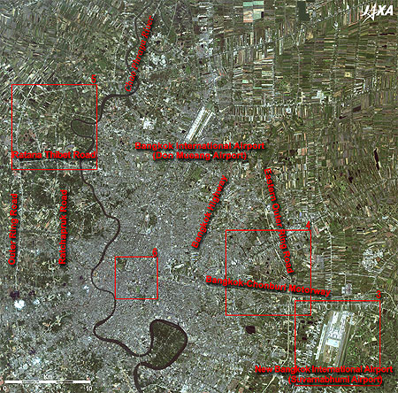 |
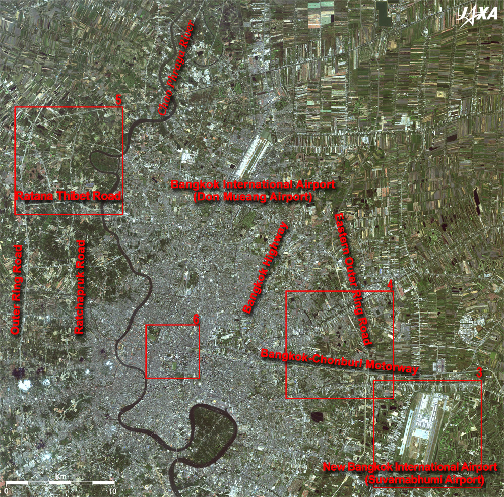
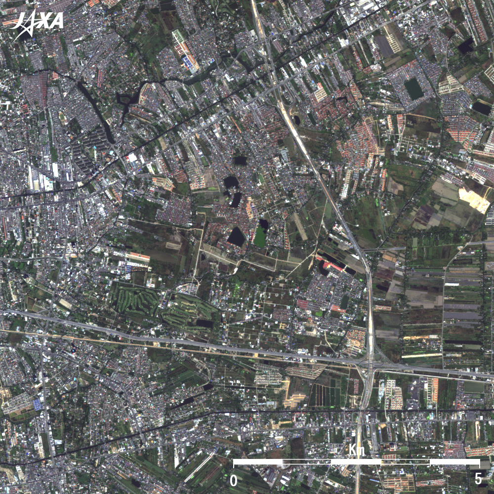
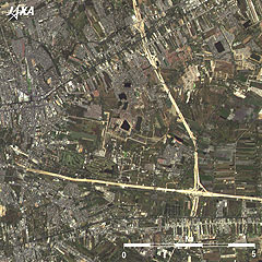
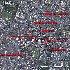
Fig. 1 Bangkok and Vicinity
(Full Image)
Bangkok (kmz,1.82MB,Low Resolution) is seen from Google Earth. |
Figure 1 depicts Bangkok (shortened official name is Krung Thep Maha Nakhon meaning the "City of Angels") and its vicinity as observed by the Advanced Visible and Near-Infrared Radiometer-2 (AVNIR-2) on board the Advanced Land Observing Satellite (ALOS) "Daichi" in December 2006. The grey area in the center of the figure is the urban area of Bangkok, the capital of the Kingdom of Thailand. Green and brownish fields surround the city area. Dark Chao Phraya River meanders from north (top) to south (bottom) in the figure. Bangkok International Airport (Don Mueang Airport) is located in the upper part of the figure and the New Bangkok International Airport, NBIA (Suvarnabhumi Airport: pronounced as su-wan-na-poom), which was opened for commercial flights in September 2006, is on the lower right.
The gross floor area of the new airport terminal is the world's largest (563,000m2). The site area (32.4km2) is five times the size of Don Mueang Airport and three times that of Japan's Narita International Airport. Airline routes from all over the world gather to this hub airport in Southeast Asia and to the front door of the popular tourism country of Thailand. His Majesty King Bhumibol Adulyadej (Rama IX), who has reigned since 1946, gave the name "Suvarnabhumi" (which means "Golden Land") to this new airport. Bangkok is known to have a world-class traffic problem; highways, elevated railways, and subways have been developed and the construction of other routes intended to ease traffic congestion continues.
 |
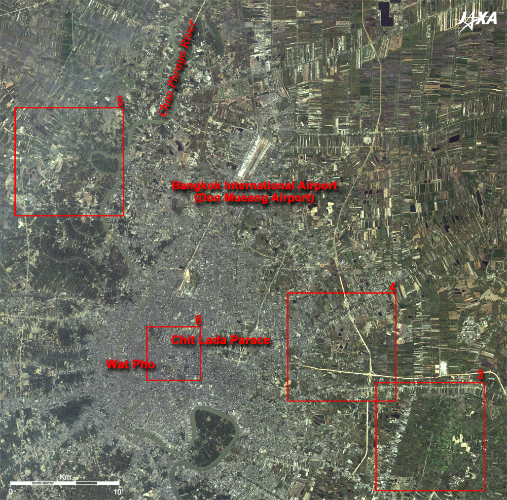
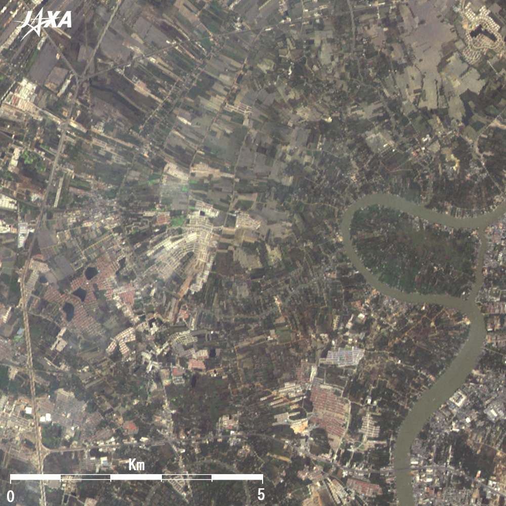
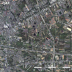
| Fig. 2 Vicinity of Bangkok, 10 Years Ago |
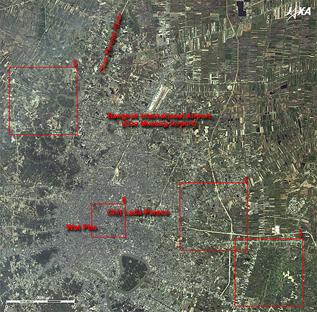
Figure 2 presents the vicinity of Bangkok as observed by the Advanced Visible and Near-Infrared Radiometer (AVNIR) on board the Advanced Earth Observing Satellite (ADEOS) "Midori" in January 1997. Comparison of Figs. 1 and 2 reveals the changes that have taken place in Bangkok over these 10 years. White lines on the right of Fig. 2 are the highways under construction. These do not look white in Fig. 1 because exposed earth and sand of roads under construction reflect more sunlight and appear white.
The farmland to the right of Fig. 1 has more brownish area than in Fig. 2. This may reflect differences in crop growth as these observations were made in different seasons. The many white dots in the urban area of Fig. 1 are considered to be new buildings constructed during these 10 years.
Image synthesis or differentiation can emphasize the changes in the images.
 |
 |
| (January 1997) |
(December 2006) |
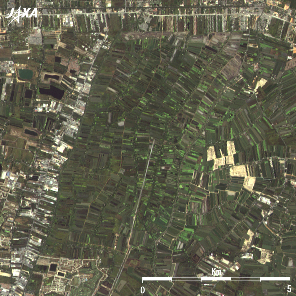
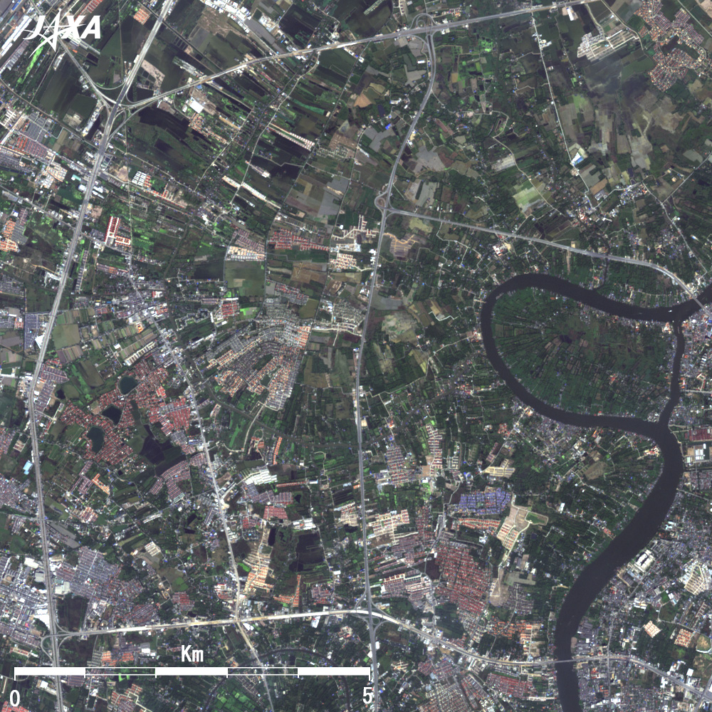
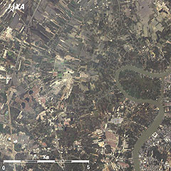
| Fig. 3 Changes in the New Airport Site, Now and 10 Years Ago |
Figure 3 presents the New Suvarnabhumi Airport and its site of 10 years ago. Construction of a new airport was a longstanding plan. The land was acquired in 1973, but the start of construction was delayed until January 2002 for many reasons. The planned site 10 years ago, therefore, consisted of fields that appear left behind from the surrounding development.
 |
 |
| (January 1997) |
(December 2006) |
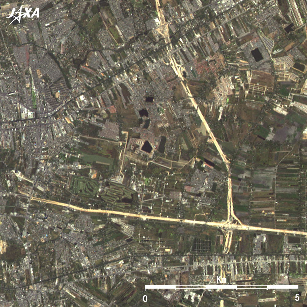
| Fig. 4 Highways, Now and 10 Years Ago |
Figure 4 depicts the highway junction at the northwest of Suvarnabhumi Airport where Bangkok-Chonburi Motorway running east and west intersects the Eastern Outer Ring Road running north and south. Roads are light brown and broken up in some places in the image of 10 years ago, which reveals that the roads were under construction. The roads are paved now and the roads, bright gray, have already been used.
 |
 |
| (January 1997) |
(December 2006) |
| Fig. 5 Road System Development, Now and 10 Years Ago |
Figure 5 depicts several highways in northwest Bangkok. Western Outer Ring Road is on the left of the image, Ratana Thibet Road is at the bottom, and a road under construction is at the top. No radial road system toward downtown Bangkok is visible in the image from 10 years ago. Comparison of the two images clearly indicates the progress of development.
 |
 |
| (January 1997) |
(December 2006) |
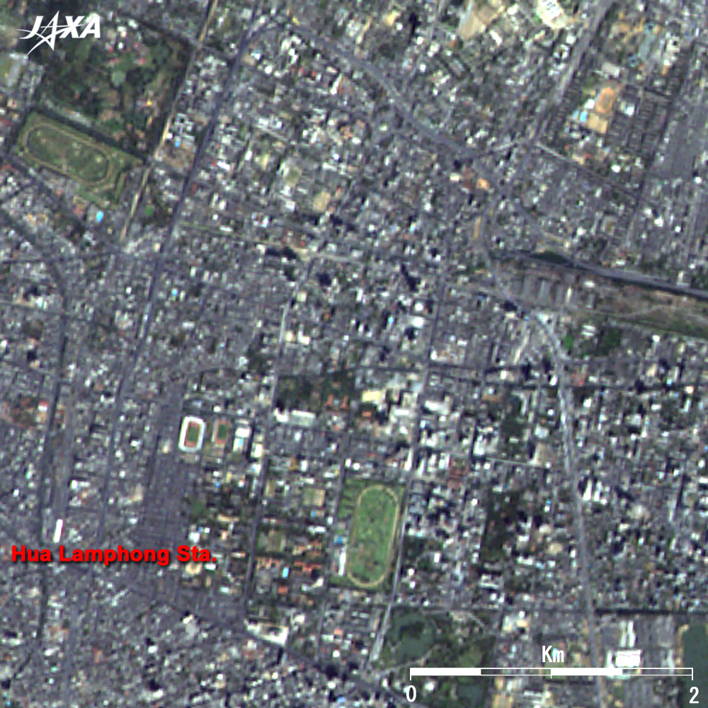
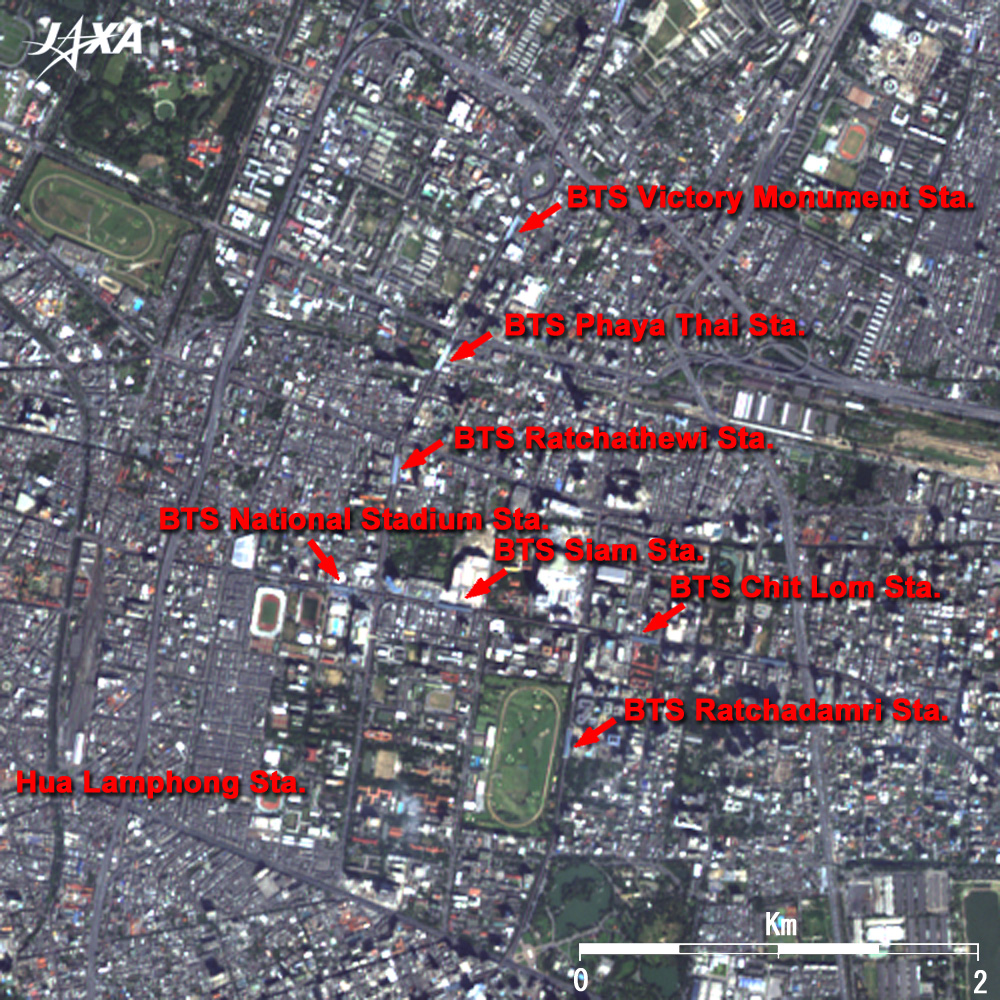
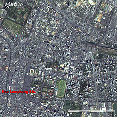
| Fig. 6 Construction of SkyTrain |
In December 1999, the elevated metro system BTS (Bangkok Mass Transit System: commonly called SkyTrain) launched operation. Sukhumvit Line connecting the northern and the eastern districts and Silom Line in the southern district are currently in service. Figure 6 is a close-up view of the urban area where SkyTrain stations along the road are visible in the 2006 image.
BTS and subways have been deployed in the public transportation system around Greater Bangkok, but have done little to overcome the notorious traffic jams on Bangkok's surface roads. Many roads are narrow and the traffic congestion is still bad, not only at rush hours every morning and evening but even during the daytime. Japan has made a large contribution in easing Thailand's traffic congestion. Some projects for construction of highways, the new airport, and subways were supported through Japan's Official Development Assistance (ODA).
Explanation of the Images:
Fig. 1, right images of Figs. 3 through 6, and full image
AVNIR-2 has four observation bands. The composite images are usually produced by assigning red to Band 3 (610 to 690nm), green to Band 2 (520 to 600nm), and blue to Band 1 (420 to 500nm). The resulting image has natural coloring as if seen by the naked eye; thus the ground objects are distinguished by the following colors.
| Deep green: |
Forests |
| Green or light green: |
Grass fields, farms, rice fields, golf courses, or shrimp farm |
| Brown or yellow: |
Withered grass fields, mown fields, or paddy fields |
| Grey: |
City area, roads, or canals |
| White: |
Cloud, roads, runways, buildings, or bare lands |
| Black, blue, or tan: |
Clear water surface, or area with no data |
Fig. 2, left images of Figs. 3 through 6
AVNIR has four observation bands. The composite images are usually produced by assigning red to Band 3 (610 to 690nm), green to Band 2 (520 to 600nm), and blue to Band 1 (420 to 500nm). The resulting image has natural coloring as if seen by the naked eye.
|
 |
|