Seen from Space 2006
Fall in Sydney, a Harbour City in the Southern Hemisphere
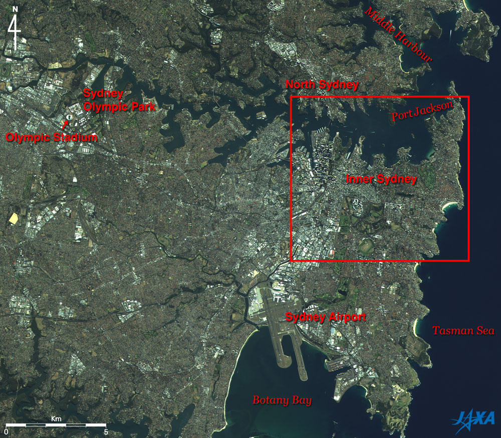
Sydney is the capital of New South Wales and is also the biggest city in Australia, with a population of about 4.3 million. Sydney has evolved on both sides of a very irregular bay line as you can see in this image. This bay, officially named Port Jackson but commonly known as the Sydney Harbour, is the largest natural port in the world, having a length of 19 km and an area of 55 km2. You can see the Sydney Airport at the center bottom of this image. The airport runs out into Botany Bay, and it takes about 15 minutes by train from the airport to downtown Sydney. The Summer Olympic Games were held in Sydney in 2000. Most of the games were held at several places visible in this image and particularly at the center of the Olympics at the Sydney Olympic Park in the suburbs of Sydney. The Olympic Stadium in this park, where the opening and closing ceremony, track and field events, etc. were held, was the goal point of the marathon races. Ms. Naoko Takahashi, who won the gold medal of the women's marathon and the first gold in the history of the Japanese track and field competition in the Olympics, started from the North Sydney, crossed over the Sydney Harbour Bridge, passed south of downtown Sydney, turned and headed west to the Olympic Park.
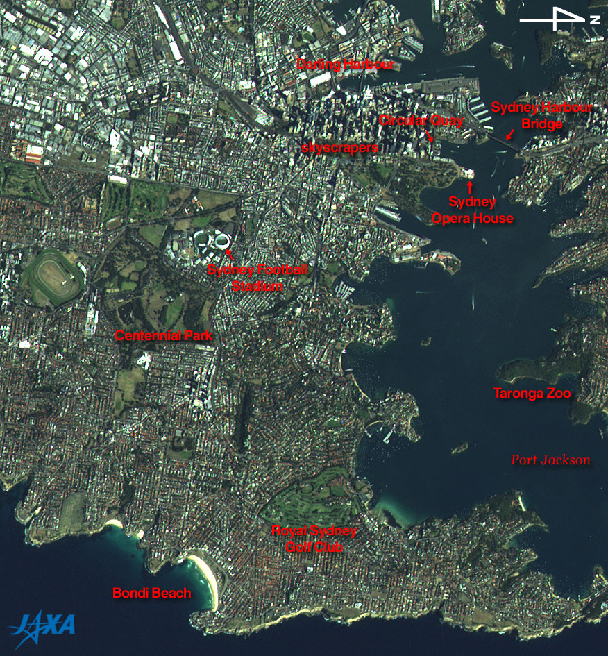
At the North end of the skyscrapers and on the waterfront, you can find the Circular Quay, the terminal of ferries, and the Sydney Opera House on a point, the emblem of Sydney appearing in bright white color. At the Sydney Exhibition Centre, which is the large white square building in the Darling Harbour area, Ms. Ryoko Tamura achieved her fervent wish for a gold medal in women's Judo. There are many white wakes in the bay, which perhaps are mostly made from ferries. The town of Sydney has evolved on both sides of the bay, and the ferries as well as the Sydney Harbour Bridge provide a key public transportation infrastructure. At the bottom of this image is Bondi Beach, where surfers enjoy their sport throughout the year. "Bondi" is an Aboriginal word meaning "waves breaking over the rocks," and you can easily find big white waves approaching. The Beach Volleyball games were held at the beach in the Olympics.
|
||||||||||||||||||||||||||||||