ページの先頭です。
本文へジャンプする。
【Important Notices】This page is an archive page of information published in the past. Since the update has been completed, it may contain broken links or outdated information. For the latest information, please use the new site Earth-graphy (earth.jaxa.jp).
ここからサイト内共通メニューです。
サイト内共通メニューを読み飛ばす。
サイト内共通メニューここまで。
ここから本文です。

Seen from Space 2006

Daichi (ALOS) captures Mt. Fuji: First Images by three sensors

 
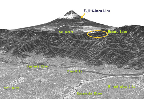
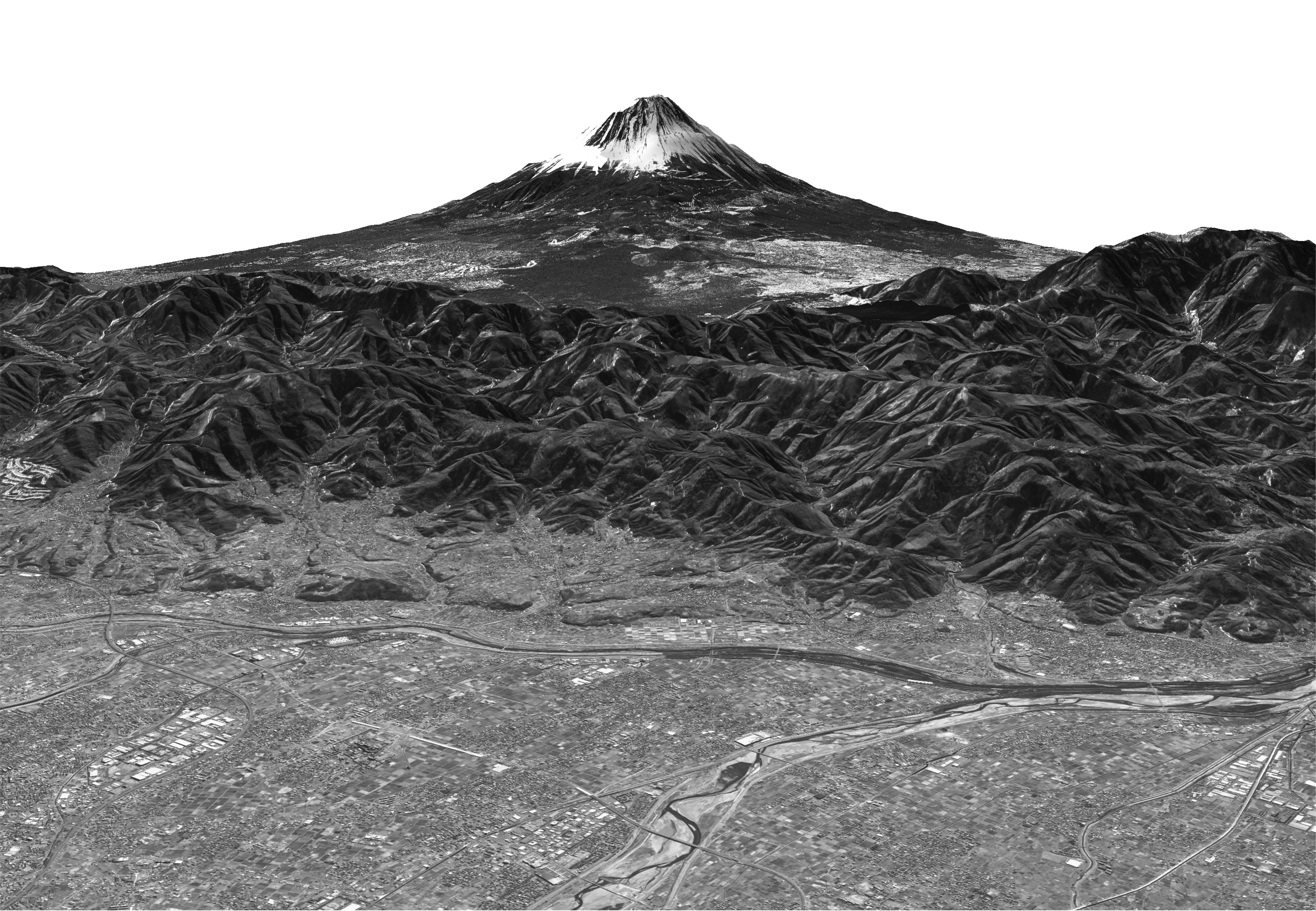
View of Mt. Fuji observed by
the Panchromatic Remote-sensing Instrument for Stereo Mapping (PRISM)
Three observation sensors aboard the Advanced Land Observing Satellite (ALOS) "Daichi" successfully observed Mt. Fuji, Shimizu Port and Tanegashima Island as part of the initial functional verification test. Please refer to the ALOS New-Arrived Images page.


Explanation of the image:
Satellite: Advanced Land Observing Satellite(ALOS)(Daichi)
Sensor : Panchromatic Remote-sensing Instrument for Stereo Mapping(PRISM)
Date: February 14, 2006(JST)
The PRISM is an optical sensor for observing visible terrain areas with a 2.5-meter spatial resolution. It has three independent optical systems to acquire terrain data including altitude data so that images for nadir, forward, and backward views can be acquired at the same time. This enables us to get three-dimensional terrain data with a high accuracy and frequency.

Related Sites:
First Images acquired by the AVNIR-2 (JAXA Press Release)
First Images acquired by the PALSAR (JAXA Press Release)
First Images acquired by the PRISM (JAXA Press Release)

本文ここまで。
image:Satellite Navigator
image:Satellite Applications and Operations Center(SAOC)
Earth Data Collection by JAXA Satellites
image:ページTOP