Seen from Space 2005
Beautiful Ripple-like Dune in the Sahara
| |
 |
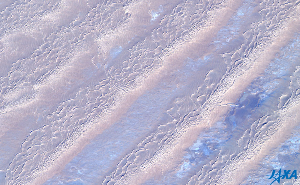
Fig. 1. Dune in the Sahara
(The upside-down image is here.) |
Figure 1 depicts the Awbari desert located in western Libya, a part of the Sahara observed by AVNIR. The dune extends in a northeast - southwest direction and looks like a ripple.
The blue areas are thought to be exposed rock that appears very flat. The wind has carried the sand onto the rock causing it to accumulate and form a dune. Since the sunlight is from the southeast (lower right) direction, the shade on the dune forms on the northwest (the upper left) side. You can see that a part of the brownish dune gives the illusion of being hollow. This is because the light shines upon some objects from above, a situation we are familiar with. When you see the upside-down image, the part of the dune looks protruding.
 |
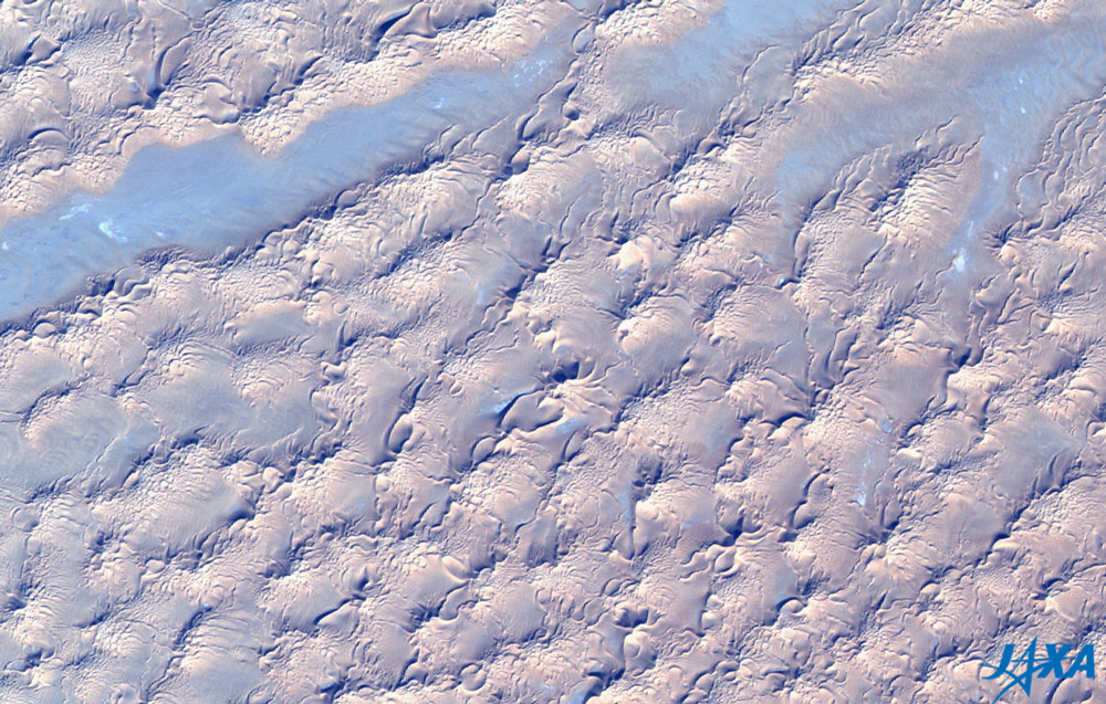
| Fig. 2. Expanded image of the center area of Fig. 1 |
When looking at Fig. 2, you can see the minute pleats on the northwestern side of the dune, indicating that the dune was created from a southeastern wind. It only looks so because of the direction that the sunlight is hitting it.
 |
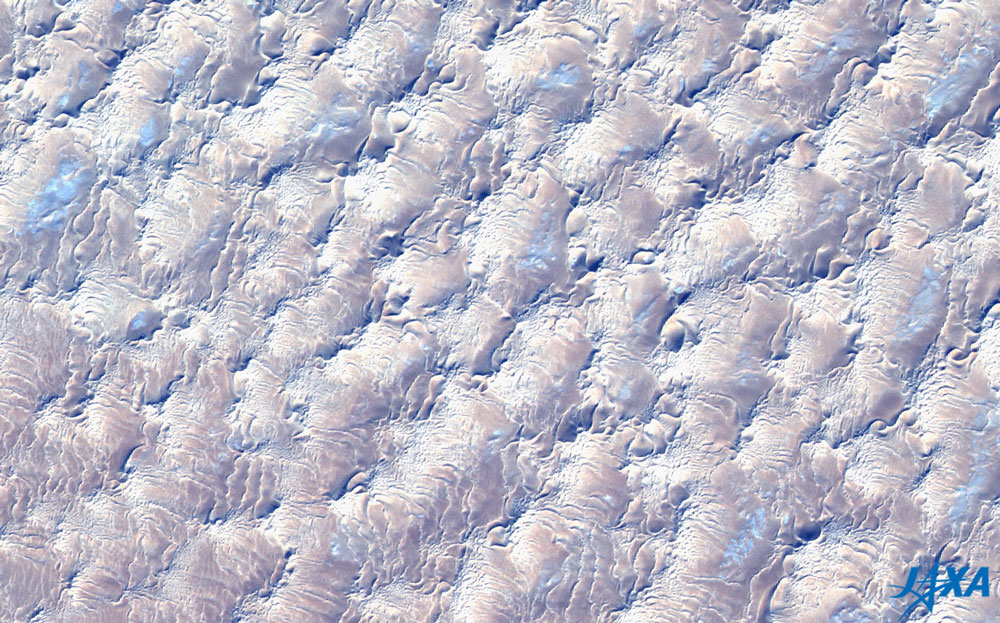
| Fig. 3. Expanded image of the lower right area of Fig. 1 |
Some star dunes are found in Fig. 3. A Star dune is formed when the wind blows from a variety of directions.
 |
| Fig. 4. Expanded image of the upper right area of Fig. 1 |
Fig. 4 shows the steep mountainous region containing landform that appears to be a crater.
UNESCO has two world heritage sites in this area. One is the "Rock-Art Sites of Tadrart Acacus" (Libya) 300 km southwest from here. The other world heritage site "Tassili n'Ajjer" (Algeria) is 300 km west from Tadrart Acacus. A lot of rock art remains at both sites, proving that the Sahara was once rich in vegetation.
Explanation of the images:
Figs. 1 to 4
| Satellite: |
Advanced Earth Observing Satellite (ADEOS) |
| Sensor: |
Advanced Visible and Near-Infrared Radiometer (AVNIR) |
| Date: |
January 15, 1997 |
| Scene center: |
27.47°N, 11.40°E |
| Coverage: |
80 km by 80 km |
|
The color composition was made by using three of the four visible AVNIR bands: 610 to 690 nm (band 3) for red, 520 to 600 nm (band 2) for green, and 420 to 500 nm (band 1) for blue. As a result, the figures have a natural coloring and appear as though seen with the naked eye. The blue is emphasized in these images. The original resolution is 16 m.
|
|
 |
|