Seen from Space 2005
Typhoon No. 14 (Nabi) on the rampage
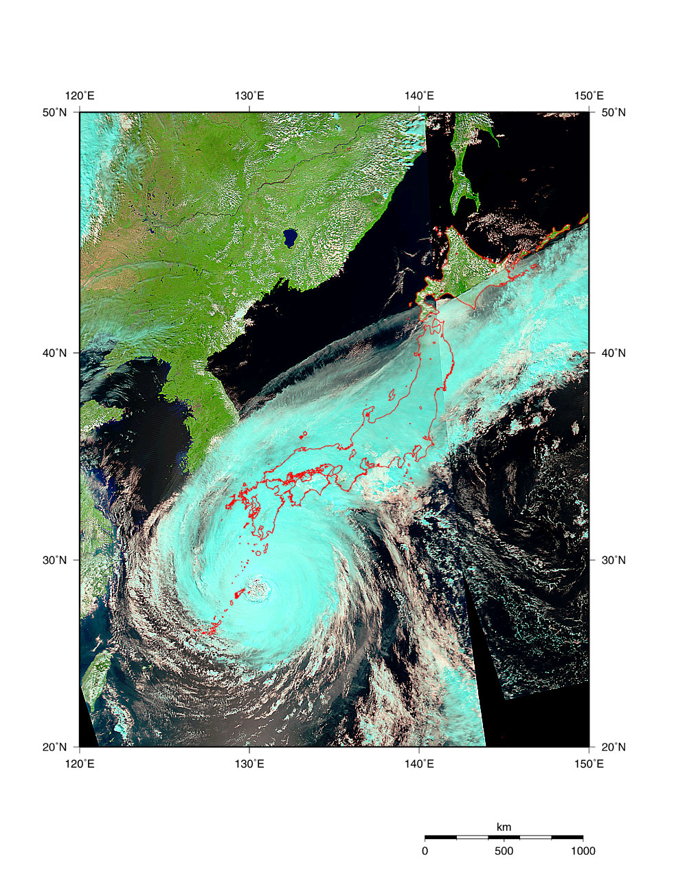
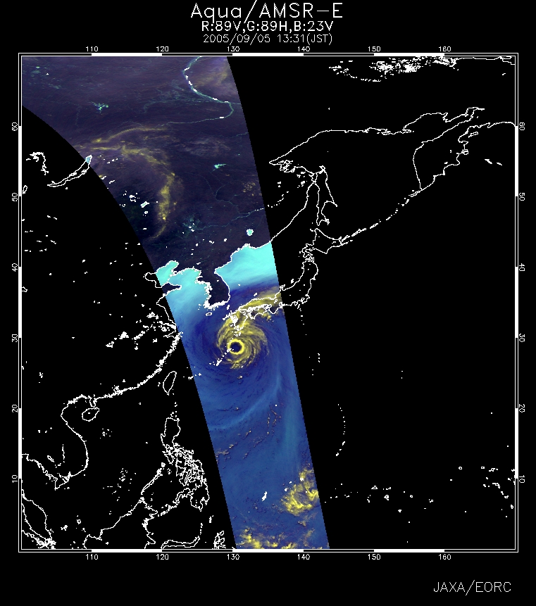
Figure 1, observed by MODIS on September 5, depicts the clouds of typhoon No. 14 (Nabi) and the frontal clouds stretching along the Island of Japan. The rain clouds of the typhoon are very developed, maintaining the large and beautiful circular shape of the typhoon. In the figure, the developed rain clouds with high-altitude cloud-tops look light blue. In the expanded image, you can see that there is no light-blue cloud near the center of the typhoon, which is the eye of the typhoon. You can also see that the front is very active with light-blue clouds because warm damp air flows into the front along the east side of the approaching typhoon. Fig. 2 presents typhoon No. 14 observed by AMSR-E. The atmosphere contains a lot of moisture and makes the sea area appear dark blue. The developed clouds appear yellow, and are distributed in a doughnut-shape, with the apparent eye of the typhoon being cloud-free.
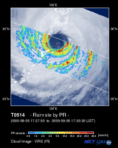
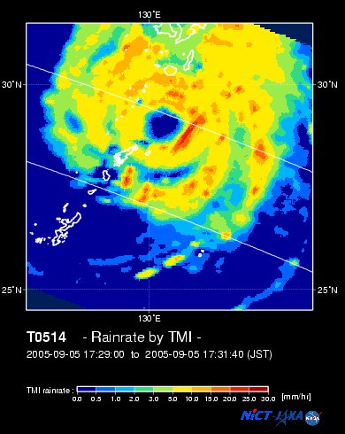
Fig. 3 is a super-imposed image of rain rates near the Earth's surface observed by PR and the cloud image observed by VIRS; both sensors are aboard the TRMM satellite. Fig. 4 presents the precipitation observed by TMI aboard the TRMM satellite. You can see that the heavy precipitation areas (red and yellow) are distributed spirally around the eye of the typhoon. According to JMA's press release at 0845 on September 6, winds of 50 knots or more of typhoon No. 14 extended 280 km to the northeast and 240 km to the southwest. This is wider than the 220 km radius of hurricane "Katrina" that destroyed parts of the Southern U.S. at the end of August, 2005. The central pressure in typhoon No. 14 is 950 hPa, and the maximum wind speed near the center is 40 m/s. The typhoon is going north along the west coast of Kyushu with keeping its strong influence because of the high sea-surface temperature (*) near Okinawa and Kyushu. A maximum 59.2 m instantaneous wind velocity was observed on Tanegashima Island at around 0430 on September 6. You can see the present status in JAXA's Tanegashima Space Center. It is expected that the typhoon will continue north or northeast at a slow speed. Please monitor and heed future typhoon information. (*) Refer to the sea-surface temperature of the AMSR-E Kuroshio monitor and the TRMM sea-surface temperature (3 day average)
Related sites: Appendix: Names of typhoons: The name of typhoon No. 14, "Nabi" means "butterfly" in Korean. Asian countries began naming typhoons in 2000. Fourteen member countries in the northwestern Pacific proposed a list of 140 names. "Nabi" is the 137th name. Details of the names of typhoons can be found on JMA's website. Why does a typhoon have an eye?: In the Northern Hemisphere, when a typhoon occurs strong winds blow spirally counterclockwise towards the center of the typhoon. The nearer the wind is to the center the stronger it is, but when the wind becomes too strong, centrifugal force* becomes too strong for the wind to pass through to the center. For this reason the area where there is no wind or rain near the very center is called "the eye of typhoon." * Centrifugal force is the force exerted away from the center when an object moves in a circular path. |
|||||||||||||||||||||||||||||||||||||||||||||||||||||||