Seen from Space 2005
Typhoon No.11 (Mawar) approaching Japan
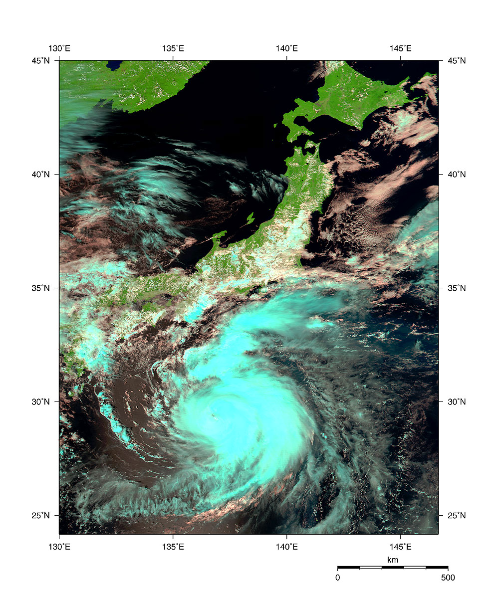
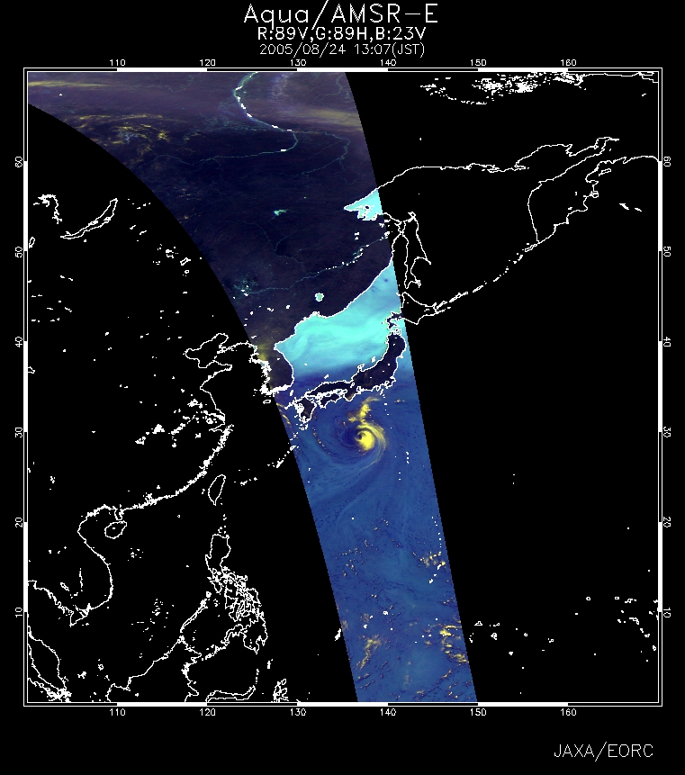
Figure 1 depicts typhoon No. 11 (Mawar) observed by MODIS aboard NASA's Earth-observing satellite Aqua at 1302 on August 24 (JST). The figure indicates that clouds spread to the area of the typhoon. Fig. 2 presents typhoon No. 11 also observed by AMSR-E aboard the same satellite at approximately the same time as in Fig. 1. The atmosphere containing a lot of steam makes the sea area appear dark blue. The developed clouds appear yellow. Figure 2 also indicates that the developed cloud leans to the extreme eastern side of the center of the typhoon. As Typhoon No. 11 approaches Japan, it is anticipated it will be close to the area from Kanto to Kinki during the evening of the 25th to the morning of the 26th. The typhoon's influence will remain strong because the sea-surface temperature (*) of the area where the typhoon is passing is high. Also, the typhoon advances slowly because of the influence of the westerly and the Pacific anticyclone, making it necessary to carefully future movements. (*) Refer to the sea-surface temperature of the AMSR-E Kuroshio monitor and the TRMM sea surface temperature (3 day average)
Related sites: Appendix: The name of typhoon No. 11, "Mawar" means "rose" in Bahasa Malaysia. The Asian countries began naming typhoons in 2000. Fourteen member countries in the northwestern Pacific proposed a list of 140 names . "Mawar" is the 134th name. The details about the names of typhoons can be found on the JMA's website. |
|||||||||||||||||||||||||||||||||