Seen from Space 2005
World Heritage Site Surrounded by High-rise, Multifamily Housing: St. Petersburg
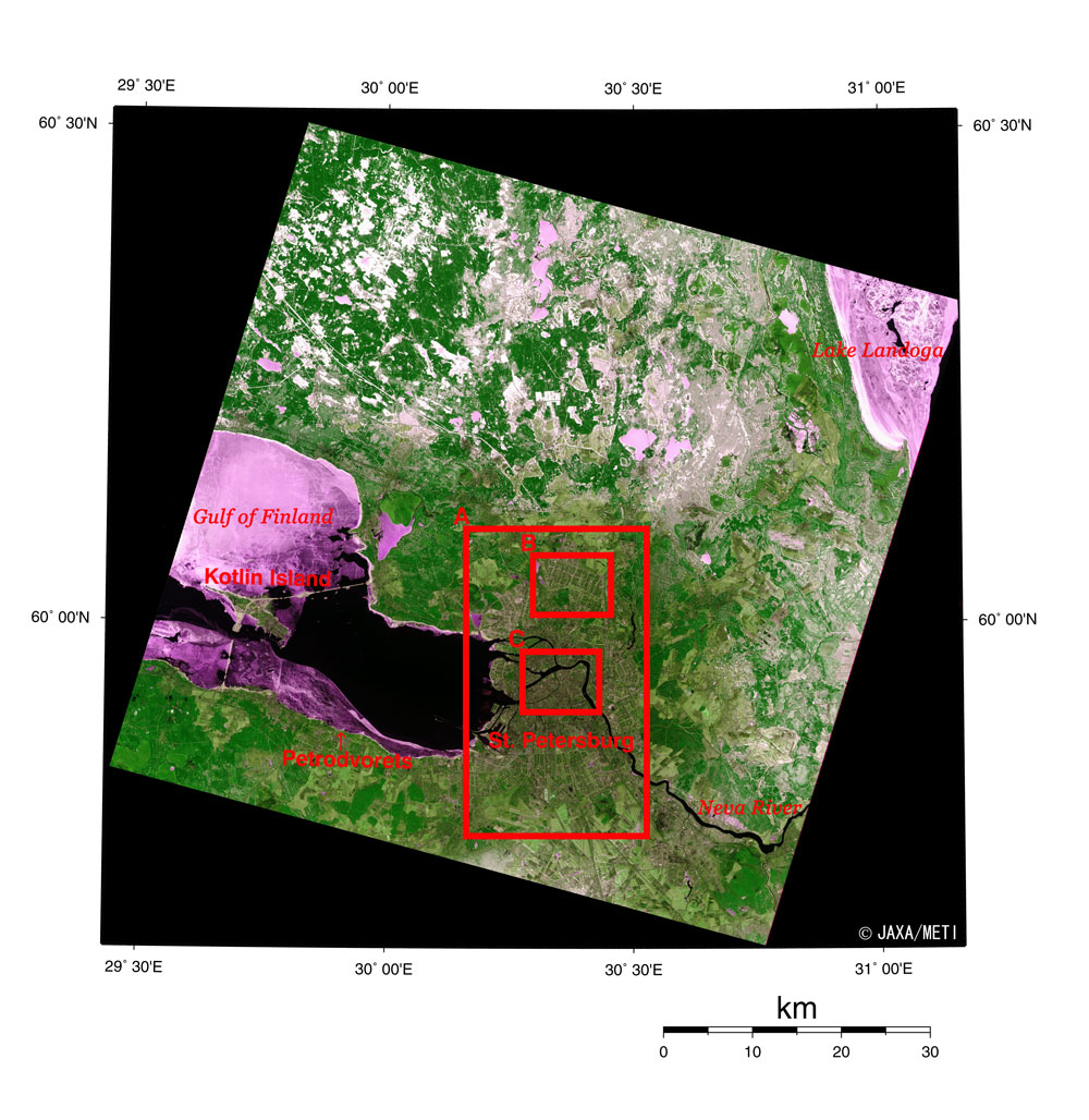
Figure 1 depicts St. Petersburg, Russia's second largest city, and its outskirts as seen from the Optical Sensor aboard the Japanese Earth Resources Satellite-1 in April 1993. The Gulf of Finland is partially frozen on the left, and frozen Lake Ladoga is on the right. Some snow still remains. The yellowish-green areas in the suburbs are farmland or grassland, but they seem very sparse compared with other cities. The brownish spot in the center is St. Petersburg. The Neva River, the only river flowing out of Lake Ladoga, streams down through the city. Kotlin Island seems to float in the Gulf of Finland, connected to the mainland by the dike extending to the east. Another dike extends to the south, but does not yet connect to the island. These dikes were constructed to protect St. Petersburg from flooding, but the project has been halted due to financial difficulties and ecological concerns since 1987. New reports say the dam building will restart soon, with completion projected for 2009.
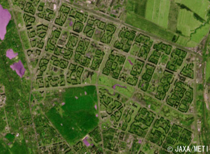
Construction of the city began in 1703 when Tsar Peter the Great built the Peter and Paul Fortress on Zaichiy (Hare) Island in the Neva River to prevent Swedish invasion. St. Petersburg continued to develop as the capital of the Russian Empire from 1712 to 1918. The population exceeded 2 million by 1914, and a lack of housing became serious, while commercialization and industrialization in fields such as steel and chemistry continued to grow. For this reason, the Soviets built a lot of 15- to 20-story multifamily housing after World War II, predominantly in the suburbs. Frame A indicates the extent of high-rise, multifamily housing in suburban St. Petersburg. In frame B, an enlarged picture of the northern part of frame A, the shadows of such multifamily housing develop a geometric pattern. By 1990, the population of St. Petersburg peaked at about five million, but it has gradually decreased, falling to 4,570,000 at the beginning of 2003.
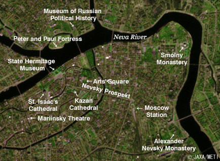
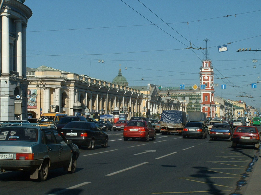
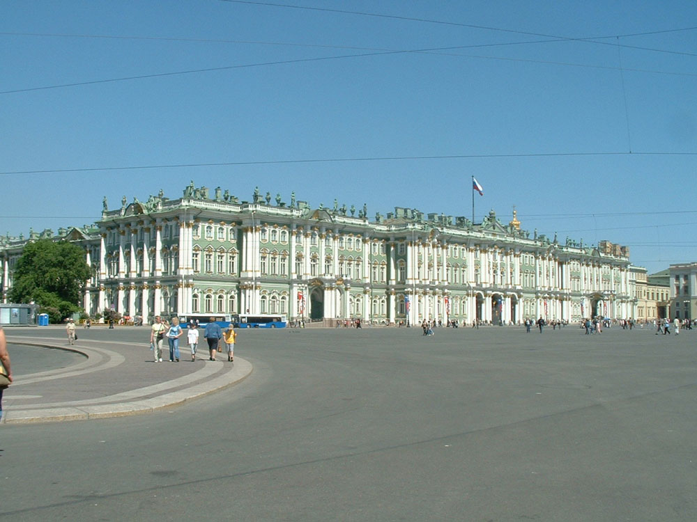
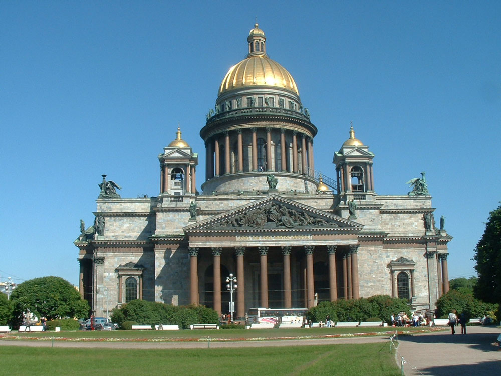
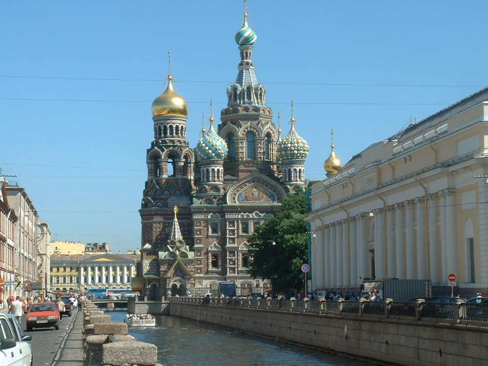
The "Historic Center of Leningrad and Surroundings" was registered with UNESCO's World Heritage list in 1990, just before the former Soviet Union's collapse. It was later renamed the "Historic Center of Saint Petersburg and Related Groups of Monuments." The Peter and Paul Fortress and the Peter and Paul Cathedral on the island in the Neva River are at the left of frame C, and the State Hermitage Museum, home of more than three million pieces of artwork, is on the opposite bank. St. Isaac's Cathedral, whose dome contains more than 100kg of gold, and the Mariinsky Theatre, the famous opera house where modern ballet was established, appear in the lower left of frame C. Nevsky Prospekt is the main street of St. Petersburg and runs across the center of frame C from east to west. The Arts' Square is on the north side, and the Kazan Cathedral is on the south side. Moscow Station, where the trains connecting Moscow to St. Petersburg arrive and depart, is near the place where Nevsky Prospekt turns to the southeast. The Smolny Monastery is visible in the upper right, and the Alexander Nevsky Monastery in the lower right. The novelist Dostoevsky, composers Tchaikovsky and Mussorgsky, and other well-known cultural icons sleep eternally in a graveyard near the Alexander Nevsky Monastery. Figures 2 through 5 present photographs taken at these locations.
Next winter, JAXA will launch the Advanced Land Observing Satellite (ALOS). It will carry the Advanced Visible and Near Infrared Radiometer Type 2 (AVNIR-2), which is capable of 10m ground resolution. We will distribute clearer images at that time. Reference Site:
Related Sites: Appendices: Pet names: St. Petersburg has many pet names. Russian poet Pushkin described St. Petersburg as a "Window on the West." Because St. Petersburg is built in a delta of the Neva River, there are many canals, their granite embankments and more than 400 bridges. They bring a unique atmosphere, earning the name "Venice of the North." There are many palaces such as the Admiralty, the Winter Palace, the Marble Palace, and the State Hermitage Museum, so it is also called the "City of Palaces." Some palaces are baroque style (Dutch style), which Tsar Peter the Great assumed to be ideal. Others are Neoclassical, in the style approved by Empress Catherine II. Others harmoniously combine both. Name changes: At first, it was called Sankt-Pitersburh, in the Dutch style. It was called Sankt-Peterburg, in the German style, around 1712 and afterwards, when the capital was relocated. Subsequently, it was named Petrograd, in the Russian style, after 1914 when Russia went to war against Germany during World War I. Later, it was called Leningrad (a town of Lenin) after Lenin died in 1924. Since September 1991, from just before the collapse of the former Soviet Union, it has been called Sankt-Peterburg again, as the result of a referendum. St. Petersburg appearing in history: St. Petersburg appears in some historically important events. The construction of St. Petersburg from 1703 to 1725 symbolizes the opening of Russia to the western world and the emergence of the empire of the Tsars on the international scene. The cruiser Aurora, which started the Russian Revolution (the Great October Social Revolution) in 1917, and the mansion of the celebrated ballerina Matilda Kshesinskaya (presently the Museum of Russian Political History), where the Russian Communist Party's headquarters were located, are both symbols of the birth of the former Soviet Union. |
|||||||||||||||||||||||||||||||