Seen from Space 2005
Natural Features in Spring: Yoshi-yaki in Watarase-Yusuichi
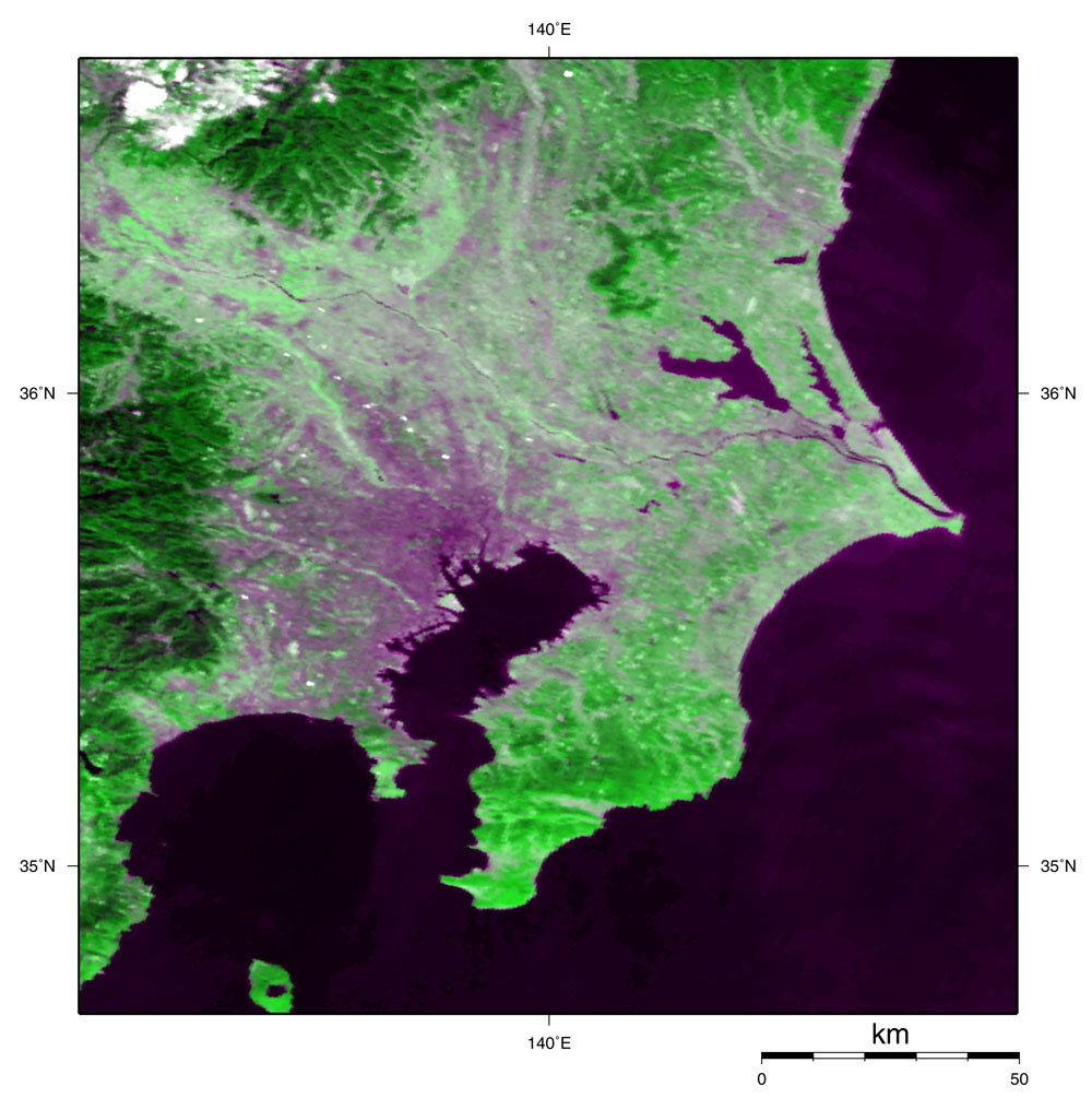
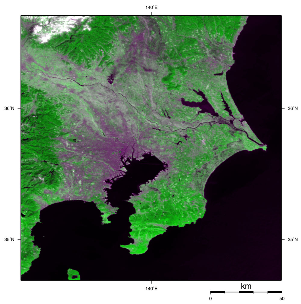
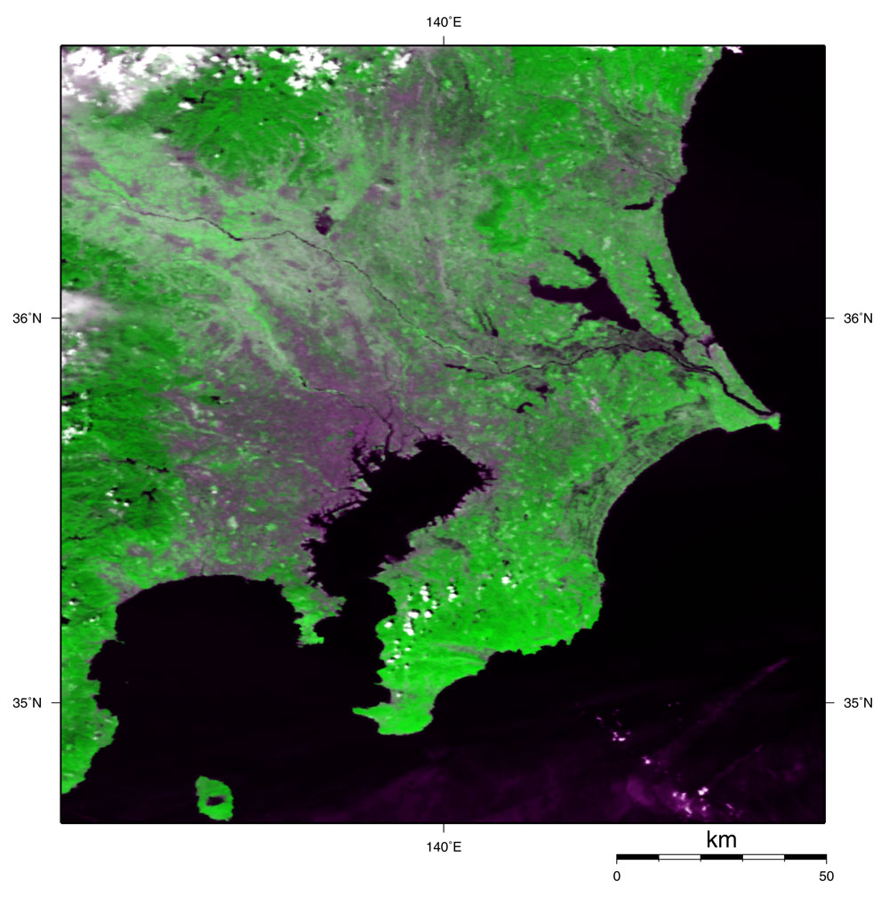
Figure 1 presents an image of the Kanto region observed by MODIS on March 21, 2005, before Yoshi-yaki (“Yoshi” means ditch reed and “yaki” means burning in Japanese). Figure 2 presents an image acquired on March 27 during Yoshi-yaki, and Fig. 3 presents an image acquired on March 31 after Yoshi-yaki. The Tone River looks like a thin line stretching from right to left, and Watarase Yusuichi (“Yusuichi” means an artificial flood plain to regulate water and prevent flooding) can also be seen slightly left of center. Watarase Yusuichi is composed of Lake Yanaka (Watarase Reservoir) and the surrounding flood plain. Green in the images represents a vegetated area. If you compare these three figures, the north side of Watarase Reservoir looks light green in Fig. 1 but blackish in Fig. 2, and the blackish part increased in Fig. 3. This blackish area is burn scarring resulting from Yoshi-yaki. Watarase-Yusuichi is located in the southernmost part of Tochigi Prefecture. The greatest artificial flood plain in Japan, it covers 33 square km and has a total water storage capacity of 200 million cubic meters. Watarase-Yusuichi stretches across four prefectures, Tochigi, Gunma, Saitama and Ibaraki. Watarase-Yusuichi was finally fired all at once at 8:30 a.m. (JST) on March 27 after being postponed twice due to strong winds this year. About 1,500 ha where Yoshi grows was burned, which equals half of the 33 square km of Watarase-Yusuichi. It is Japan's second greatest field burning after that in Mt. Aso. Yoshi-yaki was originally started to protect Yoshi from the damage caused by diseases and harmful insects and to cultivate high-quality Yoshi as a material for Yoshizu (“Yoshizu” means a blind knitted out of Yoshi). In addition, it has been understood recently that rich wetland environment in the Yusuichi has been protected by Yoshi-yaki. It also effectively prevents neighboring houses from catching fire from wildfire in the early spring. Yoshi-yaki safeguards the environment in two ways. ·First, it gives spring-set plants an opportunity to sprout by burning Yoshi withered on the stalk. Such plants grow and develop some flowers and fruit before Yoshi grows bigger. In addition, many plants assumed valuable nationwide have been confirmed in the Yusuichi and come into buds in spring. ·To prevent foresting Germinating young willows are burned by Yoshi-yaki, and the present very large Yoshi grassy plain has been maintained. After Yoshi-yaki, spring will to the Yusuichi at last.
|
|||||||||||||||||||||||||