Seen from Space 2005
Landscape of Taiki-cho Region Observed from Airship
Station-keeping flight tests (*1) of the stratospheric platform (SPF) project were conducted at Taiki-cho, Hokkaido, from July to November 2004. As one objective for the tests, we successfully conducted several Earth-observation experiments (*2) such as vegetation observation and temperature monitoring.
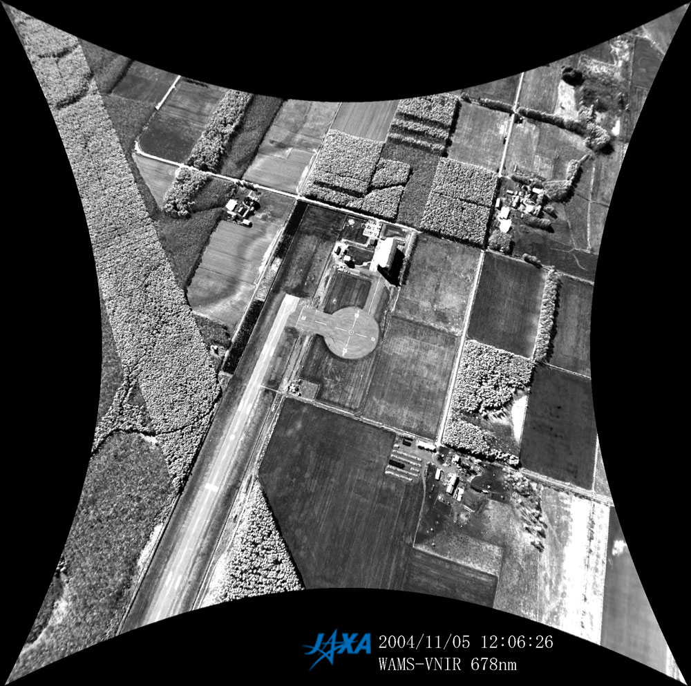
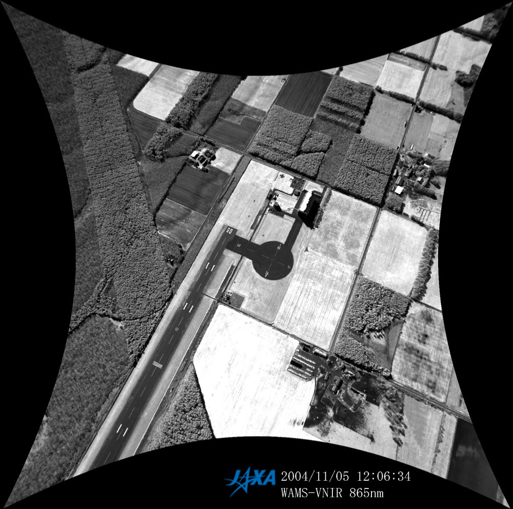
Figures 1(a) and (b) are WAMS-VNIR images from the Station-keeping test airship flying around the Taiki-cho test site at an altitude of 850 m. WAMS-VNIR can take images of several wavelength bands including red (678nm) and near-infrared (865nm). Comparing (a) and (b), near-infrared radiance in the vegetation region is higher than that in other coverage regions. Using such multiband characteristics, we are able to understand the distribution and conditions of vegetation around the test site.
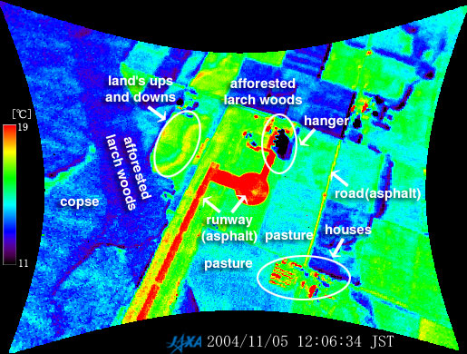
Figure 2 presents WAMS-TIR images from the airship flying around the Taiki-cho test site at an altitude of 850 m. Generally, anything radiates invisible light (thermal infrared light) whose intensity is greater when its temperature is higher. By measuring the intensity of the infrared light, we can monitor the distribution of land-surface temperatures. For example, Fig. 2 illustrates a high temperature over an asphalt-covered region (such as a landing field) warmed up by sunshine. We can also distinguish buildings and undulations from the thermal infrared image. Note that the WAMS-VNIR and WAMS-TIR were equipped with distorted optical systems (like fish-eye lens) so that after geometric correction the images are "pin-cushion" shape, as you can see in Figs. 1 and 2.
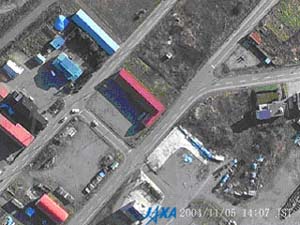
Figure 3 is an HRS image with few score centimeter resolution taken from the airship flying around Hamataiki village at an altitude of 500 m. As a traffic observation experiment, the HRS took moving images of vehicles passing, stopping, and turning. By computer processing the images, we can recognize a run pattern of the vehicles and accumulate statistics data of traffic streams. We expect this method to be applied to future traffic control systems. Earth observation from the SPF has several advantages over the traditional airborne or spaceborne observations. We can continuously monitor a specific area over a long period of time with high spatial resolution and accuracy. In the future, we expect SPF observation to be used for various applications such as remote-sensing for agriculture, forestry, fishery, traffic monitoring, and disaster monitoring. (*1) The Station-keeping flight test is conducted by the Japan Aerospace Exploration Agency (JAXA) in collaboration with the National Institute of Information and Communications Technology (NICT). The Stratospheric Platform (SPF) was selected as "The Millennium Project," which conceives new ventures, and attempts to resolve problems faced by mankind. This project was initiated by the Prime Minister in October 1999. (*2) October 5, 2004 Flight characteristics acquisition flight test: maximum altitude 600 m November 5, 2004 Mid-altitude flight test:maximum altitude 2,000 m
Related sites: Appendices: Earth-observation mission objectives in the station-keeping flight test:
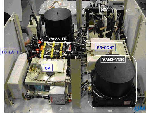
Three Sensors:
EOSS Specifications:
Photograph of EOSS:
|
||||||||||||||||||||||||||||||||||||||||||||||||||||||||||||||||