Seen from Space 2004
Super Typhoon No. 23 Hits Japan
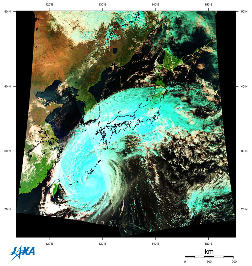
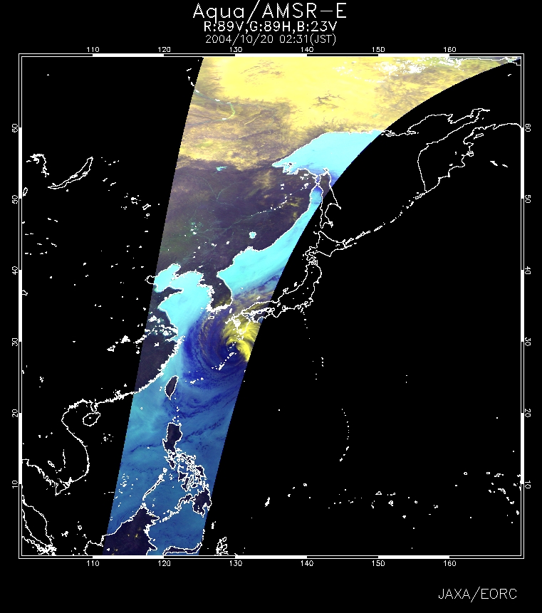
Typhoon No. 23 (Tokage) brought major damage to Japan for the first time since Typhoon No.10 in 1982. It affected Hyogo, Kyoto and Kagawa Prefectures severely. Ninety-one people were lost or killed during October 19 and 21, 2004. Typhoon No. 23 developed into a super typhoon (as of the afternoon of October 19) that covered a very wide area with 30 kt (15 m/s) winds or more. The damaged areas suffered from sustained strong winds and heavy rains over a long period while the typhoon was passing. Figure 1 is a composite image based on the data acquired at 1109 (JST) on October 19 by MODIS on NASA's Earth-observation satellite Terra and the data acquired at 1249 (JST) on the same day by MODIS on NASA's Earth-observation satellite Aqua. The diameter of the typhoon was approximately 1,200 km. The figure shows that the typhoon was accompanied by a large group of clouds from the front north and northeast of the typhoon. Ice, represented in light blue, formed in the high-altitude well-developed clouds caused by the typhoon and the front. Figure 2, an AMSR-E near-real-time image observed at 0231 (JST) on October 20,depicts a large volume of water vapor in the atmosphere (dark blue part over the ocean) and the well-developed clouds (yellow part) of Typhoon No. 23.
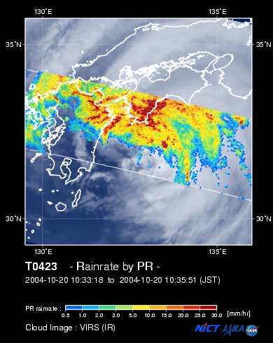
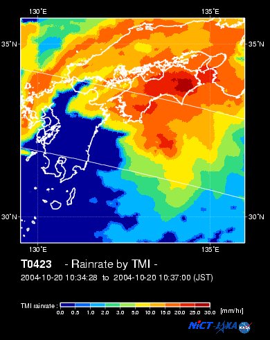
Figure 3 is a super-imposed image of rain rates near the Earth's surface observed by PR and the cloud image observed at 1034 (JST) on October 20 by VIRS; both sensors are aboard the TRMM satellite. Figure 4 presents the precipitation observed by TMI aboard the TRMM satellite at the same time. You can see that the heavy precipitation area (red and yellow) is distributed in parts of Kyushu and Shikoku. Typhoon No. 23 was also named Typhoon Tokage, after the Japanese constellation name "Tokage-za" which means Lizard (Lacerta). Please visit here for more information on the names of typhoons.
Related sites: |