ページの先頭です。
本文へジャンプする。
【Important Notices】This page is an archive page of information published in the past. Since the update has been completed, it may contain broken links or outdated information. For the latest information, please use the new site Earth-graphy (earth.jaxa.jp).
ここからサイト内共通メニューです。
サイト内共通メニューを読み飛ばす。
サイト内共通メニューここまで。
ここから本文です。

Seen from Space 2004

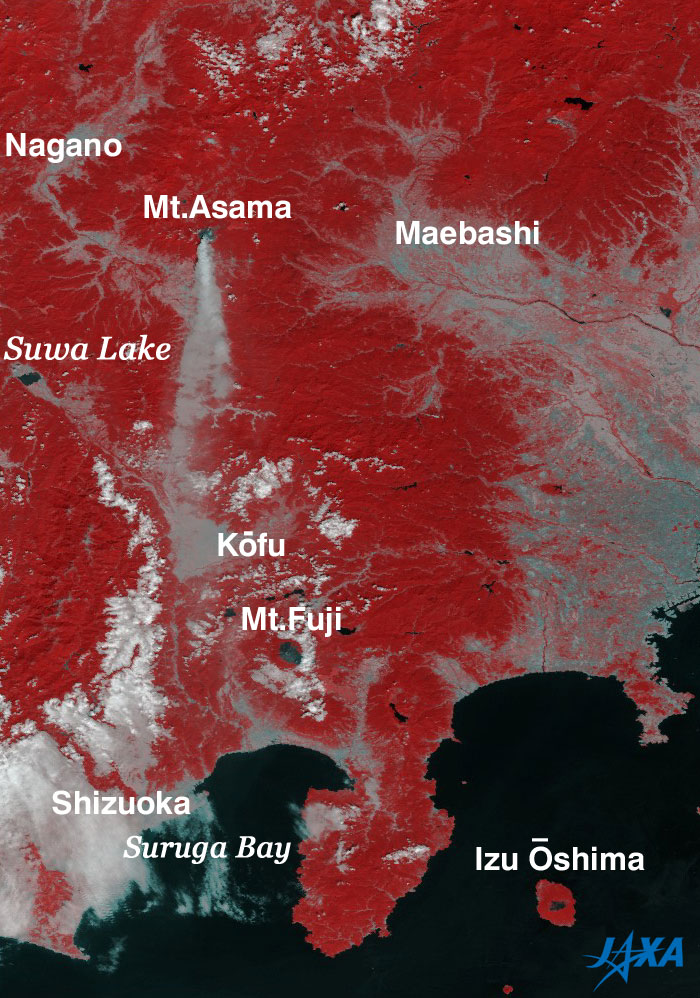
Mt. Asama seen from space

 
Fig. 1. Ash plume from Mt. Asama
(10:28 AM on September 16, 2004)
Fig. 2. Ash plume from Mt. Asama
(12:04 PM on September 16, 2004)

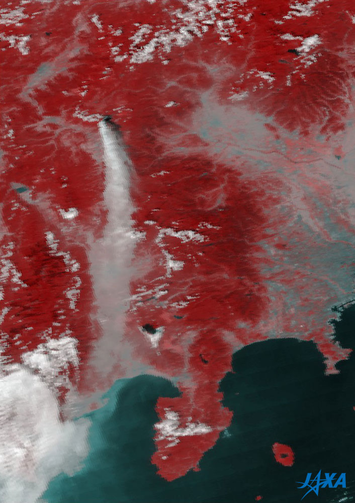
MODIS sensors aboard NASA's Earth observation satellites Terra and Aqua captured the ash plume and water vapor from Mt. Asama. Mt. Asama is located at 36°24'12"N, 138°31'34"E and appears in the upper left of the images.

Figure 1, observed at 10:28 a.m. on September 16, 2004, shows the ash plume from Mt. Asama stretching southward over Kofu city. In Fig. 2, observed one and a half hours later, the ash plume widens a little, continues stretching southward, and eventually extends over Suruga Bay.


Explanation of the images:
Fig. 1
Satellite: EOS-Terra (NASA)
Sensor: MODIS: Moderate Resolution Imaging Spectro-radiometer (NASA)
Time and date: 1028 (JST) on September 16, 2004
Fig. 2
Satellite: EOS-Aqua (NASA)
Sensor: MODIS: Moderate Resolution Imaging Spectro-radiometer (NASA)
Time and date: 1204 (JST) on September 16, 2004

Color composition was made by using MODIS 250 m resolution channels 1 and 2, and assigning channel 2 (841 - 876 nm) to red, channel 1 (620 - 670 nm) to green and blue, resulting in the figures below.
Red Forests
White Clouds
Black or dark gray Water surfaces (sea, lakes, and rivers), exposed rocks (summits of Mt. Fuji, Mt. Mihara at Izu-Ohshima Island, and Mt. Asama)
Light gray City area, ash plume

Figure 2 looks a bit blurred compared to Fig. 1 because Fig. 2 was captured near the edge of the MODIS sensor field of view.

Related sites:
MODIS near-real-time images (Proceed to "250 m" then to "Tokyowan." Mt. Asama is located in the upper left of the images.)
Mt. Usu information (Japanese only)
R&D Products
Miyake island information
本文ここまで。
image:Satellite Navigator
image:Satellite Applications and Operations Center(SAOC)
Earth Data Collection by JAXA Satellites
image:ページTOP