Seen from Space 2004
Typhoon No. 16 (CHABA) strongest in 2004
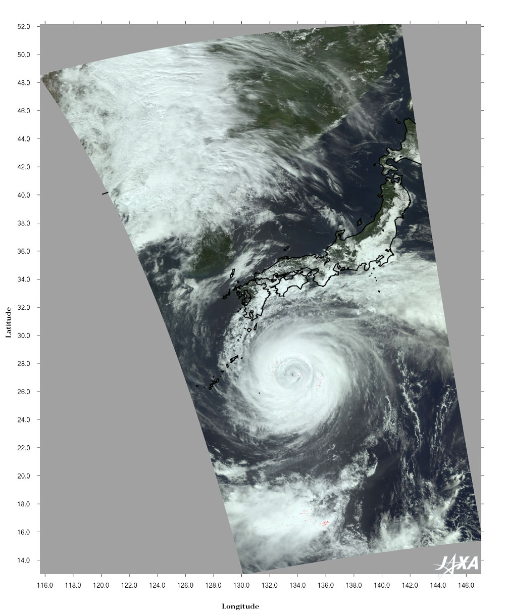
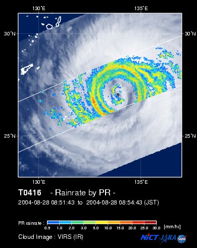
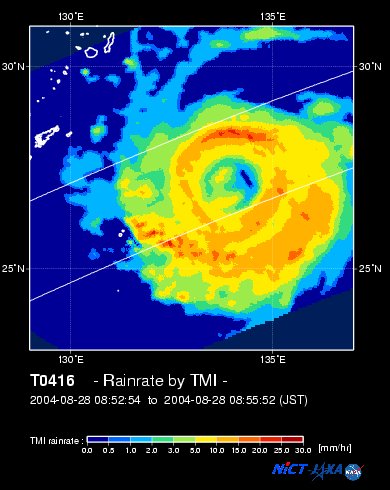
Powerful Typhoon No. 16 (CHABA) struck near Kushikino, Kagoshima, around 0930 on August 30. While the typhoon approached, maximum wind gusts reached 58.1m in Makurazaki-shi, Kagoshima, at 0240 on August 30, the second highest reported gusting ranking behind 62.7m reported for the Makurazaki Typhoon in 1945. Figure 1 is typhoon No. 16 as observed by MODIS on board the Aqua satellite at 1310 on August 28 (JST). Figure 2 indicates the rain rate near the surface observed by the Precipitation Radar(PR)on board the Tropical Rainfall Measuring Mission (TRMM) satellite overlaid with cloud images derived from the Visible Infrared Scanner (VIRS)at 0800 (JST) on August 28. Figure 3 indicates the precipitation as acquired by the TRMM Microwave Imager (TMI) on board the TRMM satellite at about the same time. Red represents intense rain. There is no rain in the center of the Typhoon.
This typhoon was the 6th to strike this year, setting the record for the most tyhoons to strike during August and tying the most typhoons for a single year. It was traveling northwest and could turn around the edge of the Pacific anticyclone since it was born near the Marshall Islands on August 19. However, the course changed under the influence of westerlies near Japan and the typhoon moved down through western Japan. It is speeding up and may enter the Sea of Japan. It is now expected to travel toward northern Japan. The tide is at its highest this time of year and is overlapped by spray tide.It is therefore necessary to be alert for tidal waves and high tide water in addition to driving wind and rain.
Related sites: |