Seen from Space 2004
Major Typhoon Namtheun Approaching Japan
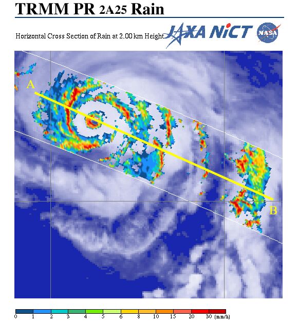
Major typhoon Namtheun is presently moving slowly west-northwest over the ocean south of Japan. It is predicted to come close to West Japan this weekend if it continues on this course. During the hot summer season, typhoons move more slowly because they are hampered by a strong high pressure over the Pacific Ocean. They also tend to follow a weaving course, which makes predicting their movement difficult. The Precipitation Radar (PR) aboard the Tropical Rainfall Measuring Mission (TRMM) acquired this image of the typhoon (*). Figure 1 presents the cloud image acquired by GOES-9 overlaid by an image of precipitation at 2km altitude acquired by PR at 6 o'clock on July 27 (JST). This typhoon seems to have double eyes, which means that there is no rain outside the heavy rain area, indicated in red around the small eye. We can also see a linear heavy rain area called a rainband in spirals outside the small eye.
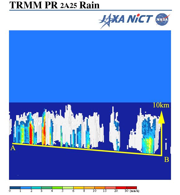
Figure 2 depicts the three-dimensional rainfall structure and precipitation along A to B in Fig. 1. Intense rainfall areas can be found around the eye, the top of which reaches 10km high. You can see the latest images of typhoon in the TRMM Tropical Cyclone quick report. (*) Typhoon Namtheun images were acquired by AMSR-E, flown aboard Aqua, on July 28 and developed by JAXA. >>Typhoon Namtheun acquired by AMSR-E
Related sites |
|||||||||||||||