Seen from Space 2004
Pair of Typhoons Approaching Japan
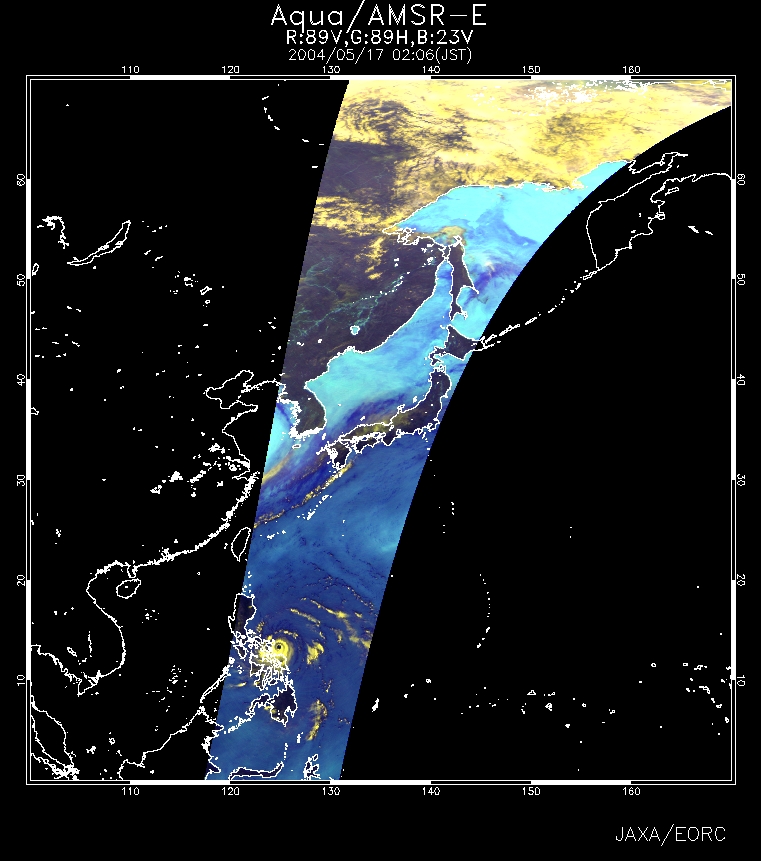
Typhoon No. 2 (Nida) was acquired by AMSR-E, developed by JAXA and flown aboard Aqua, and by TMI flown aboard the Tropical Rainfall Measuring Mission (TRMM). Figure 1 is an AMSR-E near-real-time image. Dark blue on the sea surface indicates a large volume of water vapor in the atmosphere, and yellow, well-developed clouds. These images can be seen in "Today's Image" on EORC's webpage.
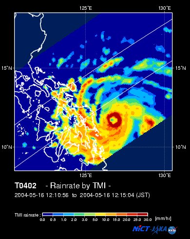
Figure 2 indicates the precipitation as acquired by TMI. You can see the strong precipitation area around the clear eye. Nida was born east of Mindanao Island, the Philippines, at 8°N and 131°E. It then moved northwest and is currently making its way to east-northeast, passing south of Ishigakijima at noon of May 19. Nida could approach Japan and move inland anytime. Also, Typhoon No. 3 (Omais) was born near Caroline Island of the Federated States of Micronesia at 8°N and 138°E. It made its way west-northwest and passed east of the Phillippines at noon of May 19. It is expected to move south of Nida. The United States had named typhoons born in the northwest Pacific Ocean until 1999. Asian names were then adopted from January 1, 2000. Nida is a woman's name in Thailand, and Omais means wandering in the United States. EORC JAXA has published the TRMM Tropical Cyclone quick report and will release the AMSR-E Tropical Cyclone quick report this year. Related sites:
|
||||||||||||||||||||||