Seen from Space 2004
A Huge Lake Capable of Expansion and Contraction: Lake Tonle Sap
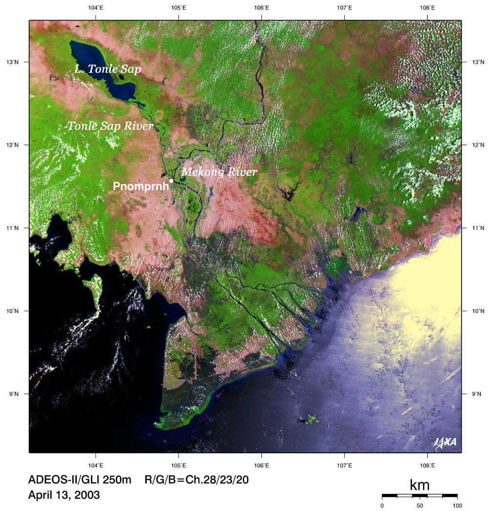
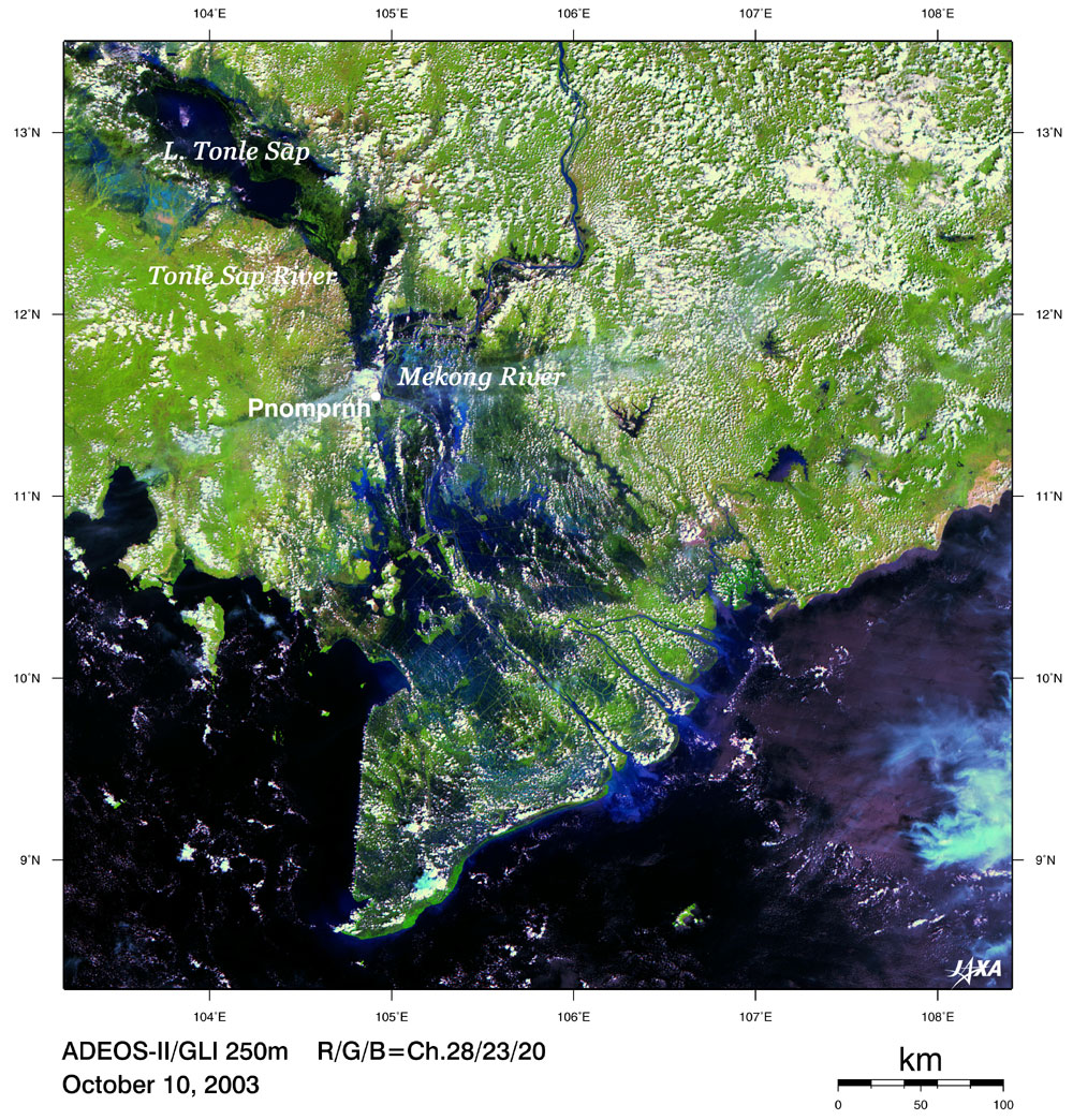
Shown above are the images of Lake Tonle Sap and the basin of the Mekong River located in the middle west region of Cambodia that were obtained by ADEOS-II/GLI. Figure 1 depicts the area in the dry season (Apr. 13), and Fig. 2, during the rainy season (Oct. 10). Portions shown in green represent vegetation areas (forests, farmland, etc.); portions shown in red or brown, non- vegetation areas (soil, etc.); and portions shown in black or blue, water areas (lakes, rivers, sea, etc.). This region experiences the summer monsoon (rainy season) from May to early October. The image shows Lake Tonle Sap, the largest freshwater lake in South East Asia (upper left corner of the image), is expanding at the end of the rainy season by flooding peripheral forests and farmland. Tonle Sap River flows out of Lake Tonle Sap and joins with the Mekong River in Phnom Penh, the capital. When the level of the Mekong River rises by 10 m during the rainy season, the level of Lake Tonle Sap also rises by 10 m due to the water that flows upstream, resulting in expansion of the area of Lake Tonle Sap to three to four times the area in the dry season. The area of Lake Tonle Sap in Figs. 1 and 2 was estimated by image analysis and found to be 3,300km2 in Fig. 1 and 1,600km2(*) in Fig. 2. The area has thus increased by 3.5 times. Though this looks like a large disaster at a glance, this is a natural phenomenon that occurs every year in this region. Inhabitants of this region therefore live together with water by adapting to changes in the environment, such as living in houses built on stilts over the water and relocating to houses on the land during the rainy season. Lake Tonle Sap was born when the sea level rose 5,000 years ago. A large variety of fish live in this lake, and the forests inundated during the rainy seasons have served as spawning grounds for fish and playgrounds for fry. Furthermore, 1.2 million people, more than 10% of the total population of Cambodia, have made a living by fishing in Lake Tonle Sap. In recent years, however, there is a fear of changes in ecosystem and decrease in water resources due to the combined effects of the inflow of sediment into Lake Tonle Sap caused by deforestation as well as reckless and illegal fishing. A great cry has thus been raised, emphasizing the importance of monitoring future environments in this region. Incidentally, the Angkor Wat, a grand Hindu temple built in the 12th century, is located to the north of Lake Tonle Sap (lat. 13°30' N and long. 104°E). (*) Almost 15 times as large as Lake Biwa.
|