Seen from Space 2004
The Source of Asian Dust (Kosa)
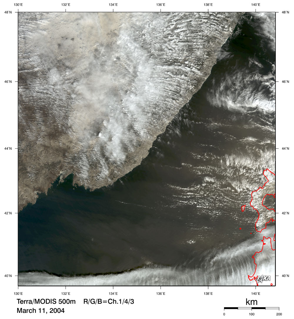
|
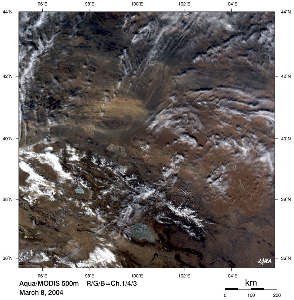
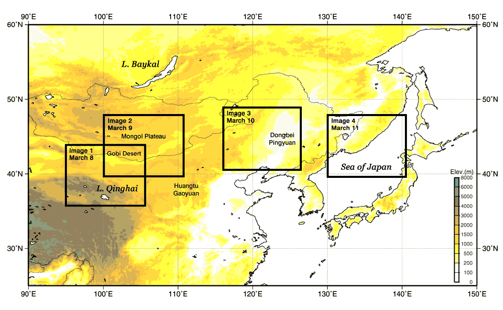
The MODIS sensor aboard NASA's Aqua satellite captured an image of the Asian dust (*) cloud around the border between China and Mongolia, north of Lake Ching Hai (see Image 1 acquired on March 8.) We estimate that this Asian dust cloud was one of the sources of the Asian dust observed in all parts of Japan on March 11. The light brown stripes in the east-west direction in the cloud gap indicate the Asian dust; the main body of the cloud is white.
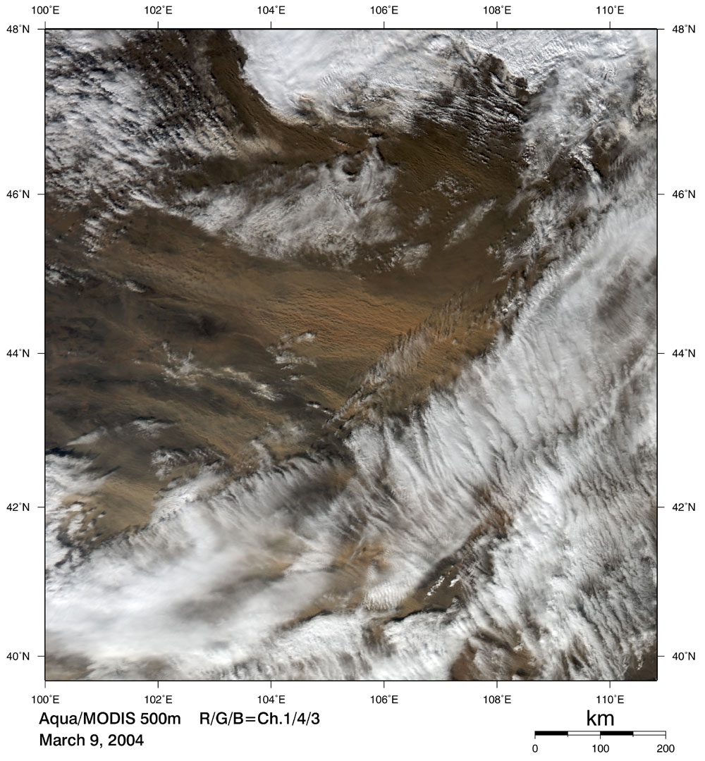
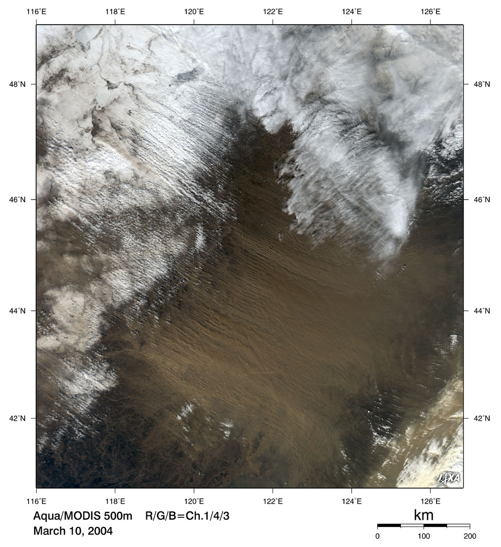
The Asian dust was carried by strong westerlies and eventually reached Japan. Image 2 (March 9), Image 3 (March 10) and Image 4 (March 11) depict how the Asian dust moves and spreads day by day. The Asian dust is generally observed annually in western Japan, such as in the Kyushu area, around March to May, but this time it was observed over a wide area including the Kanto Plain, Tohoku and Hokkaido where it was observed for the first time since November 2002. The news reported that the visibility decreased to as little as 4 km in Fukaura Town, on the west coast of Aomori Prefecture.
(*) We generally call the sand the Asian dust (Kosa) phenomenon in which much sand is lifted by strong winds in the Loess Plateau of China, Gobi desert or Taklimakan desert; travels across the sky; and finally drifts slowly to the ground. The Asian dust is lifted into the air by the wind due to a depression at the source, and is then carried eastward and spreads as the depression passes. Related topics: The Asian dust (KOSA) on November 11 and 12, 2002 Kosa over Japan Sea Explanation of the images Satellites: NASA's Aqua and Terra Sensor: Moderate Resolution Imaging Spectroradiometer (MODIS) Observation Dates: March 8-11, 2004 These are composite images generated from MODIS's three visible spectral channels, channel 1 (620-670 nm; red), channel 4 (545-565 nm; green), and channel 3 (459~479 nm; blue). This combination yields colors similar to those as seen by the human eye. The original resolution is 250 m for Ch. 1 and 500 m for Ch. 3 and Ch. 4. |