Seen from Space 2004
Shrinking Sea in the Desert: The Aral Sea
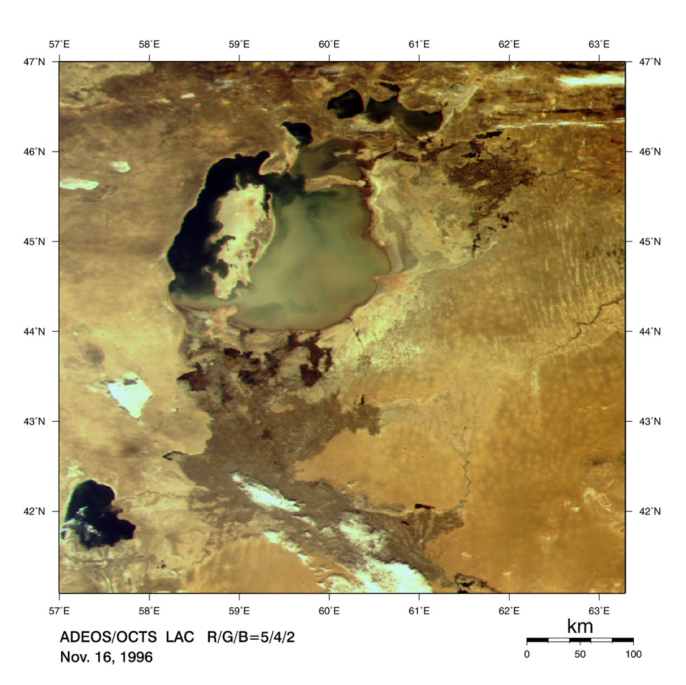
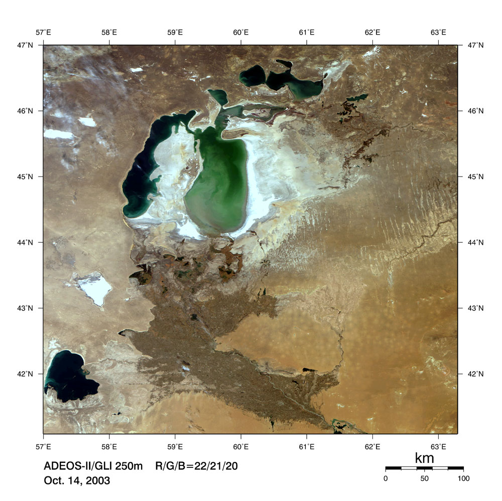
The Aral Sea lies astride Kazakhstan and Uzbekistan in Central Asia. It previously held much water in a dry area and was the fourth largest lake in the world, about 100 times as large as Lake Biwa. However, the water of the Aral Sea is currently declining rapidly, and its area is shrinking year-by-year. Around 1989, it was divided into the small Aral Sea on the north side and the large Aral Sea on the south side. Moreover, the large Aral Sea is soon going to be divided into eastern and western parts. Image 1 depicts the Aral Sea on November 16, 1996 and Image 2 depicts that of October 14, 2003. The former was acquired by OCTS on Midori, and the latter was acquired by GLI on Midori-II. We can readily see that the outline of the lake has drastically changed during the last seven years. We can see the land surface covered with salt, the white area in image 2), appears in the former lake bottom along with the shrinking Aral Sea. It was reported that the present Aral Sea is less than half of its former area and has a harsh environment dominated by salt water in higher concentrations than in the Dead Sea with water declining rapidly.
Image 3 is an overview of the area around the Aral Sea acquired by GLI on October 14, 2003. Two great rivers, the Amu Darya and Syr Darya, flow from the Hindu Kush Range and Tian Shan Range covered, which is permanently covered with snow. The rivers give greenery to Karakum Desert and Kyzylkum Desert on the way to an inland lake known as the Aral Sea. In the vicinity of the rivers, cotton is grown with the use of irrigation water (indicated as zonal dark green on the image). This irrigation is suggested as the cause of the shrinking Aral Sea. As a result, much salt that had been found on the lake bottom flies in all directions and causes damage to crops, aerial pollution, and poor health. Also, the climate change induced by the shrinking Aral Sea has negatively impacted cotton cultivation, which underpins the economy of surrounding countries. These countries are taking measures to prevent further shrinking of the lake. Acquired images Image 1: Satellite: Advanced Earth Observing Satellite "MIDORI" (ADEOS) Sensor: Ocean Color and Temperature Scanner (OCTS) Date: November 16, 1996 This is a composite image generated from GLI's three visible spectral channels, channel 5 (565 nm; red), channel 4 (520 nm; green), and channel 2 (443 nm; blue). Although the image renders colors similar to those as seen by the human eye, it looks a little yellowish as against image 2 and 3 because of the difference between GLI and OCTS. The original resolution is 700 m. Image 2 & 3: Satellite: Advanced Earth Observing Satellite-II "MIDORI-II" (ADEOS-II) Sensor: Global Imager (GLI) Date: October 14, 2003 These are composite images generated from GLI's three visible spectral channels, channel 22 (660 nm; red), channel 21 (545 nm; green), and channel 20 (460 nm; blue). The images render colors similar to those as seen by the human eye. The original resolution is 250 m. |