|
 |
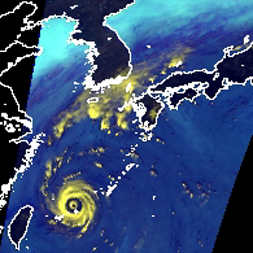
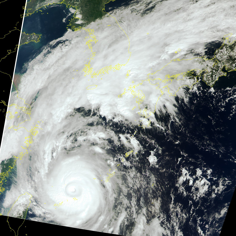
Intense typhoon Maemi is moving up the East China Sea.
According to the report of the Japan Meteorological Agency, Maemi has an atmospheric pressure of 915 hectopascals at its center with a wind speed of 55 meters a second as of 3p.m. September 11, 2003, and is classified as an intense typhoon.
AMSR and GLI on Midori-II acquired images of the typhoon moving through the Miyakojima area at 11:10 a.m. of September 11, 2003. From AMSR's images, we can obtain information about water vapor in the atmosphere, which is the advantage of Midori-II images over cloud images of meteorological satellites. In the image, whitish-yellow parts in the ocean indicate areas with heavy rain; light blue, areas with little water vapor in the atmosphere or thin clouds; and dark blue, areas with much water vapor in the atmosphere or thick clouds. GLI images are naturally colored as seen by human eyes.
In the AMSR's image, we can see a heavy rain area in whitish-yellow near Tsushima Straits, and the two-track eye of the typhoon in its center. The whitish-yellow parts in AMSR's image correspond to white parts of well-developed clouds in GLI's image.
Quick report of typhoon by TRMM http://www.eorc.jaxa.jp/TRMM/NRTtyphoon/index.htm |