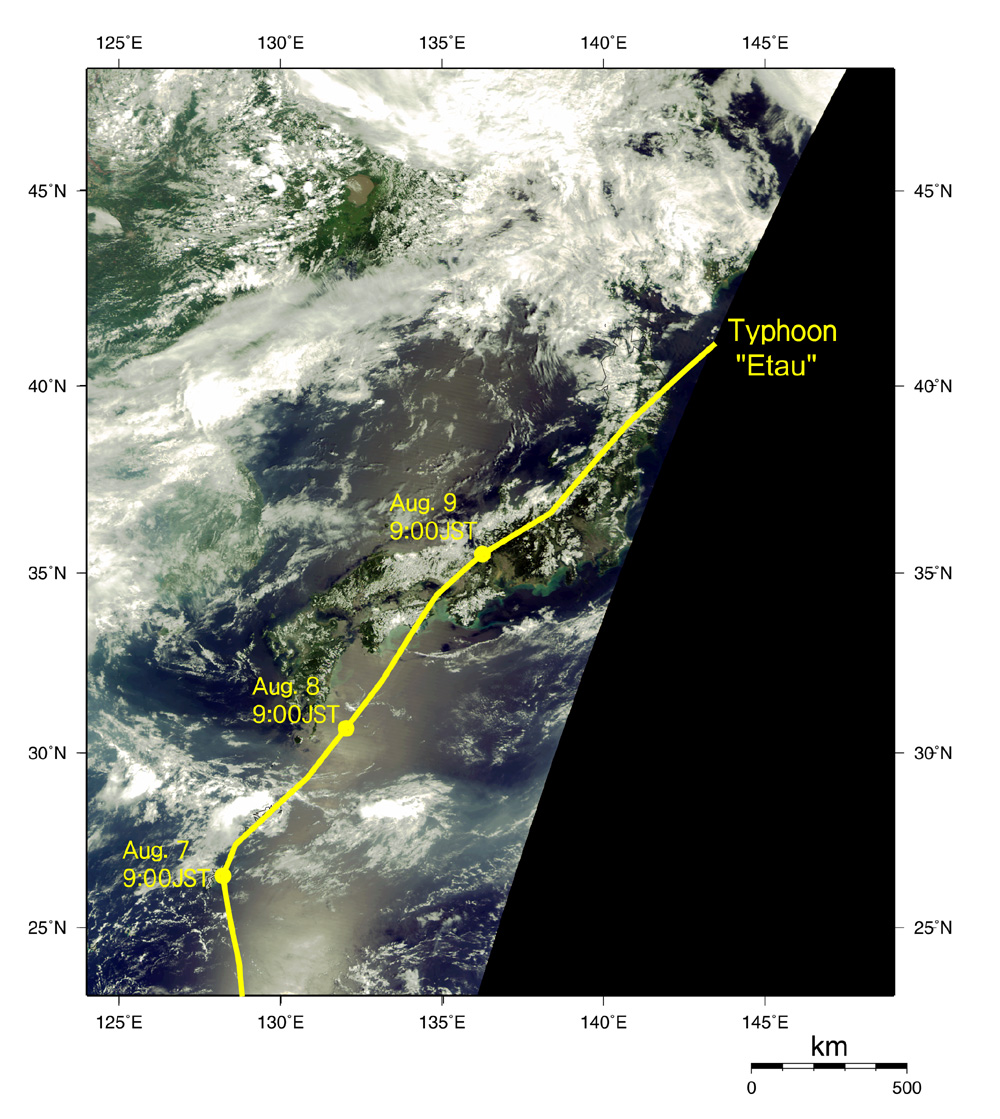
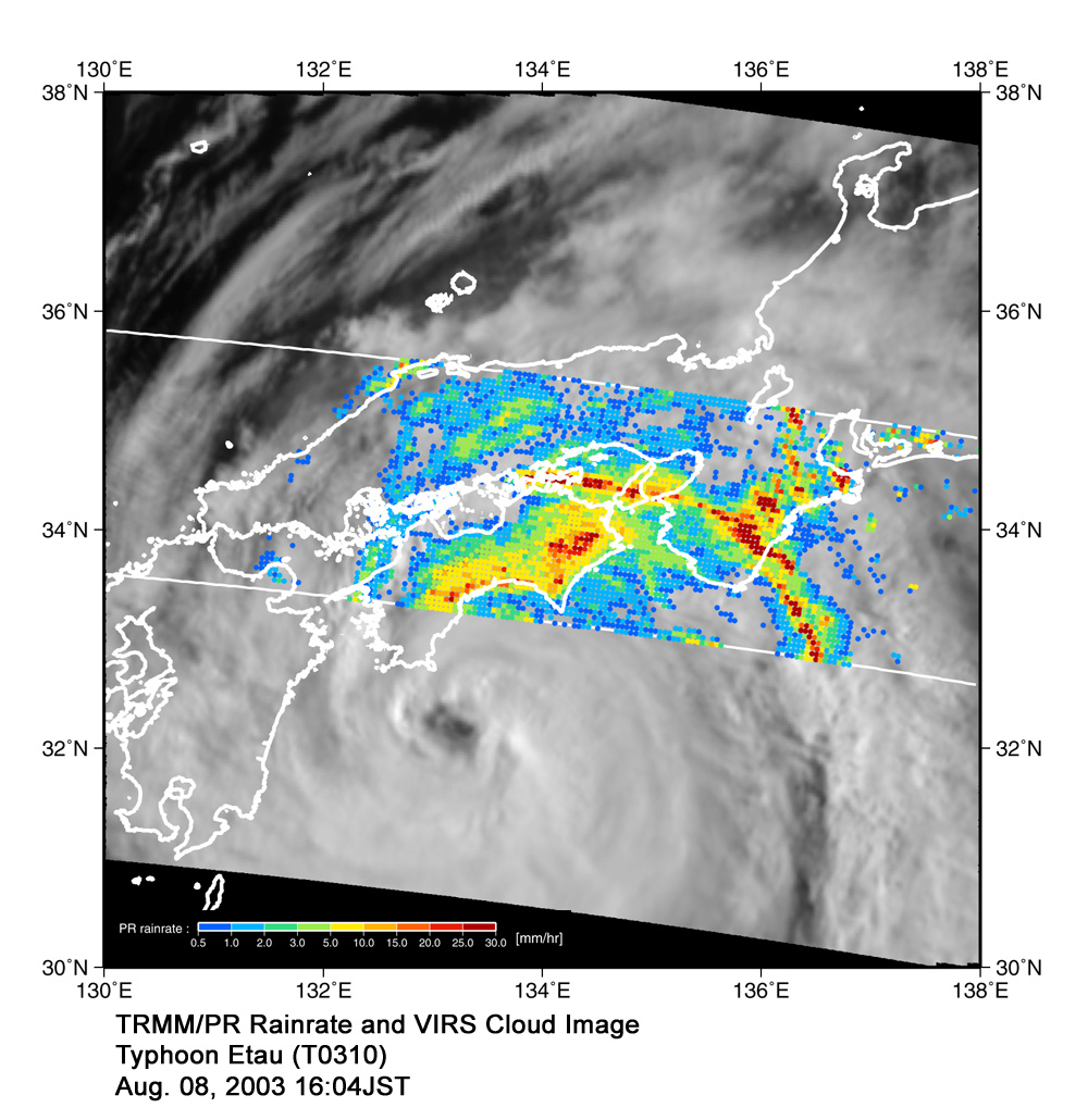
Tropical Rainfall Measuring Mission (TRMM) instruments acquired Image 5 of Kinki, Chugoku, and Shikoku districts around 4 p.m. on August 8, about five hours before the typhoon landed near Muroto-city. On a cloud image captured by Visible Infrared Scanner (VIRS) on TRMM, We overlaid an image indicating strength of rain captured by the Precipitation Radar (PR) on TRMM on a cloud image captured by Visible Infrared Scanner (VIRS) on TRMM. In this image, red areas indicate strong rain, and blue areas, light rain. We can see that moist air from the typhoon, which is the source of rain, was pushed against the Shikoku Mountains and Kii Mountains, and caused strong rainfall on the southeast side of the mountains. TRMM is a collaborative project between NASA and Japan.
|