|
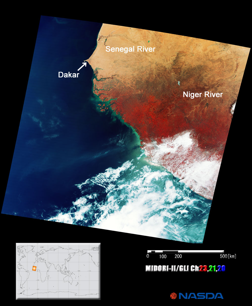
This is an image of West Africa, the area between Senegal and Liberia, acquired by GLI on March 29, 2003. Desert spreads throughout northern Africa, tropical rainforest extends from southern West Africa to the Congo River basin in Central Africa, and savanna ranges around the tropical rainforest - GLI could acquire these vegetations in different climate zone at the same time. We colored for the desert khaki, the tropical rainforest red, and the savanna dark brown. The white we see indicates clouds over the tropical rainforest. Also, we can see the headstream of great Niger River, which is 4,180 kilometers long, and Senegal River located north of Dakar and flowing along the border of Senegal and Mauritania. These are important water reserves for the people living in this dry region of West Africa.
The savanna is a prairie with an annual mean temperature exceeding 20°C and an annual total rainfall of around 1,000 millimeters. It has some shrubs in thick grass prairie, and the grass weeds feed herbivores and carnivores that eat them indirectly. When we enter the "sahel", the boundary between the savanna and desert, the scenery changes and the ground is covered by red soil with little grass and few shrubs. Sahel means "shoreside" in Arabic, and it can literally be a shoreside of green trees. In the rainy season, the shoreside of green trees extends north with rain, and in the dry season, it retracts south, and the sahel reverts to its original savage, half-desert region. This sahel, where people have long been keeping animals, suffers serious damage from drought and desertification caused by heavy cultivation and felling of trees.
In contrast, the tropical rainforest exists continuously from the seaside of West Africa to Lake Victoria via Central Africa. It has many big vines and smaller trees, in contrast to Southeast Asia that is forested with big trees, and many kinds of animals live there, such as gorillas and chimpanzees. However, 85% of the virgin forest in this area has already been destroyed by felling and cultivation. Furthermore, the area is still being reduced year-by-year without clarifying the mode of life of the animals. |