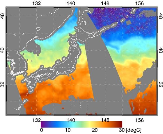
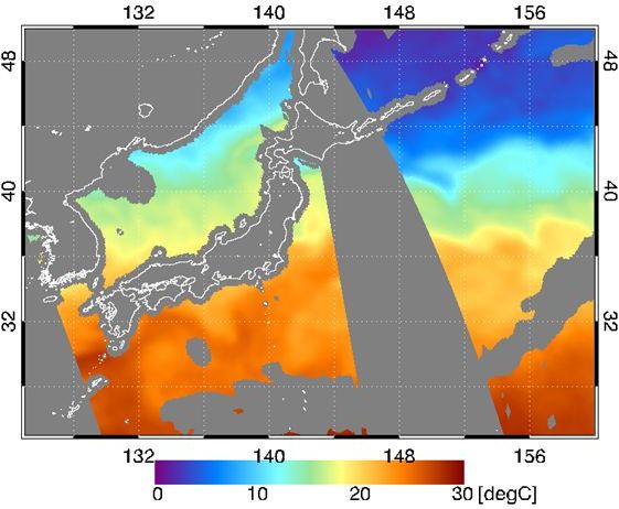
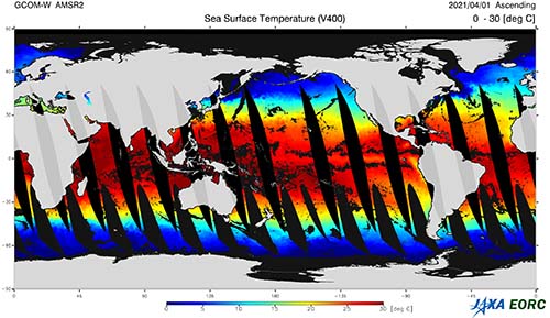
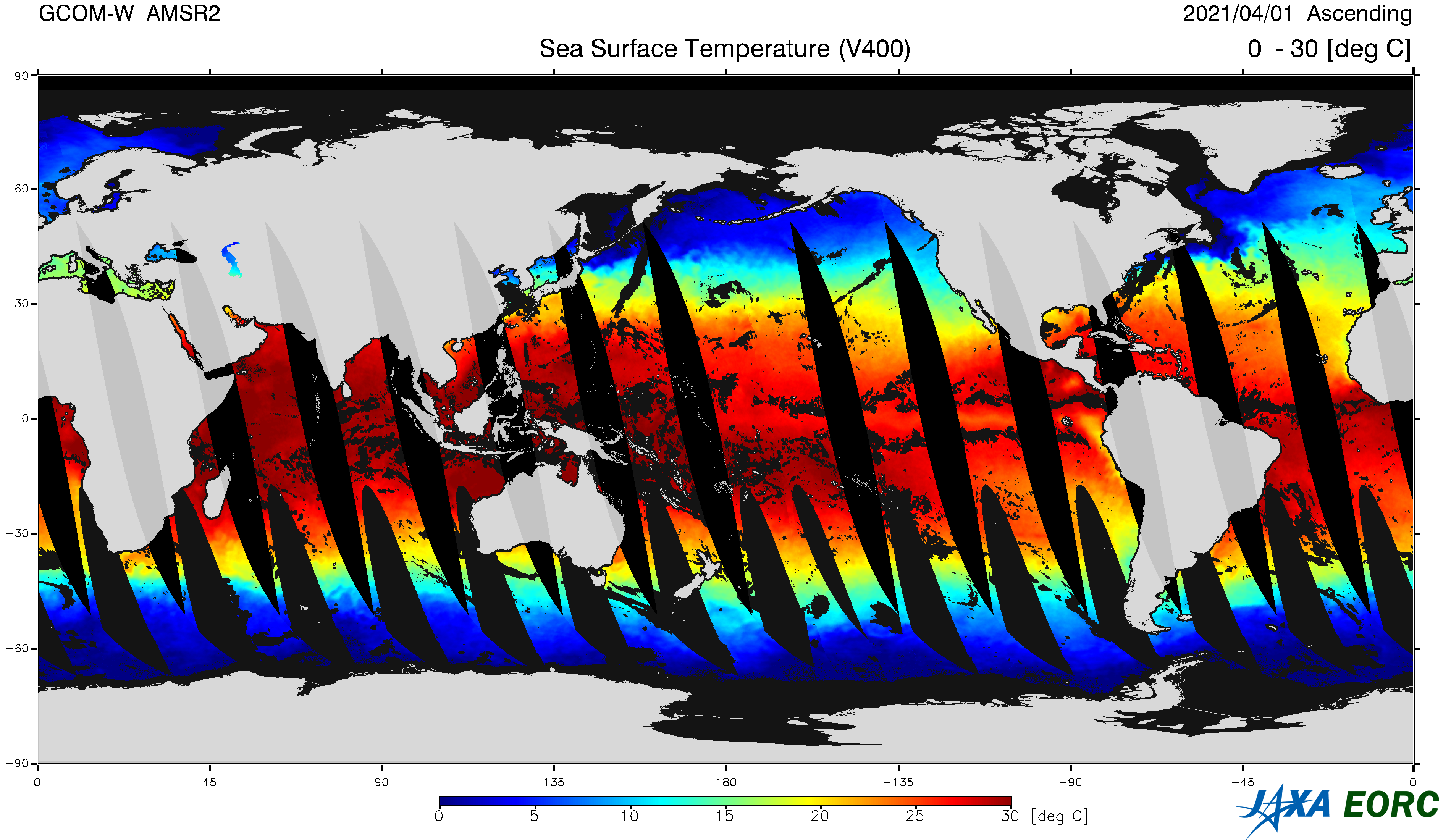
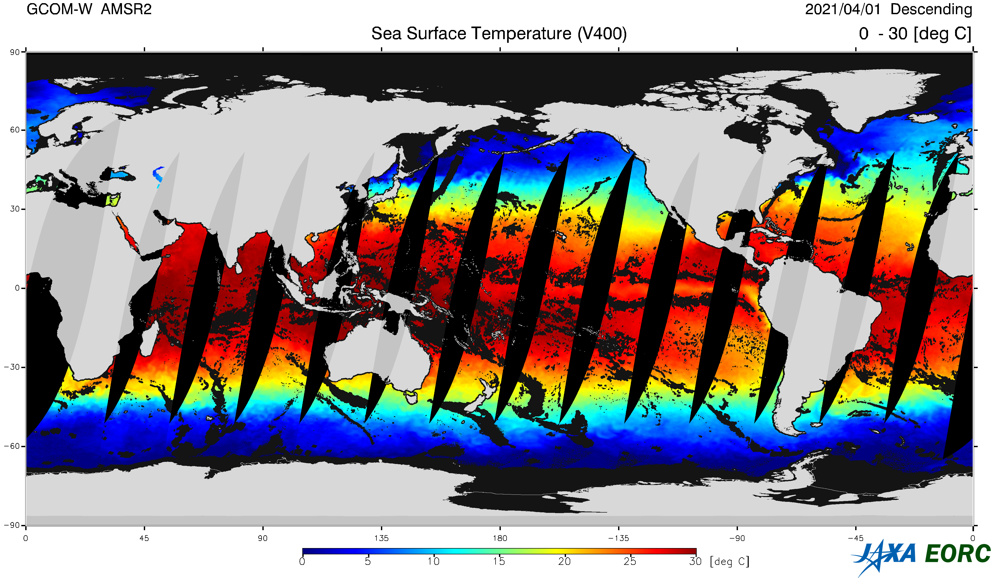
Sea Surface Temperature
(Standard Product)
Temperature of water at ocean surface. Coverage of the product is over the ocean only, and unit is [℃]. Its horizontal resolution is about 20-30 km and coarser than that of optical instruments. Microwave radiometer, however, can observe ocean surface through clouds, and monitor continuous change of sea surface temperature over the ocean where few clear region can be found in specific areas or seasons
-
SST
Ascending
-
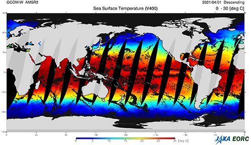
SST
Descending
Product Overview
| Product Name | Sea Surface Temperature DOI |
||
|---|---|---|---|
| Product Type | Standard Product | ||
| Processing Level | L2 (Swath data *2) and L3 (Grid data: EQR) | ||
| Product ID | SST | ||
| Spec. *1 | Satellite | AMSR3 | AMSR2 |
| Area | Global over ocean | Global over ocean | |
| Spatial Resolution | 6GHz SST: approx. 50 km 10GHz SST: approx. 30 km Multi-band SST: approx. 30 km |
approx. 50 km | |
| Accuracy Requirement | ±0.8 ℃ *3 | ±0.5 ℃ *3 | |
| Range | -2 〜 35 ℃ | -2 〜 35 ℃ | |
| Latest Version | AMSR3: ver. 0.0 2025-??-?? release
AMSR2: ver. 4.0 (2 July 2012 - 27 July 2022) 2020-10-13 release
ver. 4.1 (27 July 2022 - 17 April 2024)*4 2022-07-27 release
ver. 4.11 (18 August 2023 - 01 September 2023, 17 April 2024 - present)*4 2024-04-17 release
AMSR-E: ver.8 2019-07-05 release |
||
| Product Period | AMSR3: ??? 2025 〜 AMSR2: July 2012 〜 AMSR-E: July 2002 〜 October 2011 |
||
| Data Download | Globe Portal System (G-Portal) |
||
| Data Format | NetCDF AMSR3 Higher Level Format
???KB
HDF5 AMSR2 Higher Level Format 2.7MB
AMSR-E Level2 Format description 757KB
AMSR-E Level3 Format description 1.03MB |
||
| Stored Data | AMSR3: (1) 6GHz SST [℃], (2) 10GHz SST [℃], (3) Multi-band SST [℃] *5 AMSR2: (1) 6GHz SST [℃], (2) 10GHz SST [℃], (3) Multi-band SST [℃] *6 AMSR-E: (1) 6GHz SST [℃], (2) 10GHz SST [℃] *7 |
||
| Data Quality Flag | AMSR3 L2 SST Quality Flag
???KB
AMSR2 L2 SST Quality Flag
289KB |
||
| Algorithm Version | AMSR3 v0.0 (Algorithm Description,
??MB PDF page ?
)AMSR2 v4.1 (Algorithm Description, 3.9MB PDF page 33
) |
||
| Validation Result | GOSAT-GW・AMSR3 Standard Product
??MB PDF page ?
Update of AMSR2 SST, 10GHz and Multiband SST to Ver4.1 3.5MB |
||
- The specifications are defined in the AMSR3 Mission Requirement and AMSR2 Mission Requirement. The required accuracy is the standard accuracy of standard product defined in the mission requirement.
- Swath data is a format in which data for each footprint is stored in a two-dimensional array (observation points in scanning direction x number of scanning lines) in order of observation time.
- Except sea ice and precipitating areas. Goal accuracy is defined as monthly mean bias error in 10 degrees latitudes.
- For climate change analysis, version 4.11 (2 July 2012 – present) is available via the GHRSST server.
- The second and third layers of the AMSR3 standard product "6GHz SST" contain the standard products "10GHz SST" and "Multi-band SST".
- The second and third layers of the AMSR2 standard product "6GHz SST" contain the research products "10GHz SST" (ver. 2.1 or later) and "Multi-band SST" (ver. 4.0 or later).
- The second layer of the AMSR-E standard product "6GHz SST" contain the research products "10GHz SST" (ver. 2.0 or later).
Reference
Shibata, A., 2007: Effect of air-sea temperature difference on ocean microwave brightness temperature estimated from AMSR, SeaWinds, and buoys, J. Oceanogr., 63(5), 863-872., doi: 10.1007/s10872-007-0073-y
Shibata, A., 2006: Features of ocean microwave emission changed by wind at 6 GHz, J. Oceanogr., 62(3), 321-330., doi: 10.1007/s10872-006-0057-3
Shibata, A., 2004: AMSR/AMSR-E SST algorithm developments: removal of ocean wind effect, Italian J. Remote Sensing, 30/31: 131-142.
Revision History
April 17, 2024
AMSR2 Standard Product SST ver. ver. 4.411.411 release
Release note
225KB
July 27, 2022
AMSR2 Standard Product SST ver. 4.1 release
Release note
187KB
October 12, 2020
AMSR2 Standard Product SST ver. 4.0 release
July 5, 2019
AMSR-E Standard Product SST ver. 8 release (HDF5 AMSR2 Higher Level Format)
Reprocessing by applying the AMSR2 algorithm
Extension of swath width from 196 points to 243 points
Compliant with AMSR2 HDF5 format
Back Number
▸
March 1, 2017
AMSR2 Standard Product SST ver. 3.0
AMSR2 Products Update
1.5MB PDF page 3
March 26, 2015
AMSR2 Standard Product SST ver. 2.0/2.1
AMSR2 L2 Product
12MB PDF page 25
July 9, 2013
AMSR2 Standard Product SST ver. 1.0
AMSR2 L2 Product
3.7MB PDF page 3
September 29, 2011
AMSR-E Standard Product SST ver. 7 release
March 25, 2008
AMSR-E Standard Product SST ver. 6 release
March 12, 2007
AMSR-E Standard Product SST ver. 5 release
March 15, 2006
AMSR-E Standard Product SST ver. 4 release
March 1, 2005
AMSR-E Standard Product SST ver. 3 release
March 12, 2004
AMSR-E Standard Product SST ver. 2 release
September 19, 2003
AMSR-E Standard Product SST ver. 1 release