Image Library
Observation results of flooding in Thailand by airborne SAR sensor (Pi-SAR-L: L-band-Polarimetric and interferometry-Synthetic Aperture Radar)
Japan Aerospace Exploration Agency (JAXA) observed flooded areas in Thailand by the airborne SAR sensor (Pi-SAR-L: L-band-Polarimetric and interferometry-Synthetic Aperture Radar) on 24-27 September 2011. Pi-SAR-L was designed for developing and verifying the algorithm for ALOS and ALOS-s data processing.
Now, it is rainy season in Thailand, heavy rains have been causing intermittent flooding since last July, and more than one hundred people were killed and the damage for agricultural field was extensive. Therefore, it is imperative to identify the affected area and the situation. Observed areas were the flooded areas along the Chao Phraya River in Nakhon Sawan, Chainat, Sing Buri and Ayudhya provinces, located at North and Central parts of Thailand.
Since the flooded areas are often covered by cloud soon after heavy rain, optical sensor has a difficulty in immediate flood monitoring. However, Pi-SAR-L is a microwave sensor and all-weather imaging capability of Pi-SAR-L has enabled us to identify flooded paddy filed and other agricultural areas clearly.
In 2011, GISTDA (Geo-Informatics and Space Technology Development Agency, Thailand) and JAXA are collaborating in research projects for applications of earth observation data acquired by satellite and airborne sensors to three topics including flooding, coastal erosion monitoring and rice yield estimation. Especially, we are demonstrating the effectiveness of the observation by L-band SAR in Thailand. And this observation campaign has been held as a part of this collaboration.
JAXA plans to continue the joint research with GISTDA and utilize the findings from this project to the future missions including the Advanced Land Observing Satellite-2 (ALOS-2).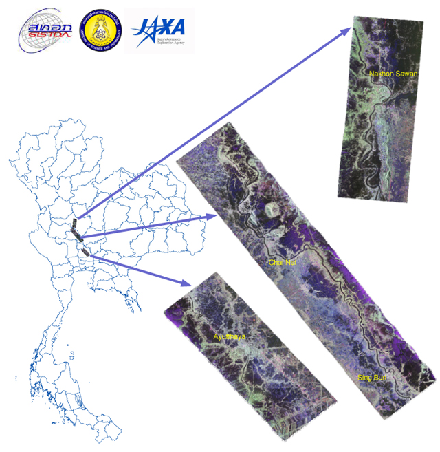
-
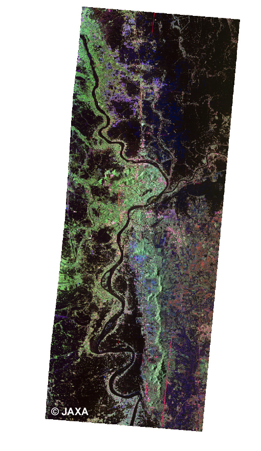 Nakhon Sawan(Click to view enlarged image)
 -
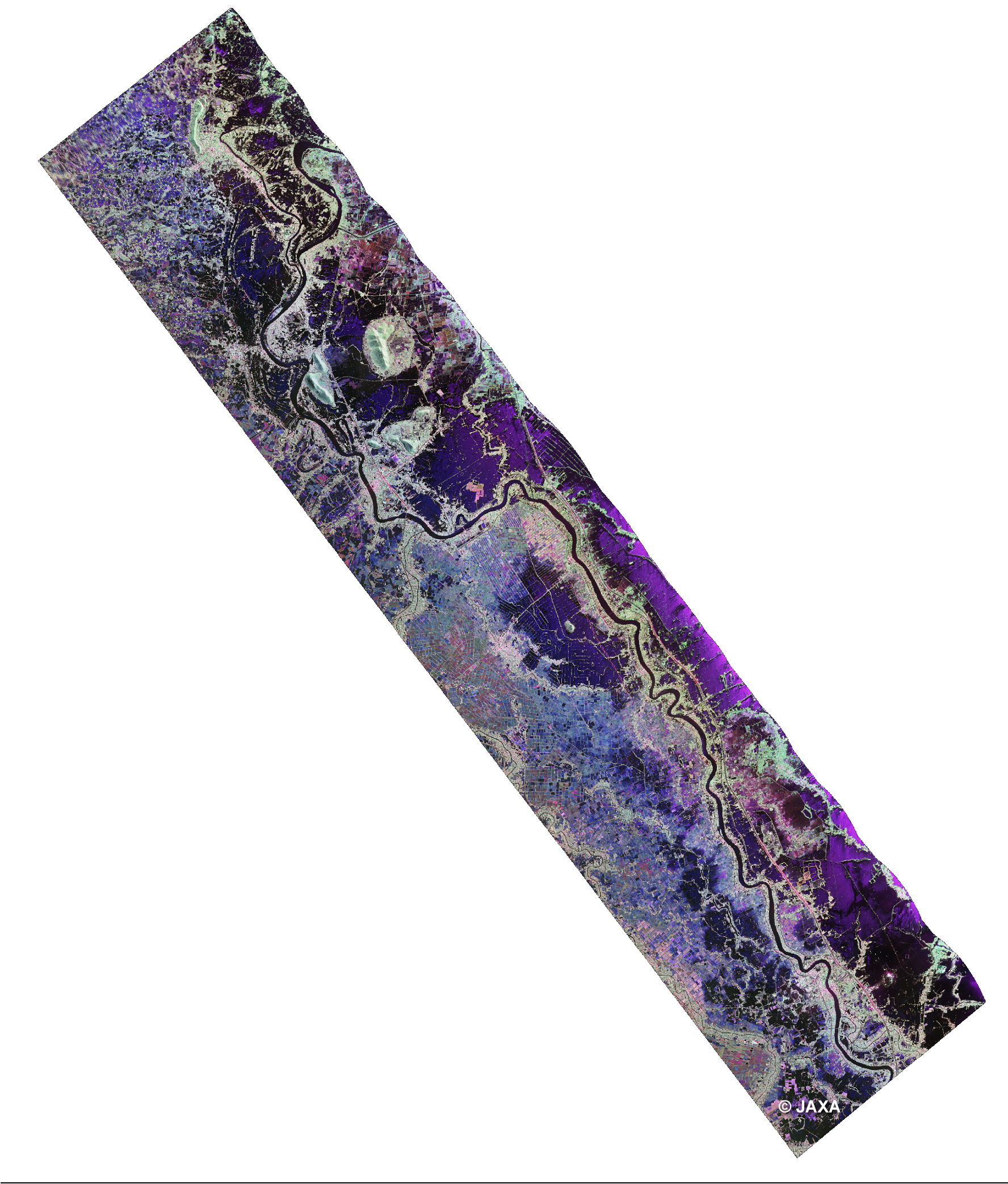 Chai Nat(Click to view enlarged image)
 -
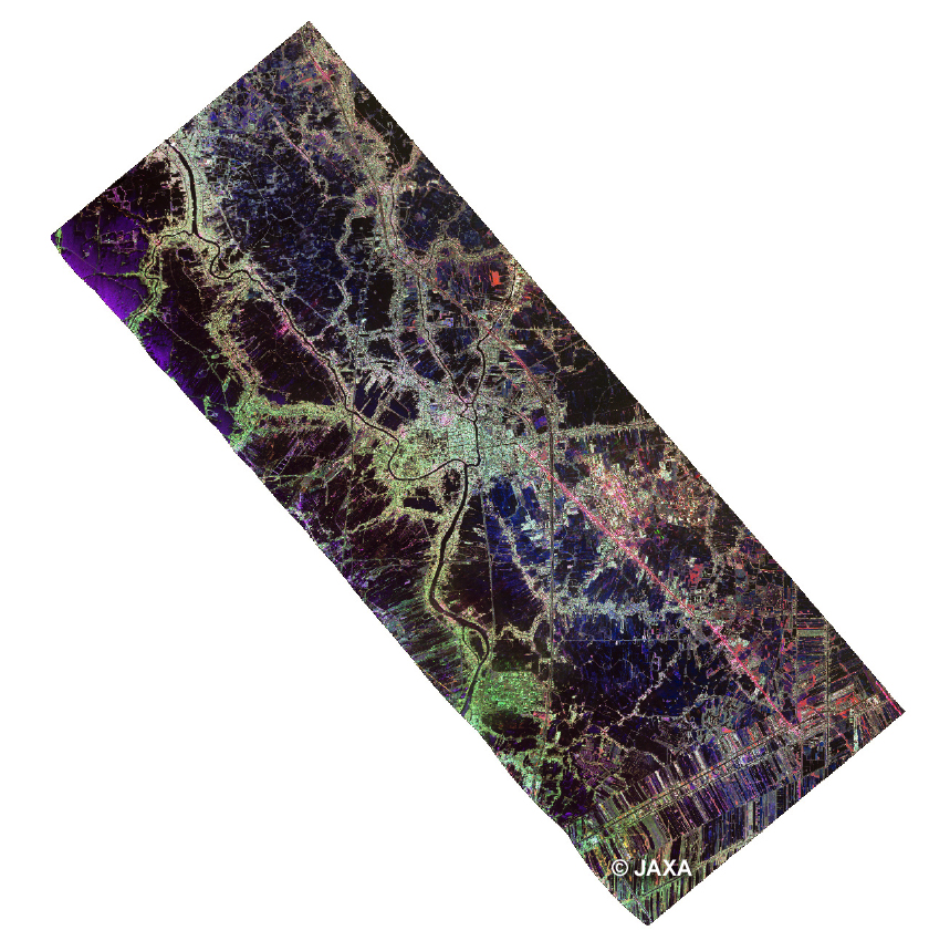 Ayudhya(Click to view enlarged image)
