Image Library
Forest monitoring using L-band SAR (PALSAR)
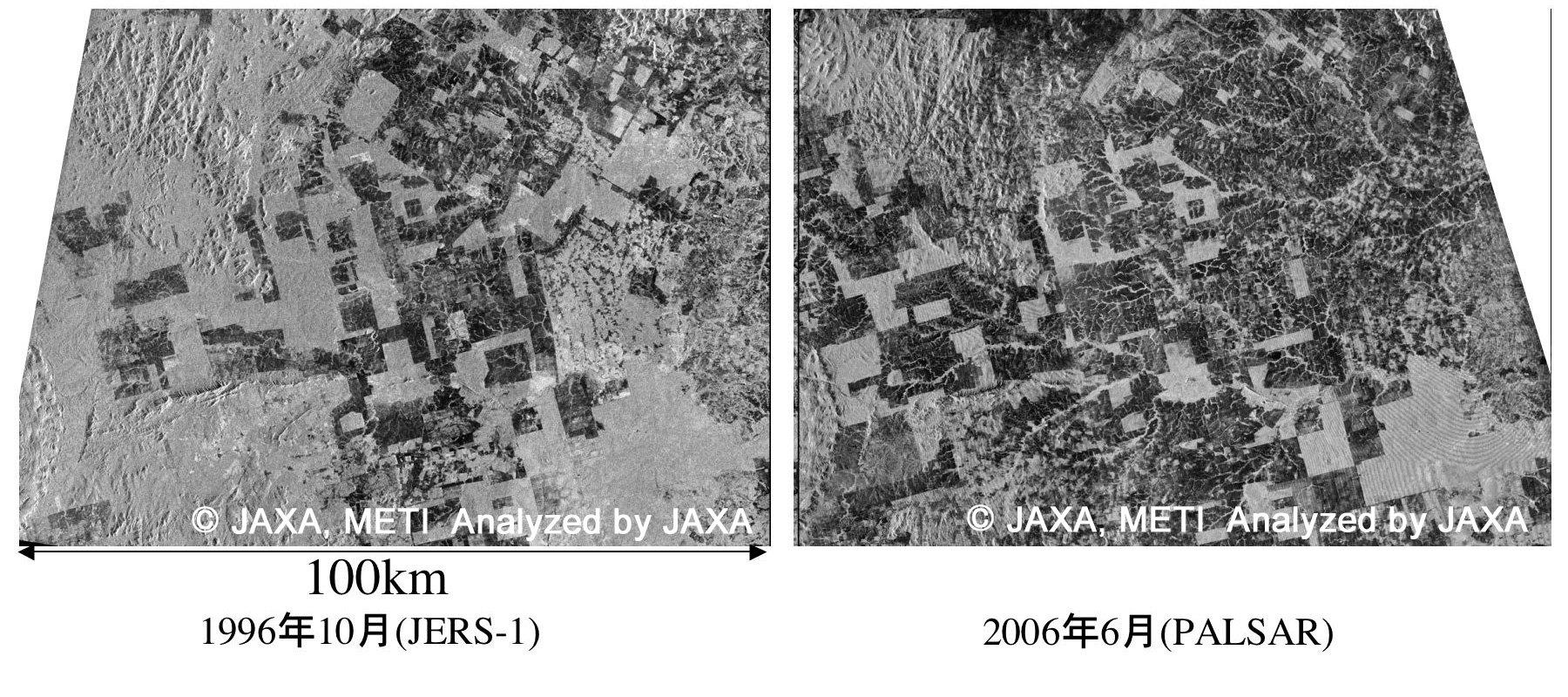
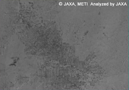
Natural tropical forests have been destroyed at the rate of 14,200,000 ha per year. Figure 1 depicts deforestation that occurred in 10 years in the Amazon, as captured in satellite images. In this image, grey indicates forested area and black represents deforested area. Comparing the image acquired by JERS-1/SAR in 1996 (Fig. 1 (Left)) with that acquired by ALOS/PALSAR in 2006 (Fig. 1 (Right)), we can easily see that much of the forest has been destroyed in the 10-year interval.
METI, JAXA
Fig. 1 Amazon deforestation in 10 years as determined using L-band SAR data.
Left: Image of Amazon forest area acquired by JERS-1/SAR in 1996.
Right: Image of same area acquired by ALOS/PALSAR in 2006.
(Click to view enlarged image)
Figure 2 depicts how the synthetic aperture radar observes a ground target, such as a forested or deforested area. A part of the radar signal emitted from the SAR antenna and scattered in the forest canopy is returned to the SAR antenna, and a bright SAR image of the forest is produced. In contrast, bare land and water surfaces act like mirrors that reflect the radar signal away from the SAR antenna, thus producing a black or dark image. SAR can acquire images even at night or in rain, which makes it useful for obtaining images of areas with heavy rainfall such as the Amazon or South-east Asia. L-band SAR (wavelength ~23cm) is more suitable for forest monitoring than C- and X-band SAR since L-band SAR doesn't affect the fine structure on the ground and can readily distinguish forested and deforested areas.
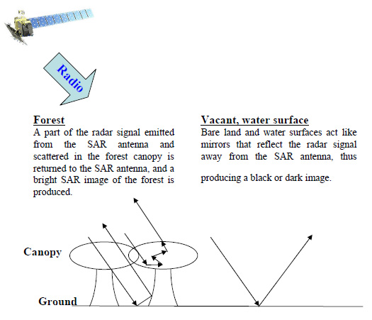
Fig. 2 Sketch of how SAR observes forested and deforested areas.
Figure 3 presents a mosaic image of the Amazon area acquired by JERS-1/SAR in 1996. Black in the image represents areas for which no data were observed. The stripe-like structure in the upper and lower images indicates observation coverage for the JERS-1/SAR, and the swath width is 75km. Mosaic images over various areas including the Amazon will be made with PALSAR in a global forest mapping project. The project will enable us to evaluate the extent of deforestation as shown in Fig. 1. JAXA will work to resolve environmental problems by providing satellite images.
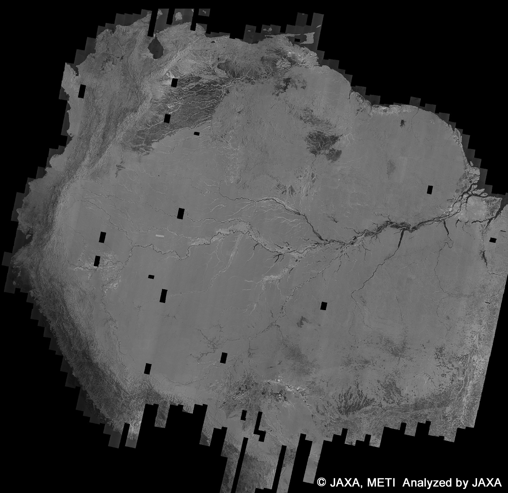
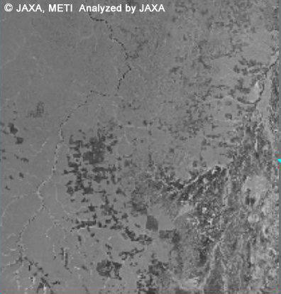
Fig. 3 JERS-1/SAR mosaic image taken in 1996 over the Amazon. Black in the image represents areas with no observation data. The enlarged image depicts a frequently deforested area.
(Click to view enlarged image)
Enlarged image
Enlarged image
JAXA EORC