Image Library
Observation Results of Mt. Ontake Volcano eruption by ALOS-2/PALSAR-2 and Pi-SAR-L2
The Japan Aerospace Exploration Agency (JAXA) observed Mt. Ontake volcano, which was suddenly erupted on September 27th, 2014, 11:53 (JST), with the Phased Array Type L-band Synthetic Aperture Radar 2 (PALSAR-2) aboard "DAICHI-2" (ALOS-2) satellite and the airborne L-band synthetic aperture radar (Pi-SAR-L2).
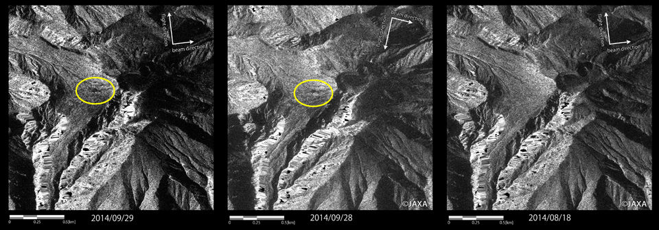
Table 1 lists the data acquisitions by PALSAR-2 over Mt. Ontake before (No. 1) and after (No. 2-6) the eruption. JAXA has provided those observed data to the agencies concerning disaster response.| Obs. date and time (JST) | Obs. mode | Obs. direction | Incidence angle(degrees) | Orbit direction |
|---|---|---|---|---|
| 2014/08/18 23:59 | Stripmap [3m] | right | 46.4 | Ascending |
| 2014/09/27 23:17 | Stripmap [3m] | left | 18.0 | Ascending |
| 2014/09/28 12:45 | Stripmap [3m] | left | 46.4 | Descending |
| 2014/09/28 23:37 | Stripmap [3m] | right | 21.9 | Ascending |
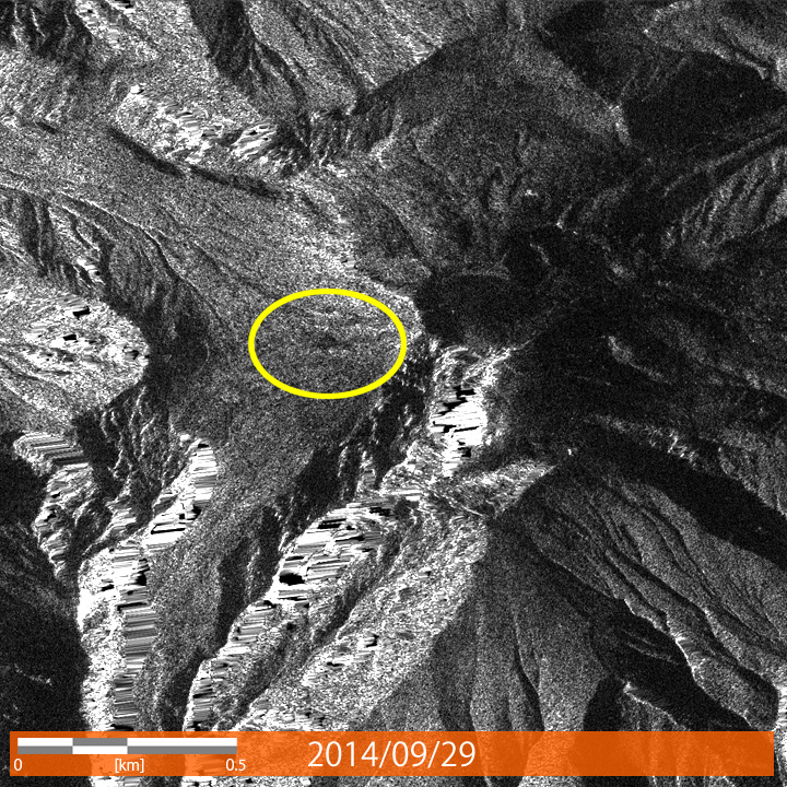
| 2014/09/29 23:59 | Stripmap [3m] | right | 46.4 | Ascending |
| 2014/10/02 12:30 | Stripmap [3m] | left | 32.4 | Descending |
(1) Change in the shape of the volcano
(Drag a slider over the image or click on the arbitrary position of the image to compare the images)*
(2) Distribution of volcanic ash accumulation

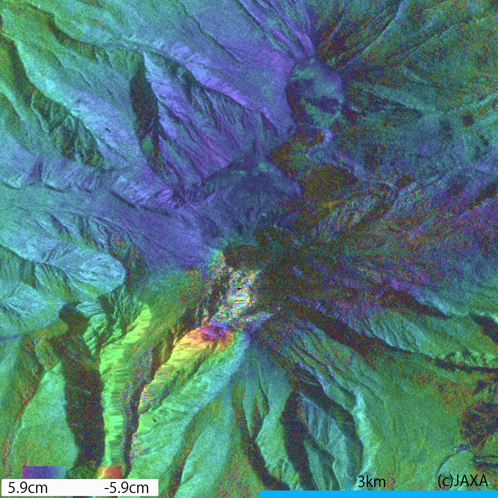
(3) Deformation detected by differential SAR interferometry
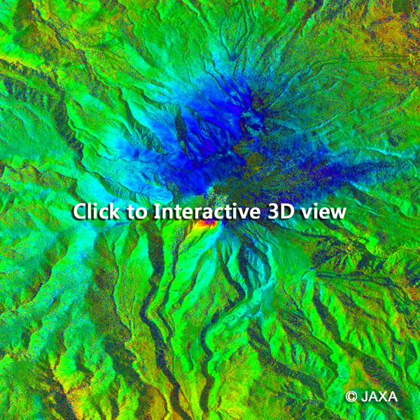
The observation data of Sep. 29 and Aug. 18 were acquired from the same orbital path. From these two datasets, differential SAR interferometry (DInSAR) processing can be used to detect the small deformation of the volcano.
Figure 4 shows the result of DInSAR over the area of 50km square including Mt. Ontake. A close-up image over 6km square around the volcanic crater is shown in figure 5. This interferogram depicts deformation of land surface (change of the distance between the satellite and the ground) in color, where green is no-change area.
From this result, deformation up to 9cm toward to the satellite is detected in the south-west side of the mountain. This change is considered to be a land motion in west direction associated with the volcanic activity. Note that this interferogram contains atmospheric error especially in high altitude area.
Figure 5 shows an interactive 3D view of the interferogram.
Required browser: IE11 or later, Safari5.1 or later, Chrome, Firefox or Opera.
For OSX Safari, WebGL may need to be enabled in the setting of your browser.
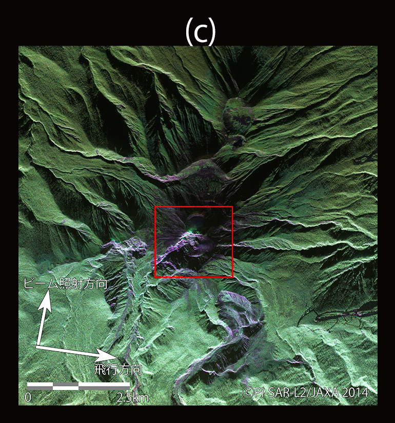
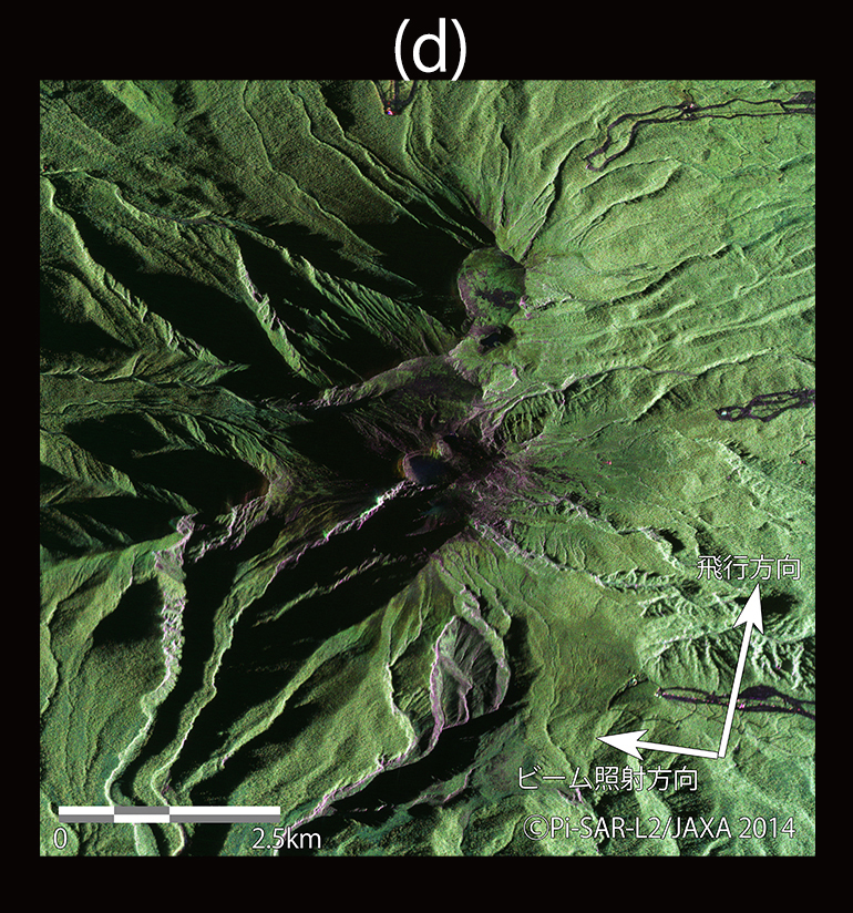
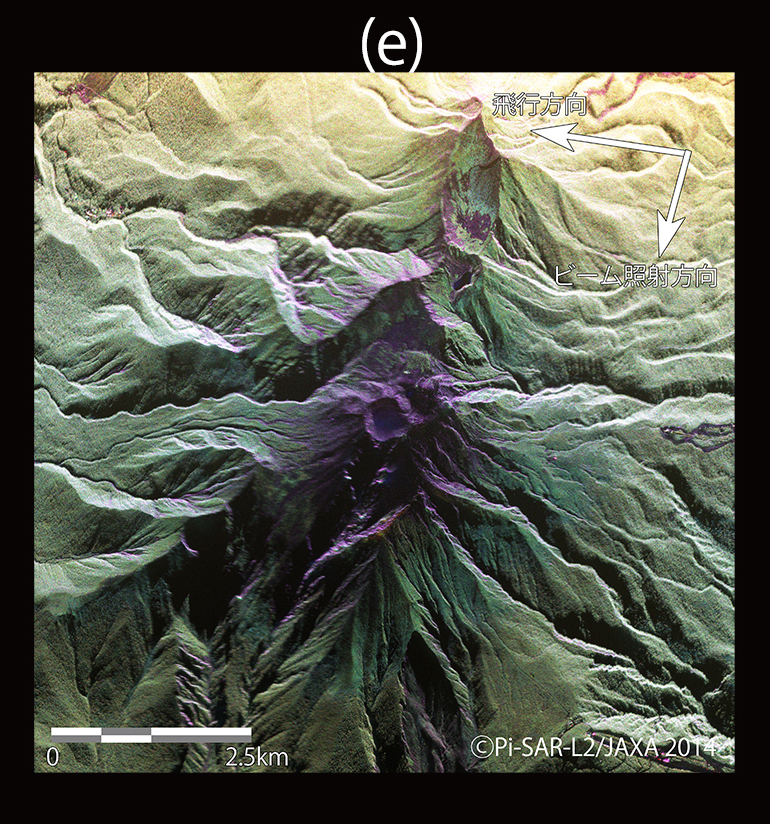
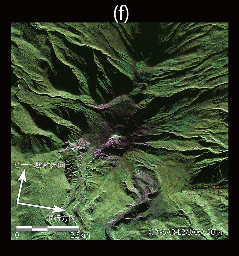
(4) Observation results by Pi-SAR-L2
JAXA observed Mt. Ontake by the airborne L-band synthetic aperture radar (Pi-SAR-L2) on September 30th, 2014. Observations from multiple directions and 13,000km altitude were conducted to monitor the volcanic activity such as new craters.
Table 2 lists the data acquisitions by Pi-SAR-L2 over Mt. Ontake with multiple flight directions and incidence angles.| # | Flight direction | Incidence angle(degrees) |
|---|---|---|
| a | east → west | 45 |
| b | north → south | 55 |
| c | west → east | 45 |
| d | south → north | 55 |
| e | east → west | 55 |
| f | west → east | 55 |
| # | Flight direction | Incidence angle(degrees) |
|---|---|---|
| a | east → west | 45 |
| b | north → south | 55 |
| c | west → east | 45 |
| d | south → north | 55 |
| e | east → west | 55 |
| f | west → east | 55 |
Figure 7 shows a bird's-eye view of the Pi-SAR-L2 image and an aerial photo captured from approximately-same direction. The craters can be seen in the circled area.
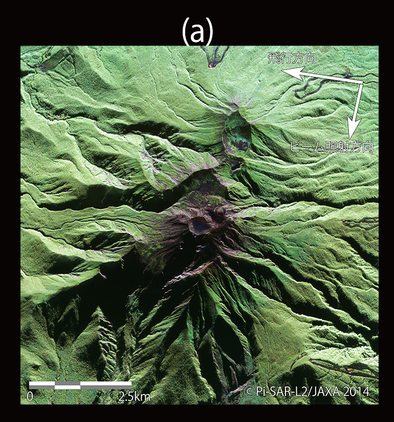
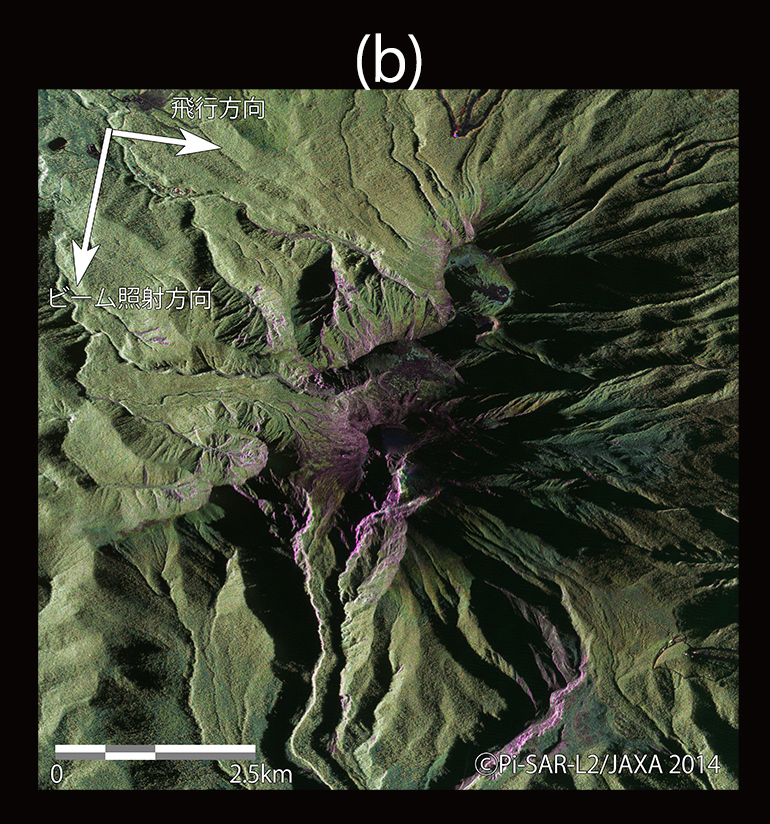
Images in figure 8 show the Pi-SAR-L2 images from multiple direction. In these polarimetric color composite (R:G:B = HH:HV:VV), green area roughly represents vegetation area and red area corresponds to bare soil.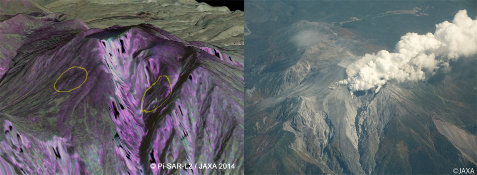
About the processing
Processing software: Sigma-SAR 2014
DEM: GSI 10m-mesh DSM (Geospatial Information Authority of Japan)
Atmospheric correction for interferogram: Topographic correction of dry atmospheric delay