Image Library
ALOS-2/PALSAR-2 Observation Results of the 2015 Nepal Earthquake (3)
Summary
- An ALOS-2 data obtained on Apr. 26, 2015 was analyzed to interpret large-scaled displacement.
- A displacement was recognized at Langtang village, along a famous trekking route in the Himalayas.
- The displacement ranges 1500 m in width and 700 m in length.
- This result has been reported to concerned authorities.
Corresponding to the emergency requests from Sentinel Asia and the International Charter related to the earthquake occurred in Nepal on April 25, 2015, the Japan Aerospace Exploration Agency (JAXA) performed an emergency observation at 7:02 (GMT) on April 26, 2015 by means of the Phased Array type L-band Synthetic Aperture Radar-2 (PALSAR-2) aboard the Advanced Land Observing Satellite-2 (ALOS-2, "DAICHI-2").
Figure 1 is a close-up image acquired by the PALSAR-2 Ultra Fine mode (3 m resolution, HH polarization). It shows a post-quake situation around Langtang village, which is located on a famous trekking route in the Nepal Himalayas. The brightness of the image represents the signal received by PALSAR-2, which is the amplitude of the backscattering microwave from the ground. Comparison between this image and pre-quake image suggests a large displacement of avalanche or landslide covering the river bed.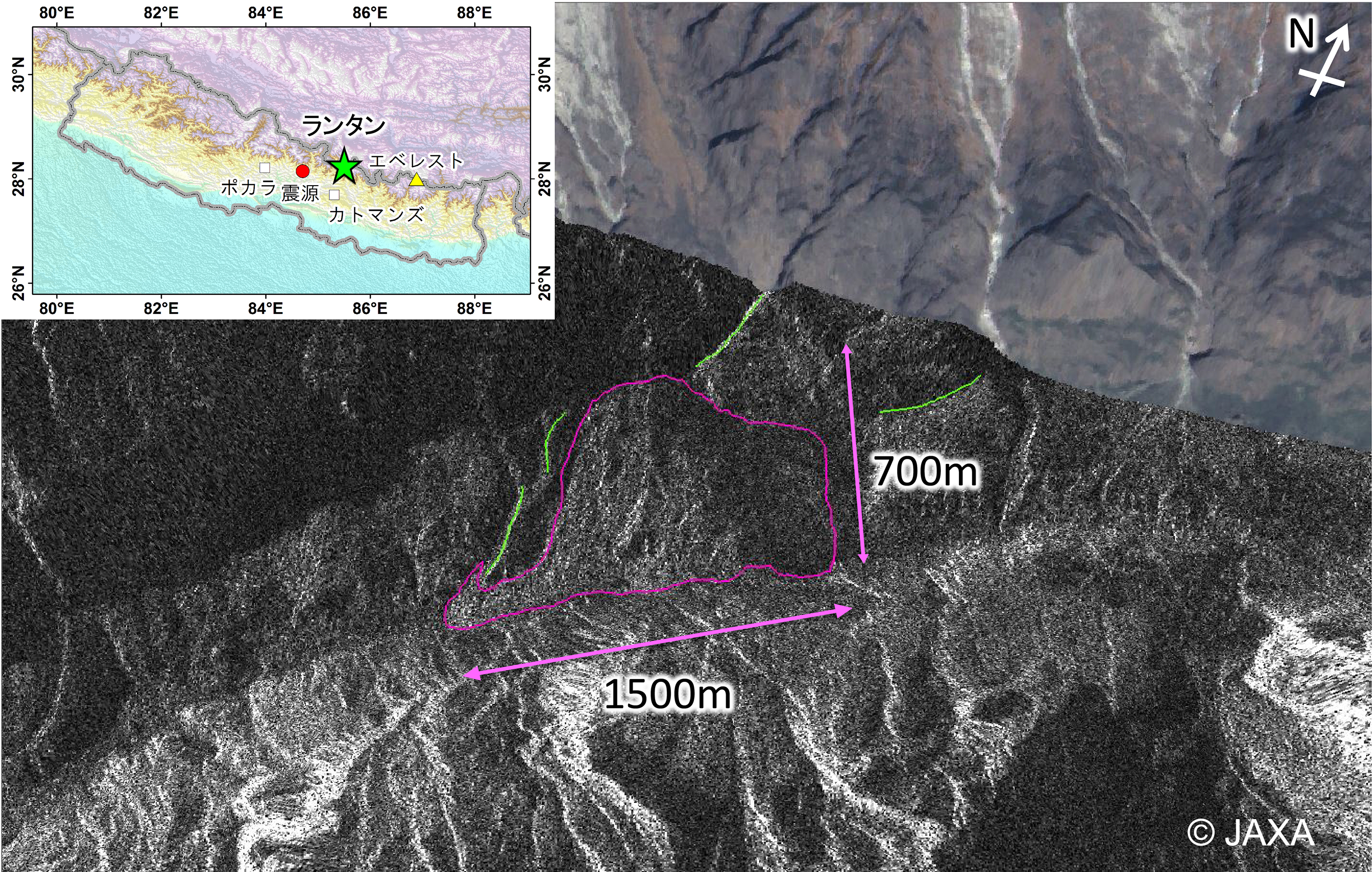
Fig. 1: PALSAR-2 image observed on Apr. 26, 2015. The background image is an ALOS pan-sharpened image. Green lines are identifiable ridges (as markings of terrain).
(Click to view enlarged image)
For comparison, a close-up image acquired before the earthquake, December 28, 2014, is shown in Figure 2. A great change can be identified on the surface.
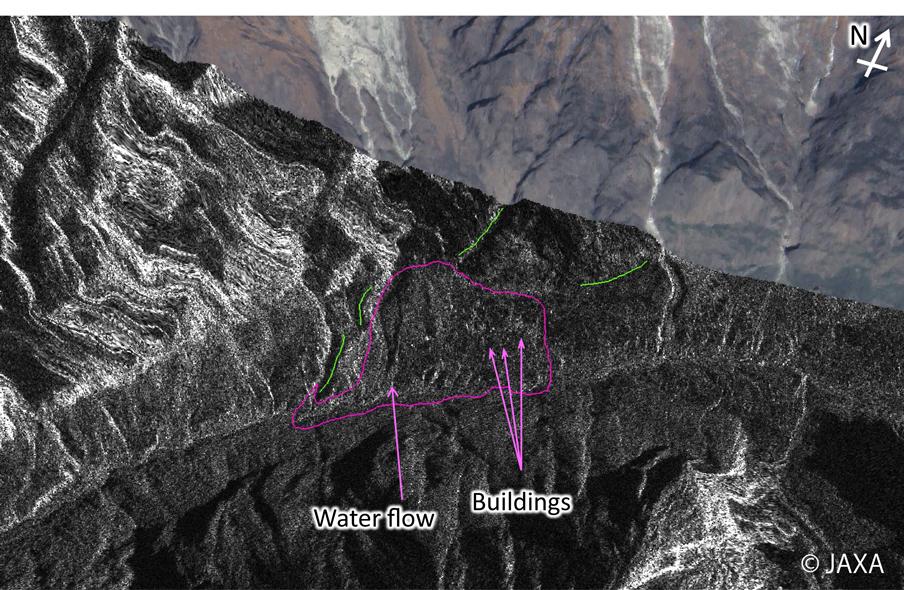
Fig. 2: PALSAR-2 image observed on Dec. 28, 2014. The background image is an ALOS pan-sharpened image.
(Click to view enlarged image)
Figure 3 is a pan-sharpened image obtained by ALOS PRISM and AVNIR-2 sensors on Oct. 12, 2008. The bright points and a valley-shaped feature denoted in Figure 2 correspond to buildings and water flow, respectively. Damaged area is estimated to be the pink polygon because of their disappearances.
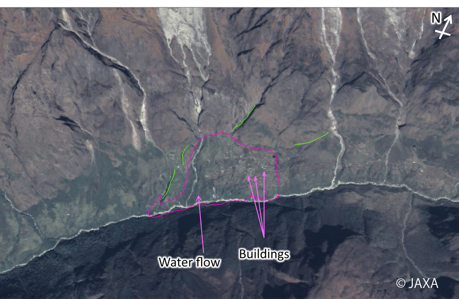
Fig. 3: ALOS pan-sharpened image acquired on Oct. 12, 2008.
(Click to view enlarged image)
Figure 4 shows birds-eye views around the damaged area from two angles, in which the ALOS pan-sharpened image is overlaid on a digital surface model generated from PRISM data. The damaged area is located on the bottom of a U-shaped valley, above which several glaciers are distributed. A large displacement induced by the earthquake is implied here.
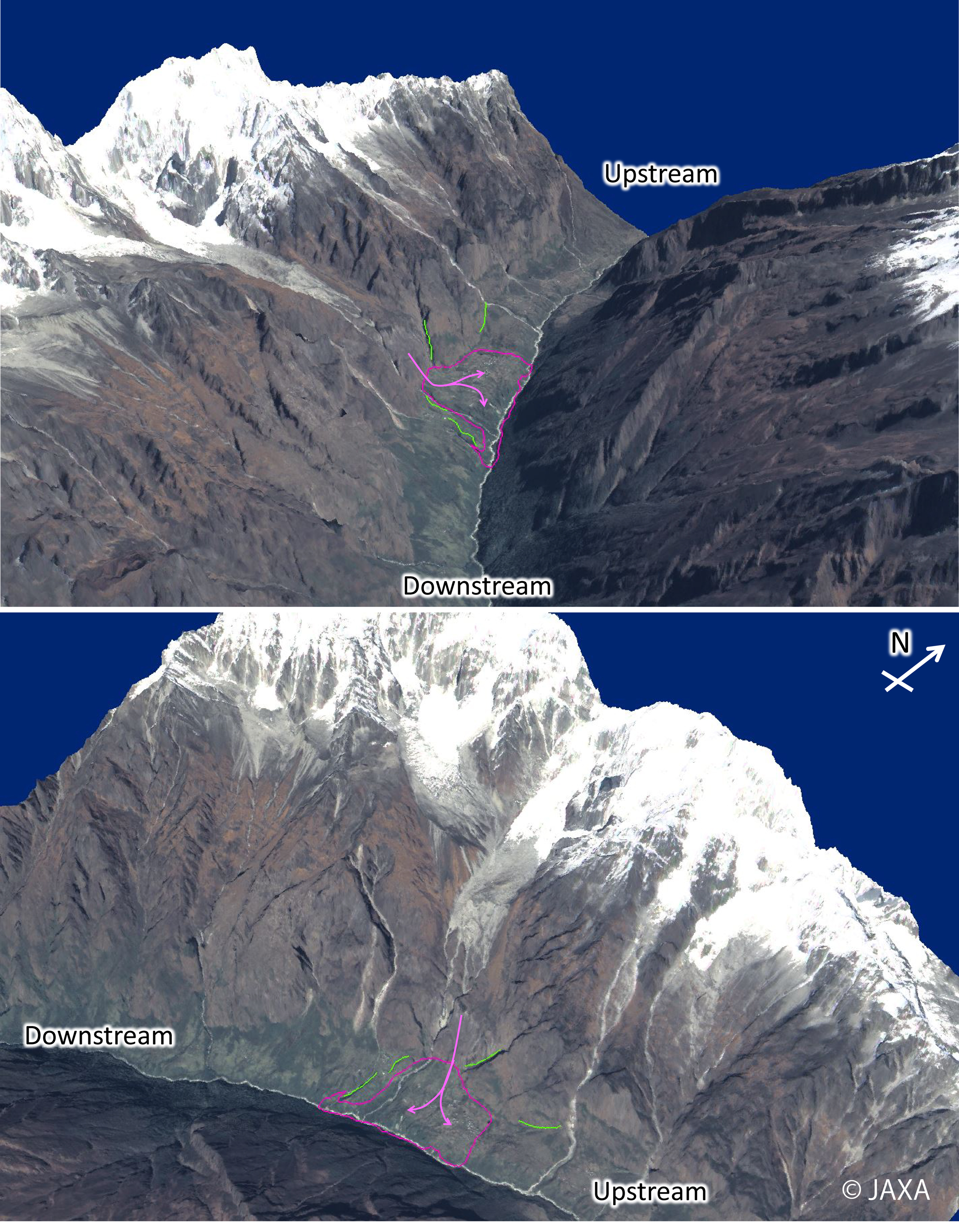
Fig. 4: Birds-eye view of ALOS PRISM/AVNIR-2 pan-sharpened image taken on Oct. 12 2008.
(Click to view enlarged image)
An emergency observation with ALOS-2 estimated that the damaged area affected by a displacement in Langtang village ranges approximately 1500 m in width and 700 m in length (Figure 1). JAXA will continue the observation in Nepal in cooperation with the concerned authorities. Acquired PALSAR-2 images will be provided to them immediately, and results of imagery analysis will be shown on this website.
See also
JAXA EORC