Image Library
ALOS-2/PALSAR-2 Observation Result for Eruption of Mt. Agung in Indonesia
Posted: Dec. 6, 2017, 2:00 (UTC)
Overviews
- On November 21, 2017, Mt. Agung in Bali Island, Indonesia, started the eruption for the first time in 54 years.
- JAXA performed an emergency observation by ALOS-2 (“DAICHI-2”) on November 30, 2017 (UT),and ALOS-2 captured lava showing up in the crater.
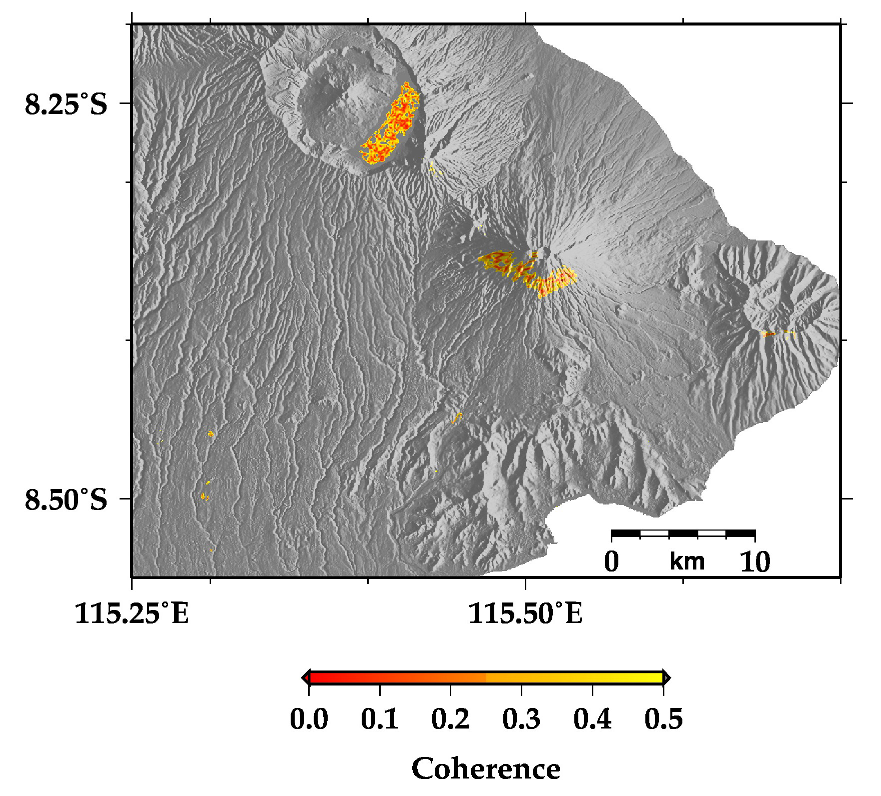
- Although InSAR analysis does not detect the crustal deformation around Mt. Agung, there is a low coherence area in southern side of the crater, which indicates the surface change such as the deposition of volcanic ash and ejecta.
- The observation data were provided to local institutions via. Sentinel Asia. We can contribute to monitor volcanic activity using ALOS-2 which can observe earth surface regardless of clouds, volcanic plumes, and sun light.
On November 21, 2017 Mountain Agung in Bali Island, Indonesia, began eruption for the first time in 54 years. JAXA performed an emergency observation with the Phased Array Type L-band Synthetic Aperture Radar 2 (PALSAR-2) onboard Advanced Land Observing Satellite 2 (ALOS-2, "DAICHI-2") on around 16:38 on November 30, 2017 (UT).
Figure 1 illustrates the observation area and the overall image. The observation mode was the high-resolution 10 m mode (dual polarization). The color composite in the image represents HH polarization in red, HV polarization in green, and HH/HV in blue. In this image, black or dark blue roughly show water or bare land, green shows the vegetation covered areas, and bright green or purple show the urban areas.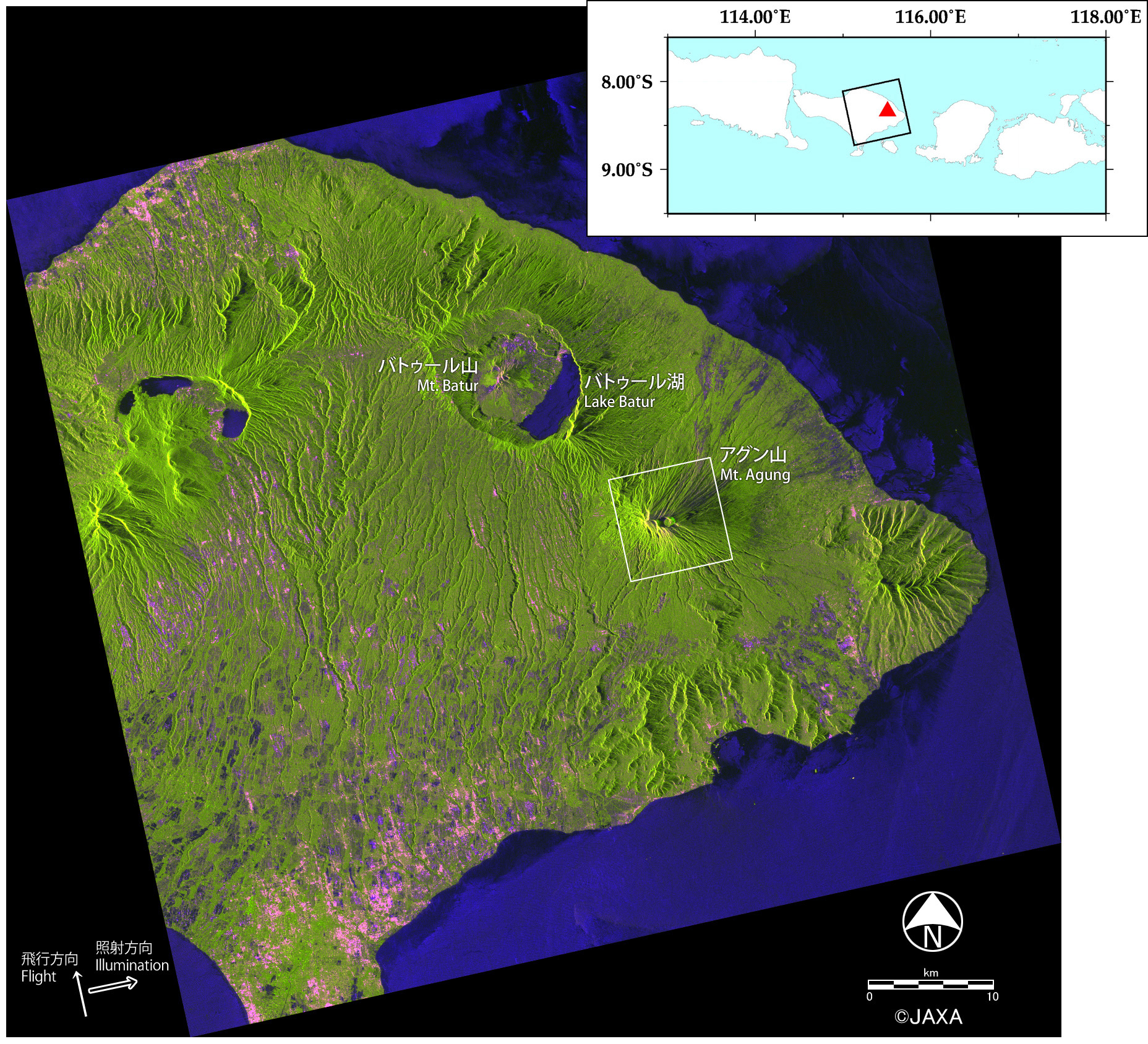
-
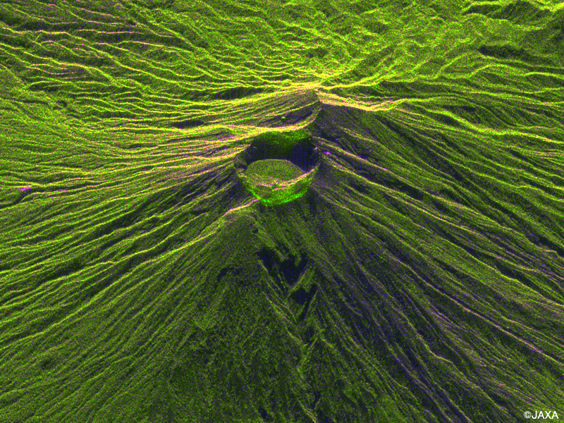 Fig.2: Enlarged images around Mt. Agung on October 5, 2017(Click to view enlarged image)
 -
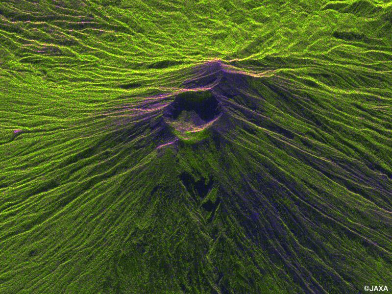 Fig.2: Enlarged images around Mt. Agung on November 30, 2017(Click to view enlarged image)
 -
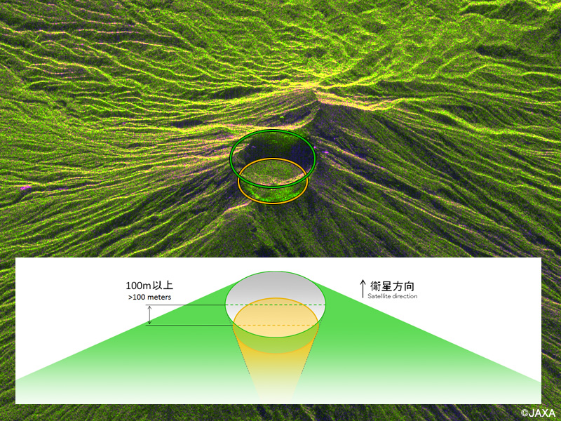 Fig.2: The schematic explaining how the inside of the crater is seen(Click to view enlarged image)
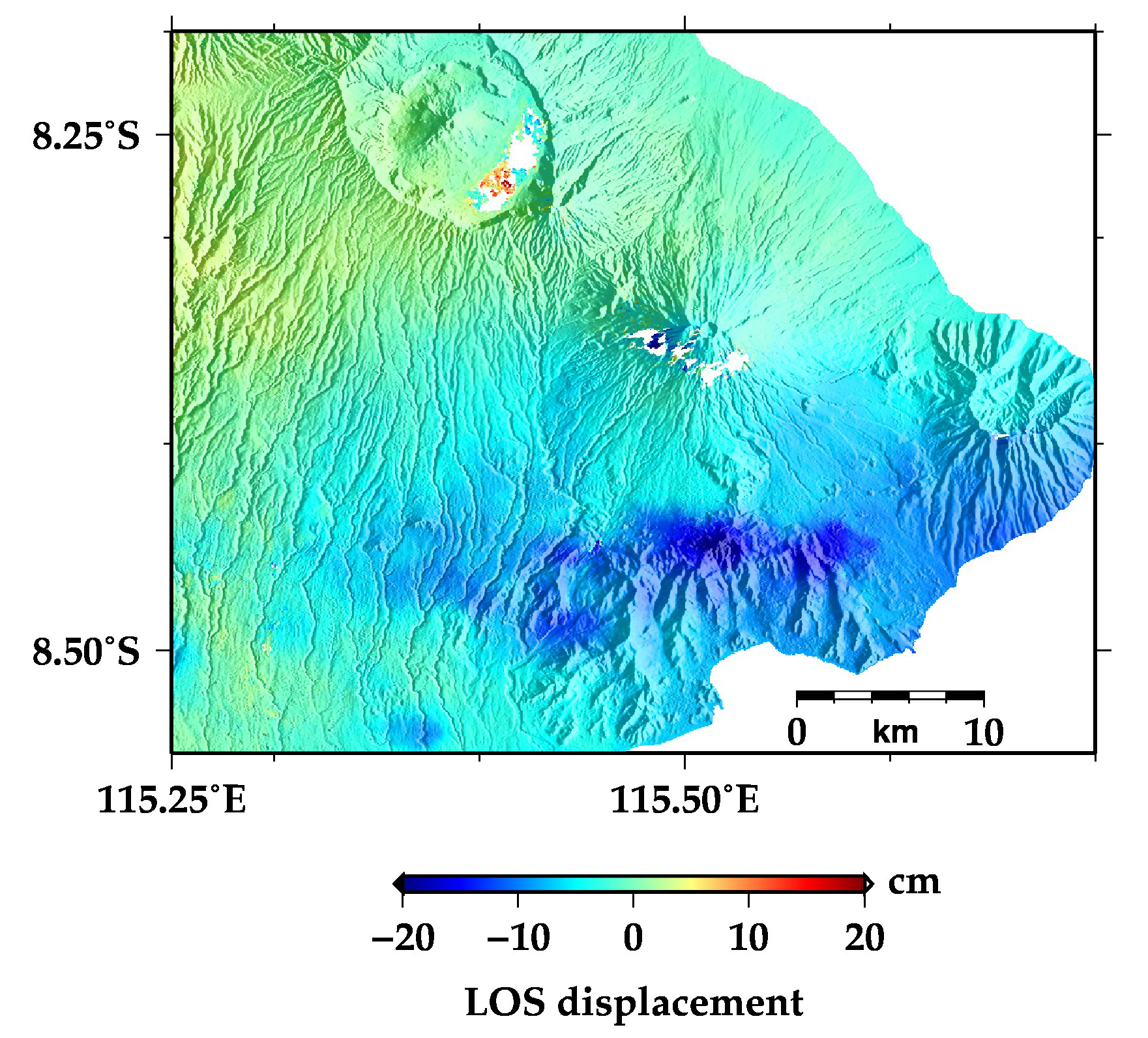
Figure 4 shows the coherence obtained in the interferometric analysis. The coherence stands for the similarity of two images, and it decreases when the surface condition changes during two observations. In figure 4, the gray zone shows the coherence greater than 0.5, and the area whose coherence is lower than 0.5 is shown in yellow and red. Although the coherence over the entire scene is high, we find the low coherence area in southern part of the crater. This reflects the deposition of volcanic ash and ejecta, and the concentration only in the southern area of the crater is thought to be caused by wind direction. The similar area of low coherence is in northwestern Mt. Agung, but there is Lake Batur and the coherence becomes low on water surface.
These PALSAR-2 observations were requested by Sentinel Asia, and the observed data were provided to local institutions from JAXA via. Sentinel Asia.