Image Library
Emergency Observation of Magnitude-9.0 Earthquake off the Pacific coast of Tohoku-Kanto District in Japan in 2011 by AVNIR-2 onboard "Daichi" (ALOS)
A magnitude 9.0 giant earthquake occurred off the Pacific coast of Tohoku-Kanto district in Japan accompanied by a massive tsunami at 14:46 (JST) or 5:46 (UTC) on March 11, 2011.
A magnitude 7.4 occurred at 15:15 (JST) or 6:15 (UTC) on March 11, 2011, and then aftershocks continuously have occurred. Tsunami caused by the giant earthquake seemed to be up to more than ten meters height and caused enormous damage in the coastal area.
The Japan Aerospace Exploration Agency (JAXA) has decided to observe here by the Advanced Visible and Near Infrared Radiometer type 2 (AVNIR-2)* onboard the Advanced Land Observation Satellite (ALOS, "Daichi") at 10:11 (JST) or 1:11 (UTC) on March 14, 2011 as an emergency observation further to March 12, 2011. The cloud-free image was taken in entire coverage on March 14, 2011.
Fig. 1 shows an observed image, which is assigned band 3, 2 and 1 of AVNIR-2 as the true color composite. The white colored areas show clouds or snow regions.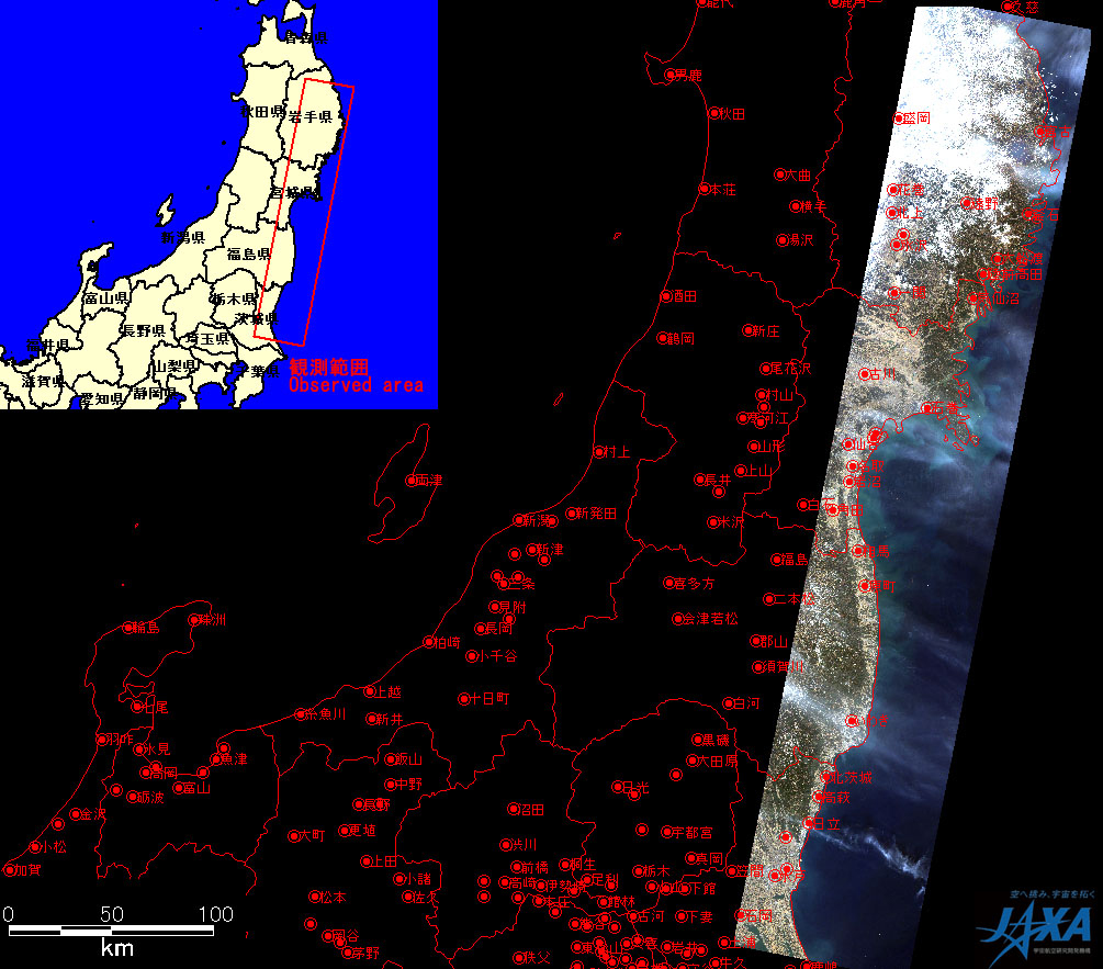
Yellow squares show location of Figs. 2, 3 and 7.
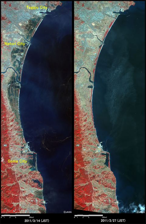
(2,500 square kilometers, left: March 14, 2011; right: February 27, 2011).
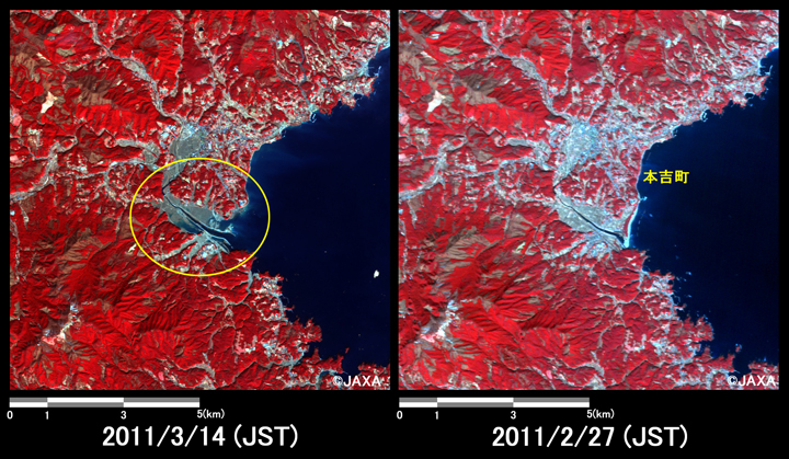
(400 square kilometers, left: March 14, 2011; right: February 27, 2011).
(100 square kilometers, left: March 14, 2011; right: February 27, 2011).
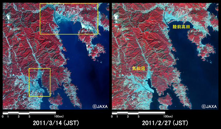
(100 square kilometers, left: March 14, 2011; right: February 27, 2011).

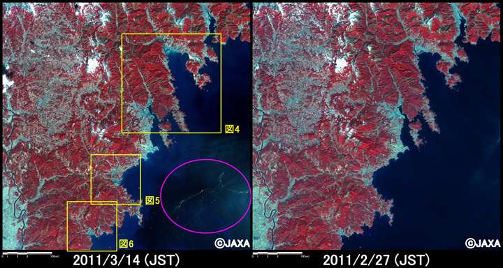
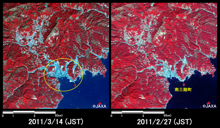
(1,500 square kilometers, left: March 14, 2011; right: February 27, 2011).
The acquired images were provided to the Cabinet Office of Japan, Government Agencies of disaster prevention and local governments.
JAXA plans continuous observation of these regions.
German satellite "RapidEye" imageries have been provided to JAXA via the International Charter "Space and Major Disasters". JAXA has analyzed them observed in Sanriku coast at 11:20 on March 13, 2011 (JST).
* Advanced Visible and Near Infrared Radiometer type 2 (AVNIR-2):
AVNIR-2 is a visible and near infrared radiometer for observing land and coastal zones. It provides 10-m spatial-resolution image and 70-km swath on the ground. The pointing angle of AVNIR-2 is +44 and - 44 degrees. The image taken after disaster on March 14, 2011 was acquired by 23.0 degrees west.