Image Library
Emergency Observation of flood damage in Slovenia by AVNIR-2 onboard "Daichi" (ALOS)
Slovenia in the east Europe was damaged due to floods caused by heavy rain which had occurred since September 17, 2010. The Japan Aerospace Exploration Agency (JAXA) has decided to observe here by the Advanced Visible and Near Infrared Radiometer type 2 (AVNIR-2)* onboard the Advanced Land Observation Satellite (ALOS, "Daichi") at 19:03 (JST) or 10:03 (UTC) on September 24, 2010 as an emergency observation.
Fig. 1 shows an observed image assigned band 3, 2 and 1 of AVNIR-2 as the true color composite. Most of the image was covered by clouds, however disaster areas could be seen through clouds.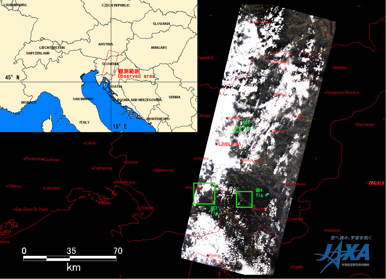
Fig. 2 shows enlarged images of flooded area at Prikrnica, 700 km south-southwest from Ljubljana, which were taken after disaster on September 24, 2010 (left) and before disaster on July 11, 2010 (right).
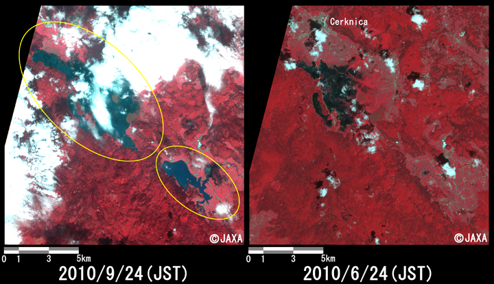
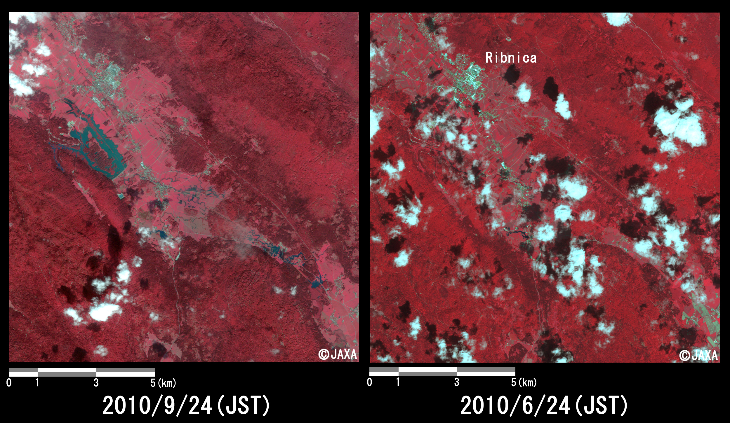
Figs. 3 and 4 show enlarged images of flooded area at Cerknica (southwest from Ljubljana) and Cerknica (southeast from Ljubljana), which were taken after disaster on September 24, 2010 (left) and before disaster on June 24, 2010 (right), respectively.
They are assigned band 4, 3 and 2 of AVNIR-2 as the false color composite, therefore vegetation can be seen in red color and submerged areas can be seen clear in light blue or blue color.
In comparison to before as well as after disaster, yellow circles in Figs.2 to 4 show that the agricultural land was widely flooded.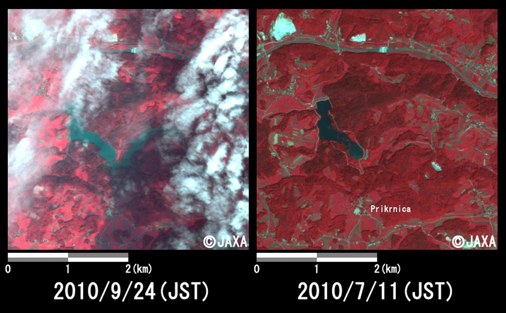
The acquired images were provided to "Slovenia Private Conservancy" and "Slovenia Disaster Rescue" via "The International Charter".
* Advanced Visible and Near Infrared Radiometer type 2 (AVNIR-2):
AVNIR-2 is a visible and near infrared radiometer for observing land and coastal zones. It provides 10-m spatial-resolution image and 70-km swath on the ground. The pointing angle of AVNIR-2 is +44 and - 44 degrees. The images taken on September 24, July 11 and June 24, 2010 were acquired by 0.0 degree.