Image Library
Emergency Observation of Mount Merapi Eruption in Indonesia by AVNIR-2 onboard "Daichi" (ALOS)
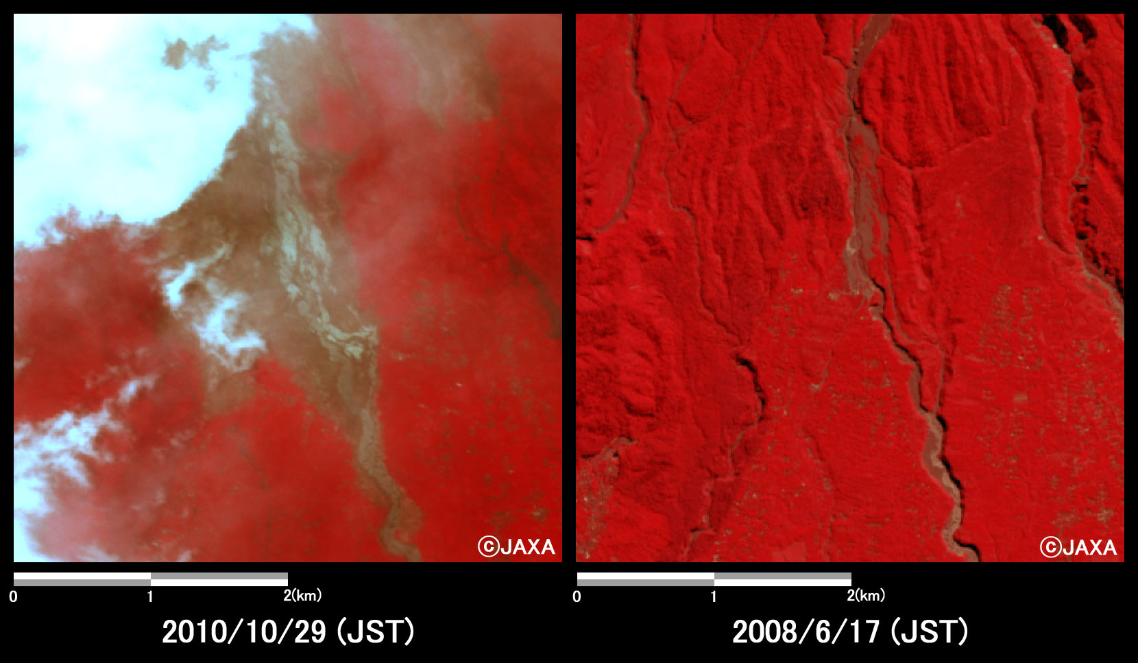
Mount Merapi of Java in Indonesia was erupted on October 26, 2010. It causes some 10 people to be killed or injured and some 1000 people to be evacuated who live in the mountain base district. Sentinel Asia has performed the emergency observation to monitor the state of the damage by the Advanced Visible and Near Infrared Radiometer type 2 (AVNIR-2)* onboard the Advanced Land Observing Satellite (ALOS, "Daichi") at 11:49 (JST) or 2:49 (UTC) on October 29, 2010.
Fig. 1 shows an observed image and is color assigned band 3, 2 and 1 of AVNIR-2 as the true color composite.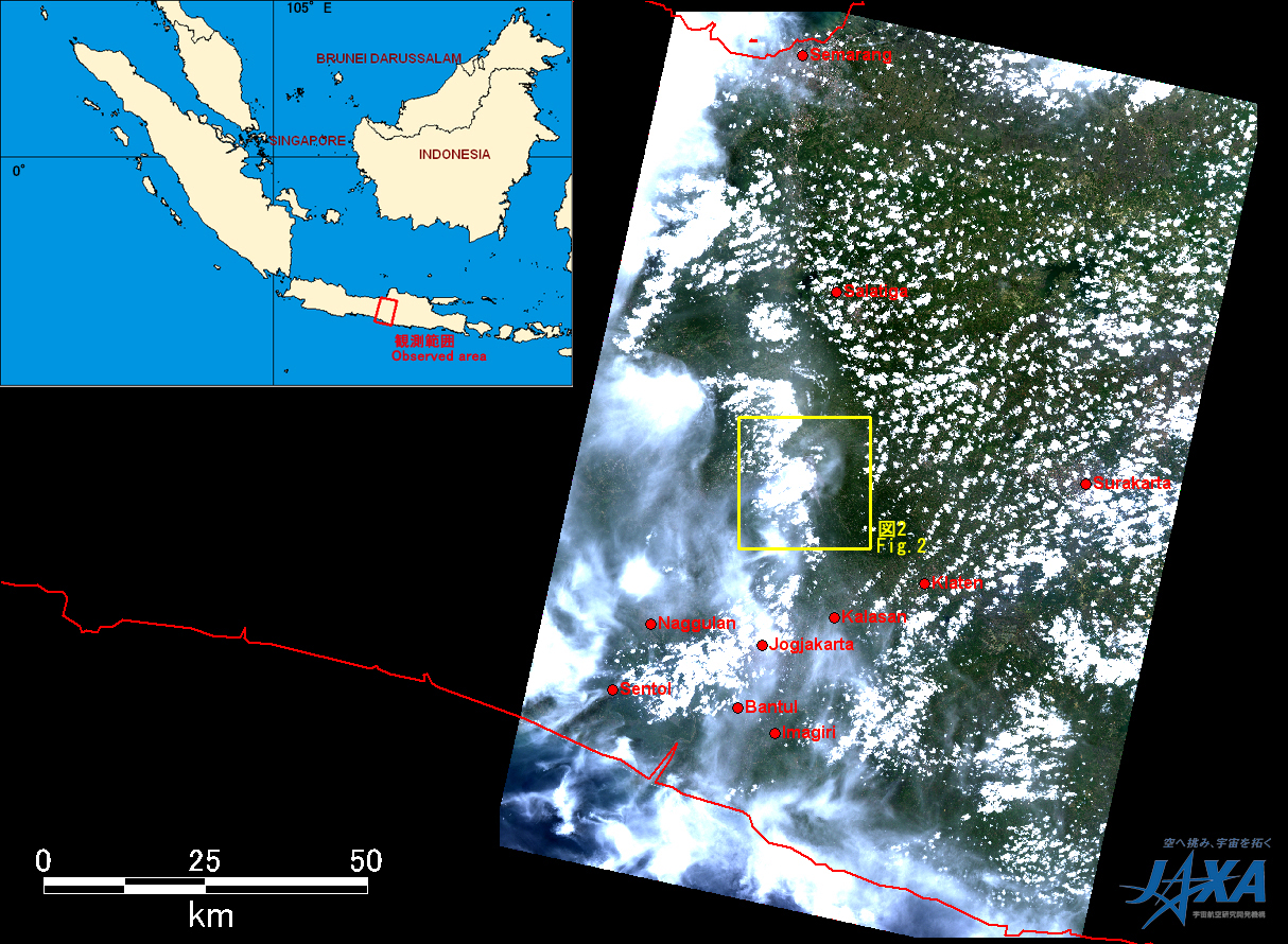
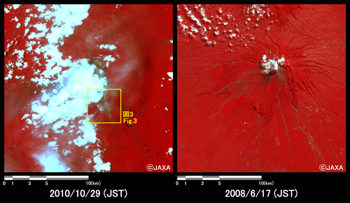
Yellow square shows location of Fig.3. (Click to View Enlarged Image)
JAXA plans continuous observation of this area in the future as well, these acquired images were provided to Indonesian National Institute of Aeronautics And Space (LAPAN) via "Sentinel Asia".
* Advanced Visible and Near Infrared Radiometer type 2 (AVNIR-2):
AVNIR-2 is a visible and near infrared radiometer for observing land and coastal zones. It provides 10-m spatial-resolution image and 70-km swath on the ground. The pointing angle of AVNIR-2 is +44 and - 44 degrees. This image was acquired by 26.0 degrees east.