Image Library
Emergency observation of concentrated heavy rain in India by AVNIR-2 onboard "Daichi" (ALOS)
North India in the south Asia was damaged due to floods caused by heavy rain which had occurred since from September 18 to September 19, 2010. The Japan Aerospace Exploration Agency (JAXA) has decided to observe here by the Advanced Visible and Near Infrared Radiometer type 2 (AVNIR-2)* onboard the Advanced Land Observation Satellite (ALOS, "Daichi") at 14:06 (JST) or 5:06 (UTC) on September 19, 2010 as an emergency observation.
Fig. 1 shows an observed image assigned band 3, 2 and 1 of AVNIR-2 as the true color composite. Most of the image was covered by clouds, however the swollen river could be identified through clouds.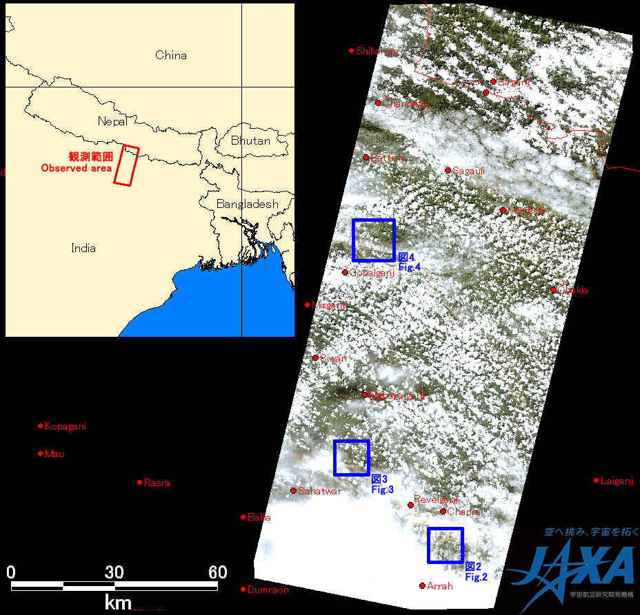
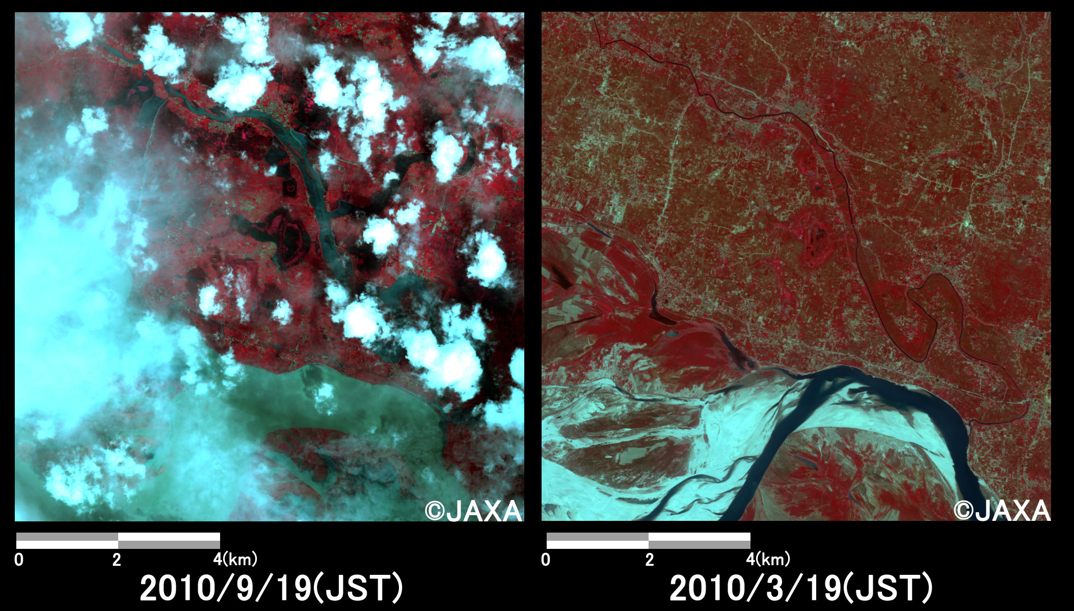
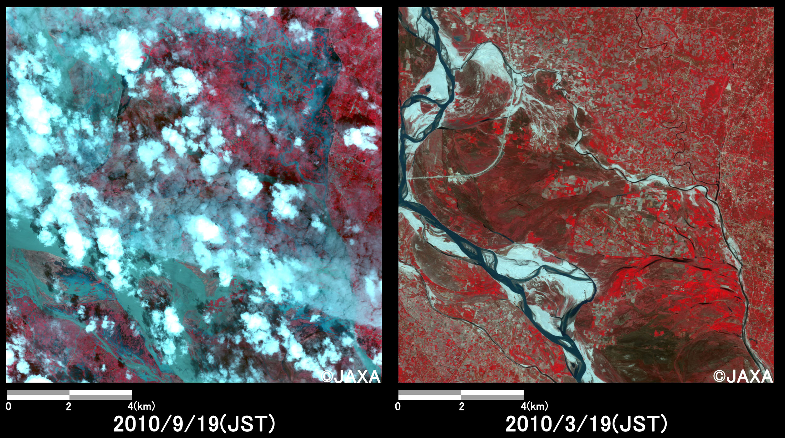
Figs. 2, 3 and 4 show enlarged images of Ganga River basin. Fig. 2, 3 and 4 are located at Semaria, Siswan and Gopal Ganj, respectively.
They are assigned band 4, 3 and 2 of AVNIR-2 as the false color composite, therefore flood areas can be seen clear in light gray color.
In comparison to before as well as after disaster, they indicate that river overflowed and river width was wider than it in before disaster, which are shown by yellow circles. Yellow circled areas at both Figs. 2 and 4 seem that water areas spread over the flow path of the river and the river overflowed due to the heavy rain.
If the heavy rain continues, flood damage may be expanded.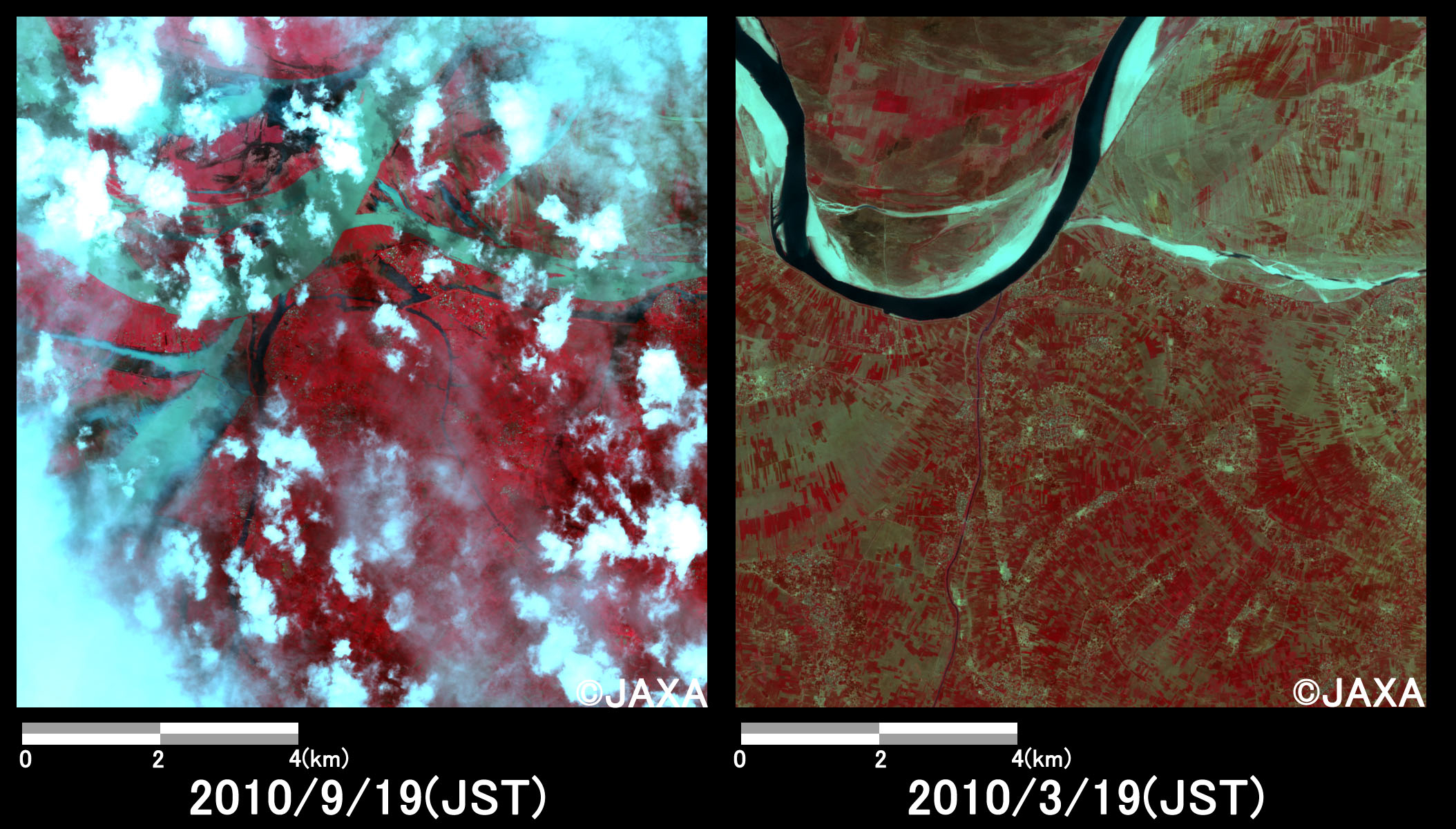
JAXA plans continuous observation of this area.
The acquired images were provided to Indian Space Research Organization (ISRO) via "The International Charter" and "Sentinel Asia".
* Advanced Visible and Near Infrared Radiometer type 2 (AVNIR-2):
AVNIR-2 is a visible and near infrared radiometer for observing land and coastal zones. It provides 10-m spatial-resolution image and 70-km swath on the ground. The pointing angle of AVNIR-2 is +44 and - 44 degrees. The images taken on September 19 and March 19, 2010 were acquired by 0.0 degree.