Image Library
Emergency Observation of Tsunami in Indonesia by PRISM and AVNIR-2 onboard "Daichi" (ALOS)
Kepulauan Mentawai of West Sumatra in Indonesia was seriously damaged by Tsunami caused by the 7.7-magnitude large earthquake which was occurred at 23:42 (JST), 14:42 (UTC) on October 25, 2010. Sentinel Asia has triggered the emergency observation to monitor the state of the damage by the Panchromatic Remote-sensing Instrument for Stereo Mapping (PRISM) and the Advanced Visible and Near Infrared Radiometer type 2 (AVNIR-2)* onboard the Advanced Land Observing Satellite (ALOS, "Daichi") at 12:45 (JST) or 3:45 (UTC) on October 28, 2010.
Fig. 1 shows an observed image and is color assigned band 3, 2 and 1 of AVNIR-2 as the true color composite.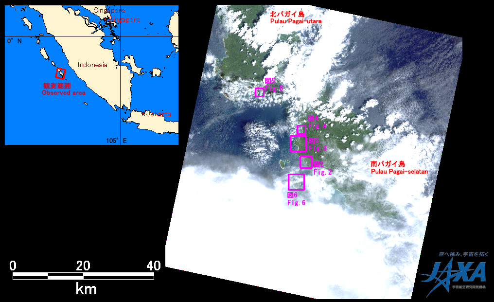
Fig.1: AVNIR-2 image with 0.0 degree pointing angle acquired at 12:45 on October 28, 2010 (JST).
Purple squares show location of Figs. 2 and 6.
(Click to view enlarged image)
Figs. 2 to 6 are enlarged pan-sharpened images around Pagai Island produced by both PRISM and AVNIR-2 images that were taken on October 28, 2010. The location is 220 km south-southwest from Padang (Provincial capital of West Sumatra). They can be identified vegetation area since vegetation area is seen like red color before affected by Tsunami. In comparison to before and after Tsunami disaster, the image taken after disaster indicates that vegetation in the west coast (yellow marked) near earthquake center seemed washed away by Tsunami since vegetation (red color) decreased.
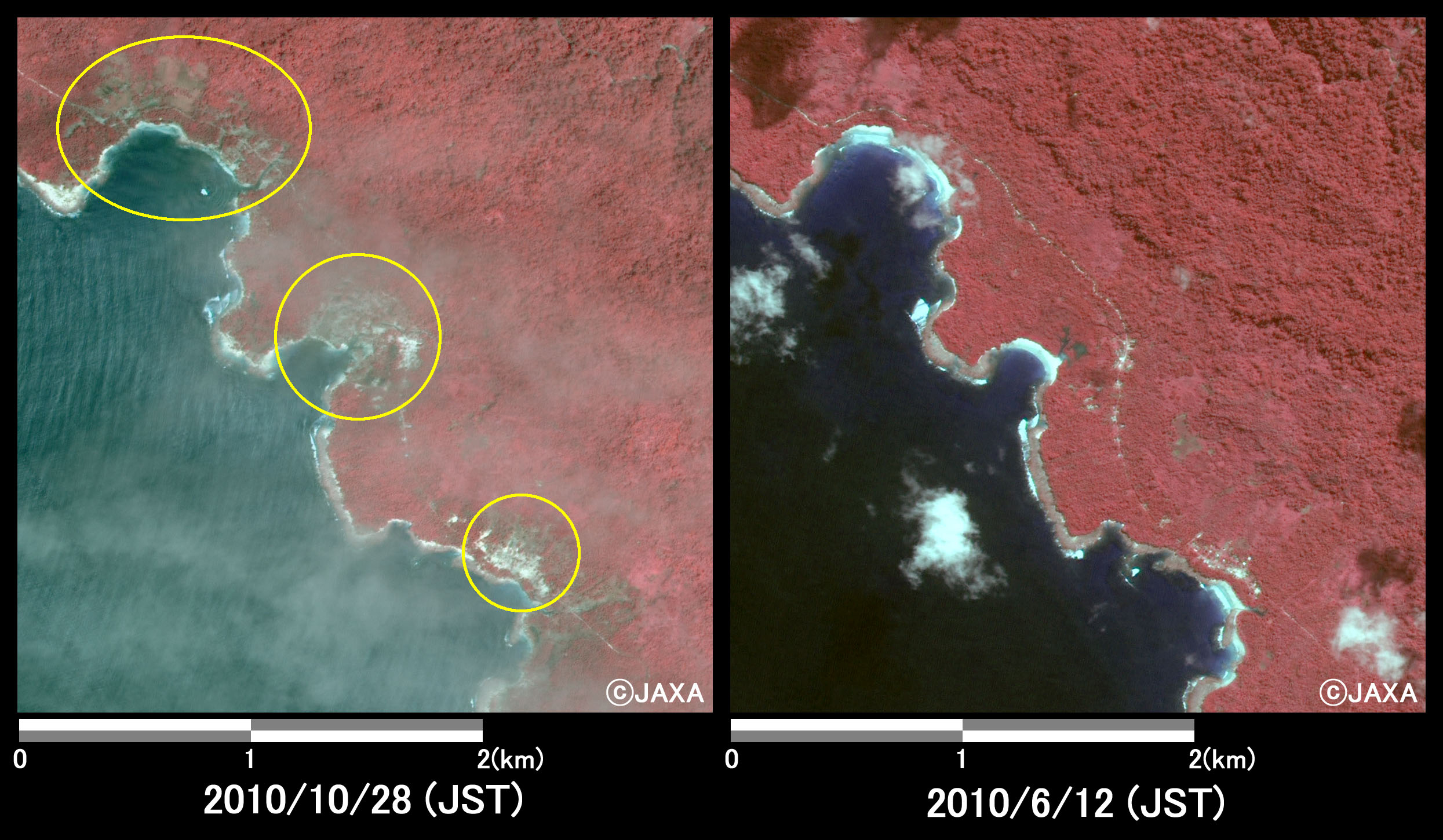
Fig.2: Enlarged images at the coast in South Pagai Island
(9 square kilometers, left: October 28, 2010; right: June 12, 2010).
(Click to view enlarged image)
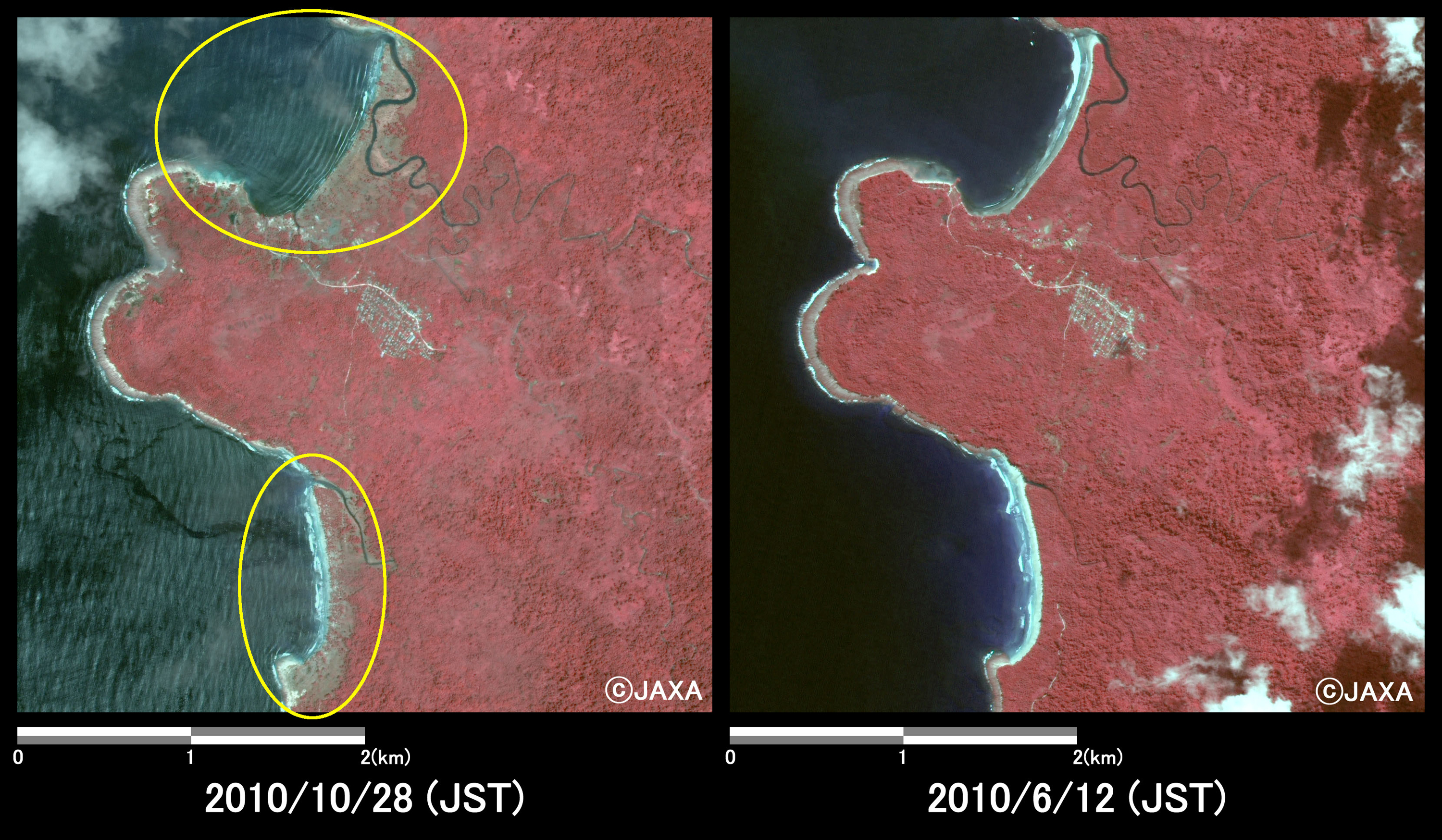
Fig.3: Enlarged images at the coast in South Pagai Island
(16 square kilometers, left: October 28, 2010; right: June 12, 2010).
(Click to view enlarged image)
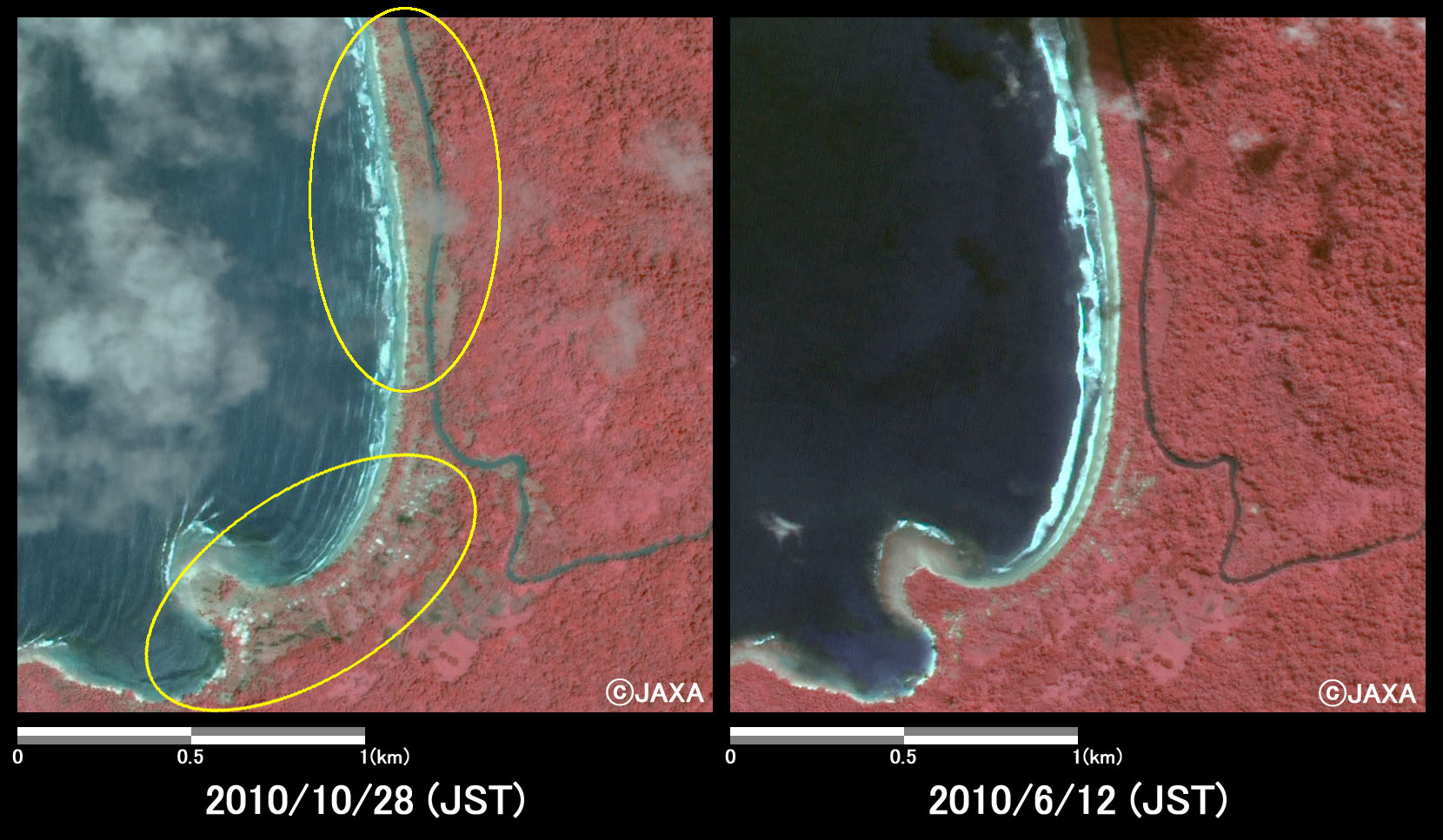
Fig.4: Enlarged images at the coast in South Pagai Island
(4 square kilometers, left: October 28, 2010; right: June 12, 2010).
(Click to view enlarged image)
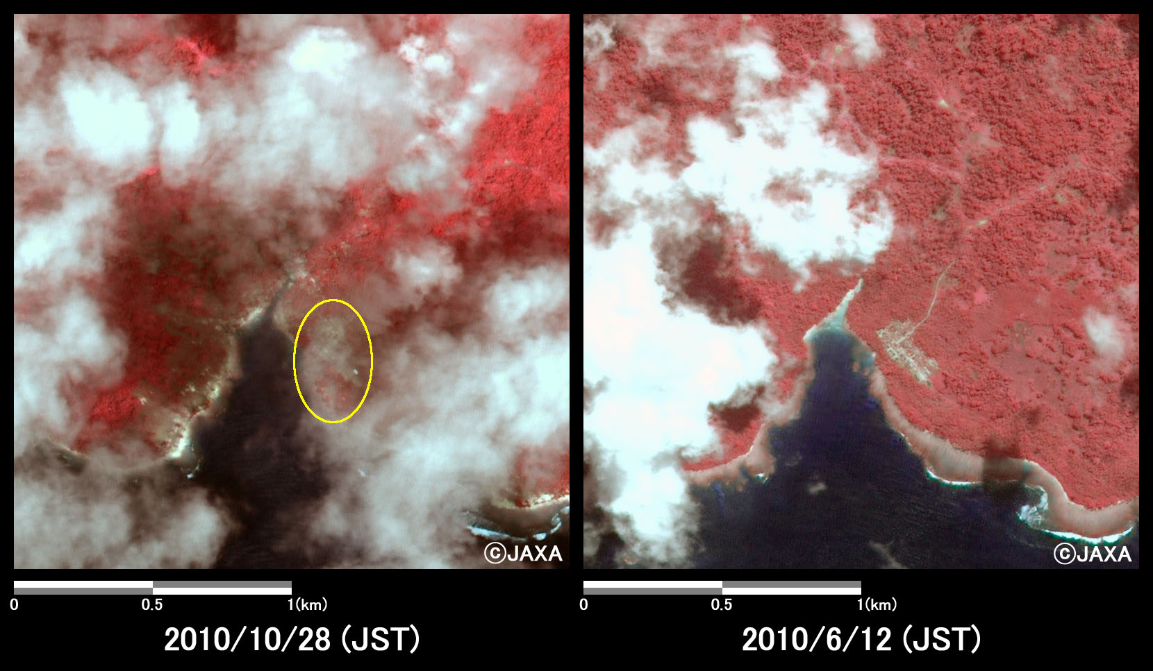
Fig.5: Enlarged images at the coast in North Pagai Island
(4 square kilometers, left: October 28, 2010; right: June 12, 2010).
(Click to view enlarged image)
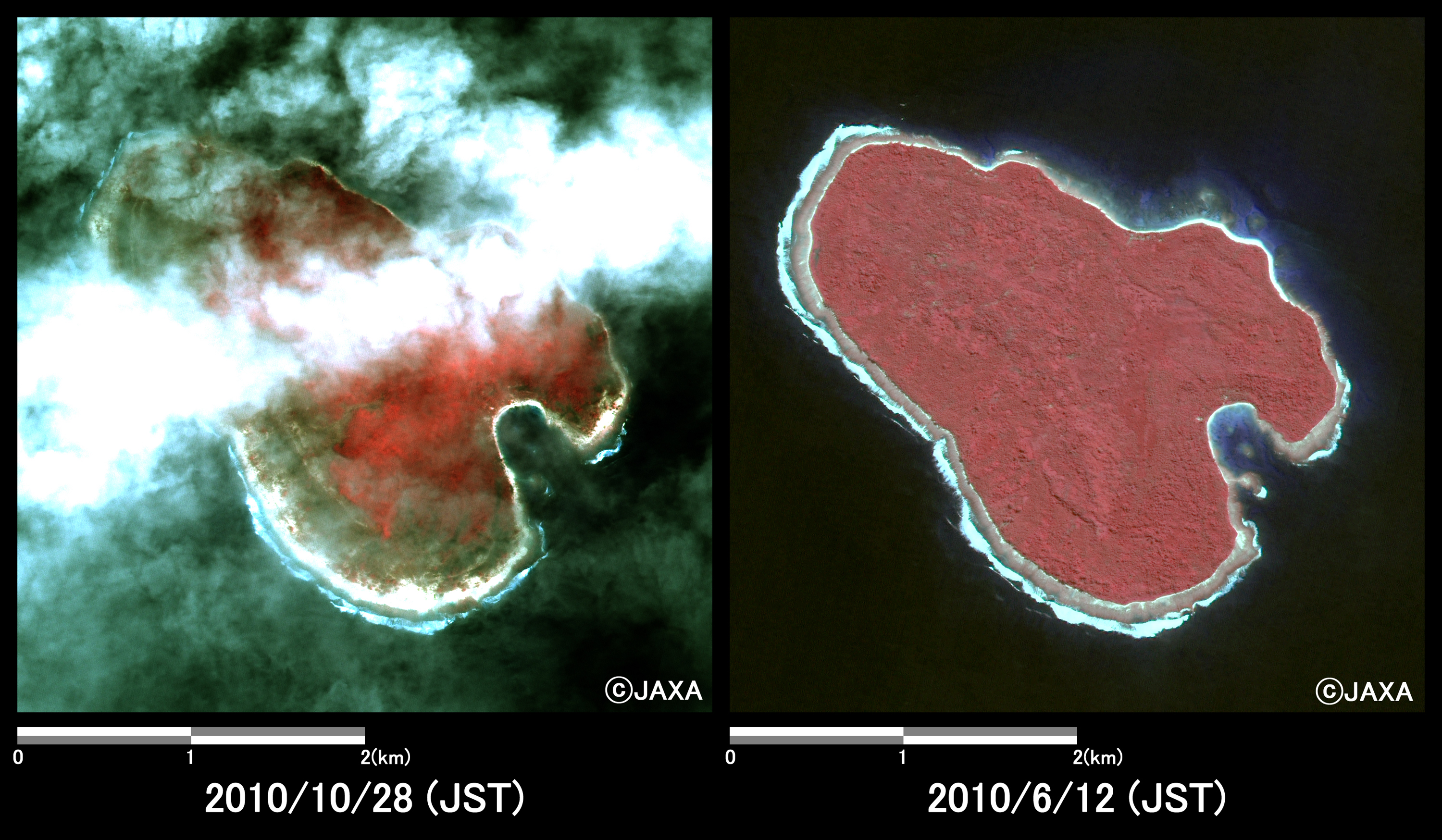
Fig.6: Enlarged images in an island off South Pagai Island
(16 square kilometers, left: October 28, 2010; right: June 12, 2010).
(Click to view enlarged image)
JAXA plans continuous observation of this area in future as well and, these acquired images were provided to Indonesian National Institute of Aeronautics And Space (LAPAN) via "Sentinel Asia".
The pan-sharpened image by both PRISM and AVNIR-2 image is pseudo-color one of 2.5 m ground resolution that is produced by PRISM with a 2.5-m spatial resolution and AVNIR-2 with a 10-m spatial resolution in multispectral region.
JAXA EORC