Image Library
Observation of mudslides in Guatemala by AVNIR-2 onboard "Daichi" (ALOS)
Guatemala in the Central America has been seriously damaged due to floods and mudslides caused by heavy rain, which had occurred continuously since beginning of September 2010.
The Japan Aerospace Exploration Agency (JAXA) has performed the observation to monitor the state of the damage by the Advanced Visible and Near Infrared Radiometer type 2 (AVNIR-2)* onboard the Advanced Land Observing Satellite (ALOS, "Daichi") at 1:34 (JST) on September 15 or 16:34 (UTC) on September 14, 2010.
Fig. 1 shows an observed image and is assigned band 3, 2 and 1 of AVNIR-2 as the true color composite. White colored areas show clouds, however some ground surface could be seen through the clouds.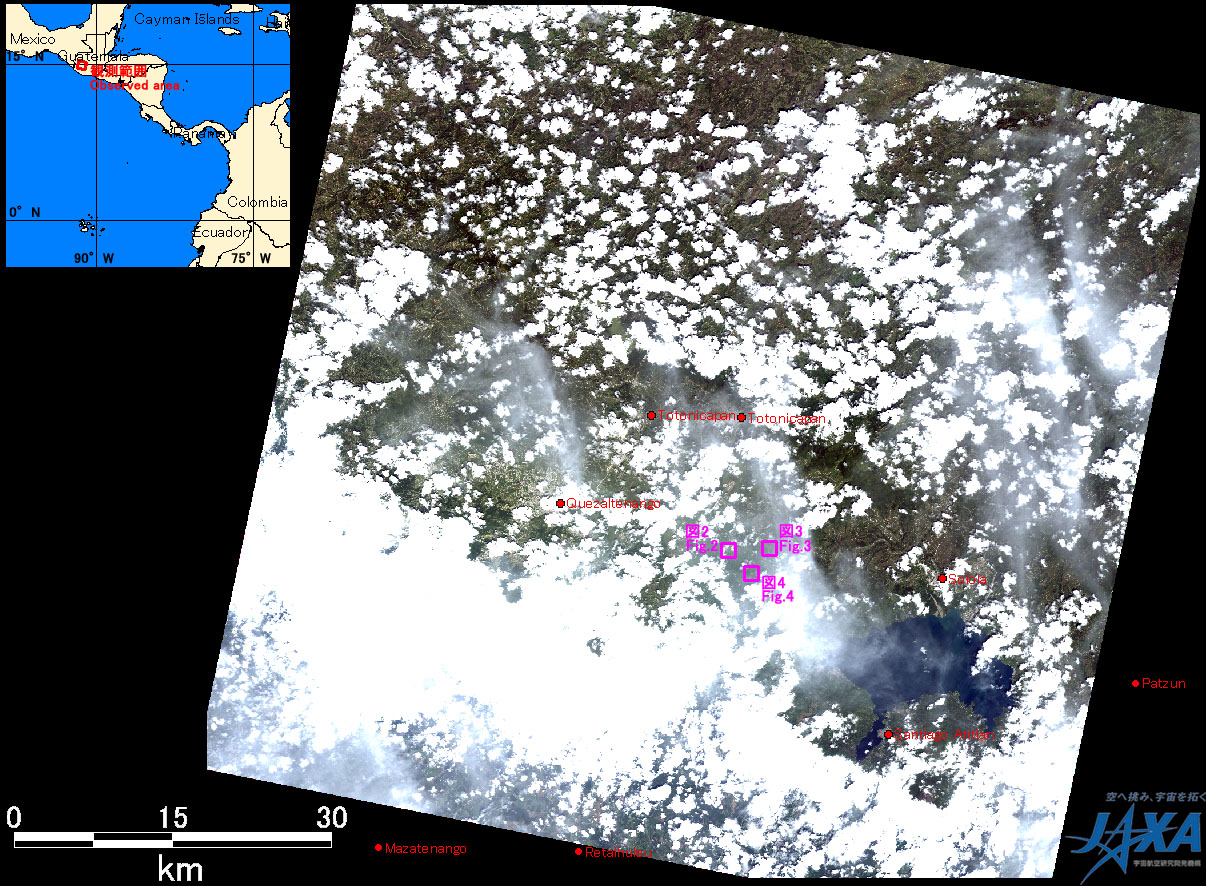
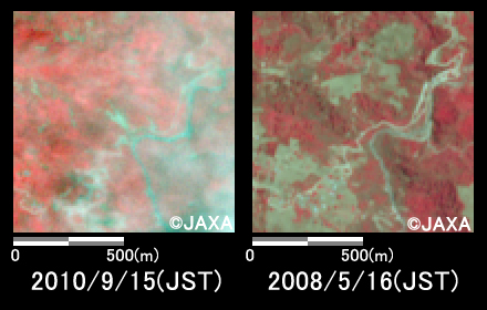
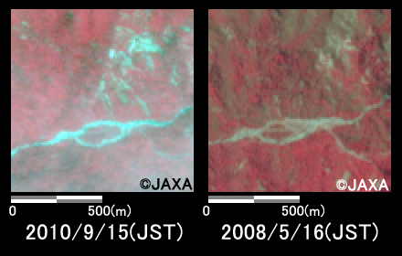
Figs. 2 to 4 are comparison of images taken after disaster on September 15, 2010 (left) and before disaster on May 16, 2008 (right). The all images are located on 80km west from Guatemala City. They are assigned band 4, 3 and 2 of AVNIR-2 as the false color composite, therefore vegetation can be seen in red color and areas where vegetation is lost due to mudslides.
Yellow circle in Fig. 2 indicate swollen river can be seen in light blue color.
Yellow circles in Figs. 3 to 4 indicate vegetation was lost and mudslides occurred because of the reduced red color area.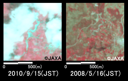
JAXA plans continuous observation of this area.
* Advanced Visible and Near Infrared Radiometer type 2 (AVNIR-2):
AVNIR-2 is a visible and near infrared radiometer for observing land and coastal zones.
It provides 10-m spatial-resolution image and 70-km swath on the ground. The pointing angle of AVNIR-2 is +44 and - 44 degrees. The image taken after disaster on September 15, 2010 was acquired by 19.0 degrees east. The image taken before disaster on March 10, 2010 was acquired by 0.0 degree.