Image Library
Myanmar flood water observation by PALSAR
Myanmar was heavily flooded from May 2 to May 3, 2008, due to Cyclone Nargis. JAXA decided to activate the ALOS/PALSAR*1 to observe the area quickly, and succeeded to image the area on May 6 2008. The data were provided to the "Disaster Charter" and "Sentinel Asia".
*1 PALSAR, Phased Array type L-band Synthetic Aperture Radar, is a microwave sensor receiving radio wave reflections transmitted from the satellite. It can acquire image data regardless of the weather and time of day.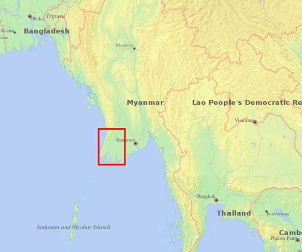
Fig. 3: Map of observed place
Fig.1 left shows a pre-disaster image observed with ScanSAR mode on Apr. 24, 2008 and Fig.1 right a post-disaster image observed with fine mode on May 6, 2008. PALSAR measures the brightness of the land and ocean surface. The flat surface, like water, tends to look dark.
Thus it is inferred from the May 6 image that large area were flooded (looks dark) by the cyclone.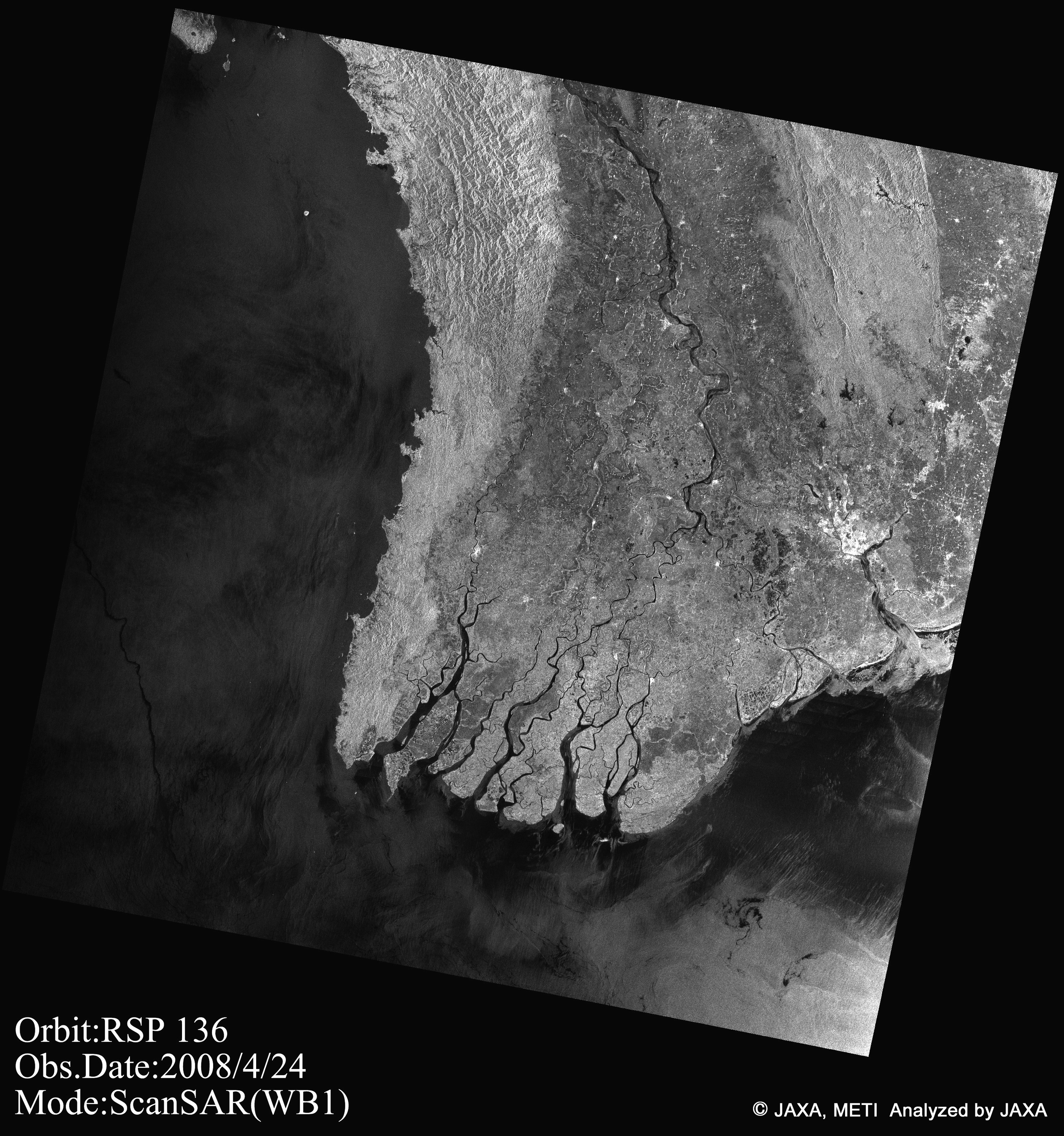 April 24(Click to view enlarged image)
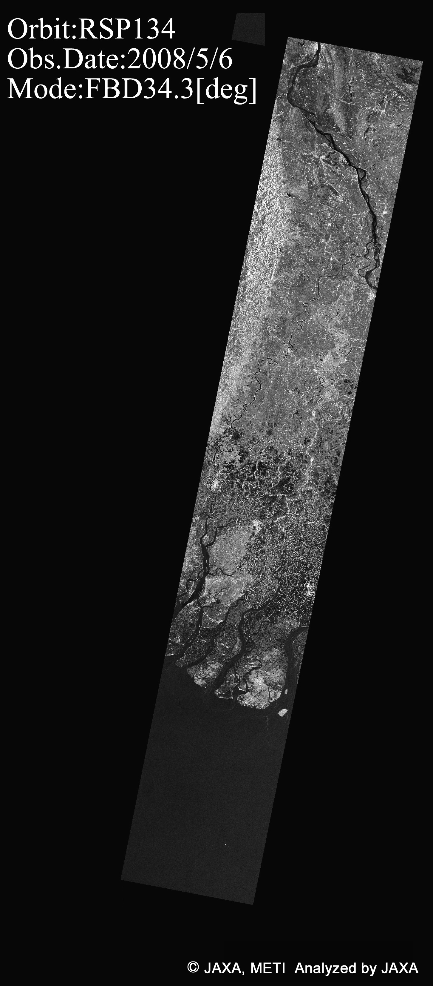 May 6, 2008(Click to view enlarged image)
Fig. 1: Images of Ayeyarwaddy, Myanmar, observed by PALSAR
A color composite of these images (Fig.2), RED and GREEN for after the flood of May 6 and BLUE for the before of Apr. 24, shows the land surface change in the color. BLUE color in the figure shows the flooding in dominant and it spread out widely in the image.
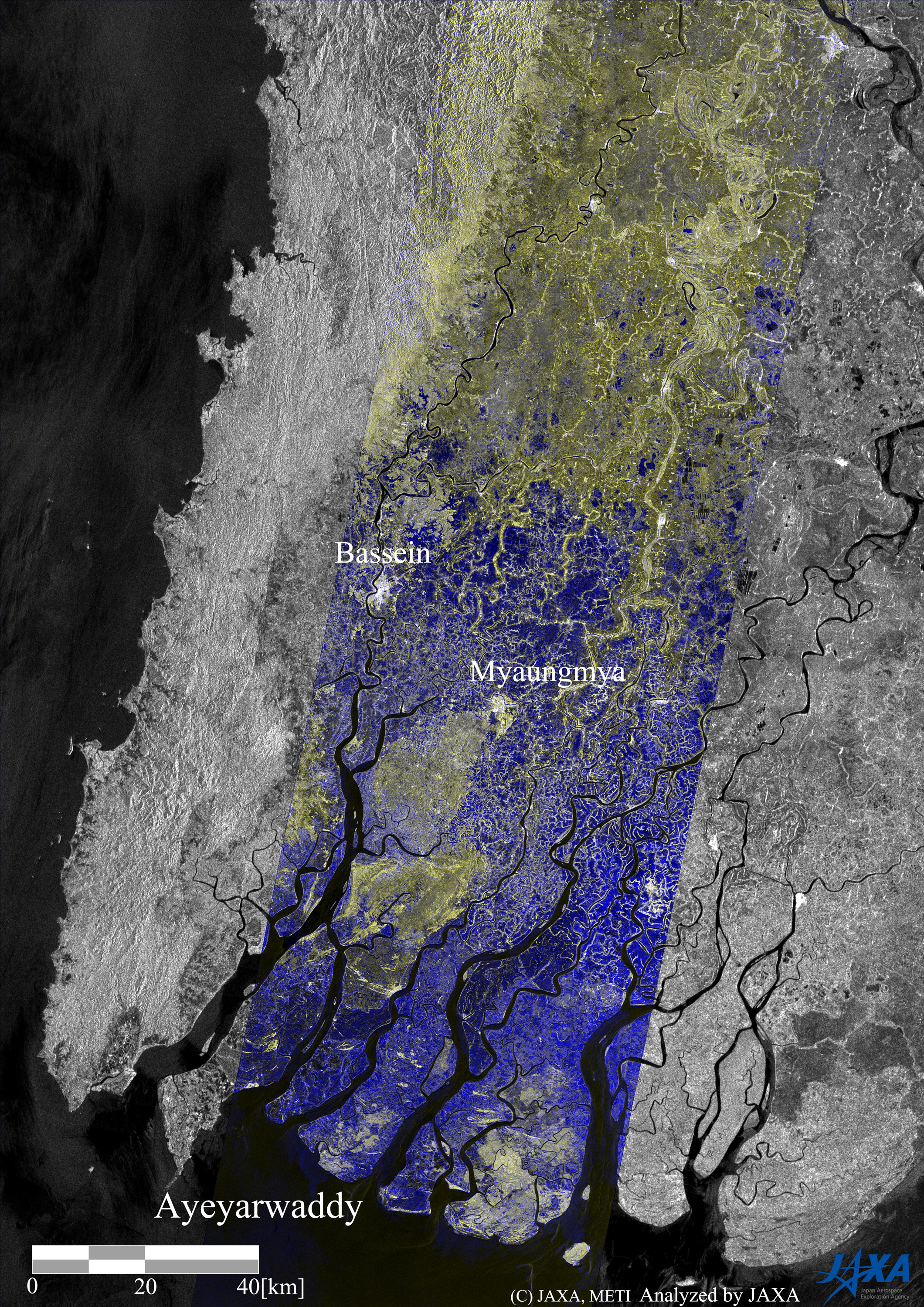
Fig. 2: A color composite of the pre- and post-disaster images, RED and GREEN for after the flood of May 6 and BLUE for the before of Apr. 24.
(Click to view enlarged image)
JAXA EORC