Image Library
Emergency Observation of Flooding In the southern Poland by AVNIR-2 onboard "Daichi" (ALOS)
The southern Poland was hit by the worst flooding in the past decade, which was by long rains since early May. The Japan Aerospace Exploration Agency (JAXA) has performed an emergency observation of the Advanced Land Observation Satellite (ALOS, "Daichi") to monitor the state of damages caused by the flooding. The Advanced Visible and Near Infrared Radiometer type 2 (AVNIR-2) onboard ALOS was activated on 9:59 (UTC) of May 21, 2010.
Fig. 1 shows an observed image of AVNIR-2 at 9:59 (UTC) on May 21, 2010. Fig. 1 assigned by channel 3, 2 and 1 for red, green and blue colors as true color composite, therefore white colored areas shown clouds. Unfortunately, Krakau in the southern Poland, where were reported the damages of the flooding, was covered by clouds. However, several regions were inundated as shown in Figs. 2 to 4.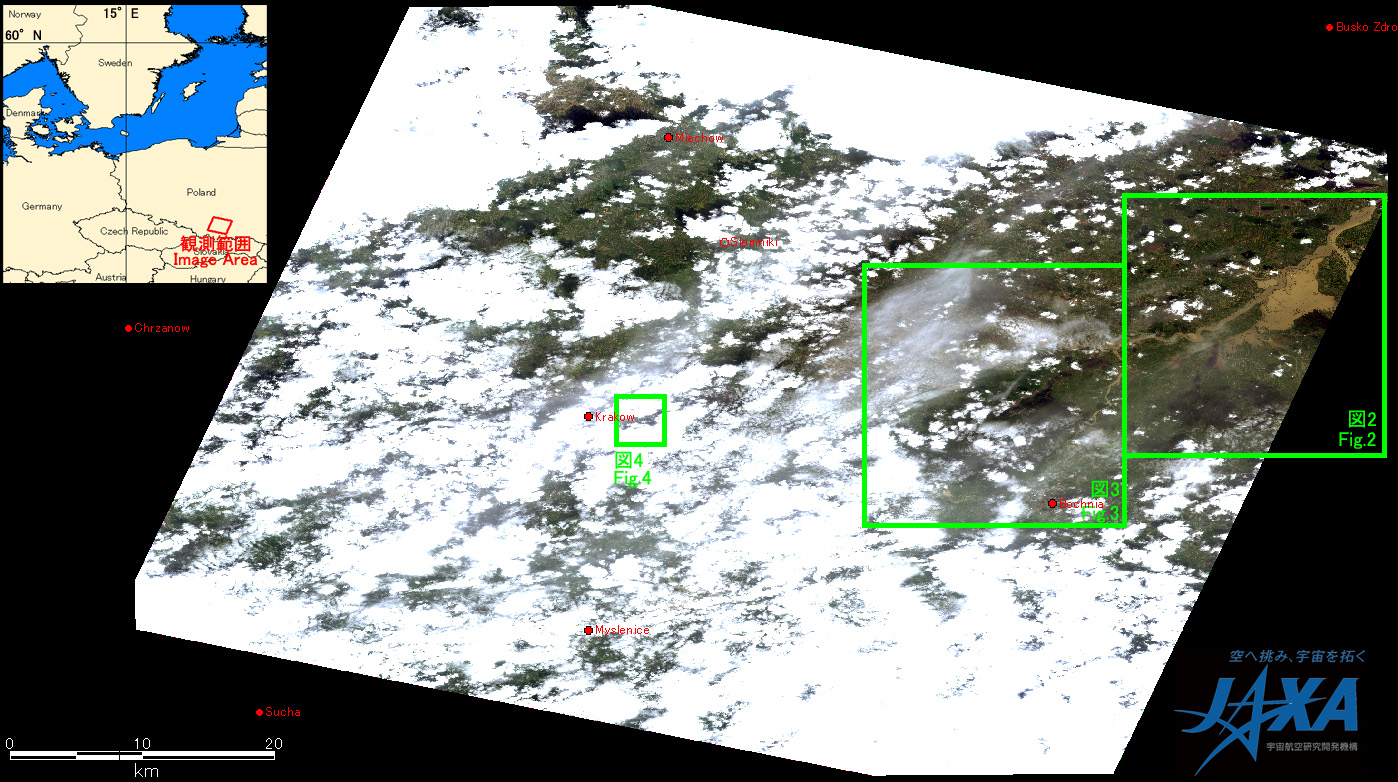
Fig.1: AVNIR-2 image with +14.0 degrees pointing angle acquired on 9:59 of May 21, 2010.
Green squares show locations of Figs. 2 to 4.
(Click to view enlarged image)
Fig. 2 shows the enlarged images of AVNIR-2, which were taken after the disaster on May 21, 2010 (left) and about one month before the disaster on April 12, 2010 (right), where were around Vistula River at Przemykow, which is 52 kilometers east from Krakau. Fig. 2 assigned by channel 4, 3 and 2 for red, green, and blue colors as false color composite, therefore red color show vegetated areas. In comparison to the image before the disaster, the image after the disaster seems the width of rivers was spread and many fields at east of Vistula river were inundated as shown by light blue color in Fig. 2.

Fig.2: Enlarged image of Vistula River in Przemykow
(20 kilometers squarers, left: May 21, 2010; right: April 12, 2010).
(Click to view enlarged image)
Fig. 3 shows the enlarged images of Vistula River in Nowe Brzesk, which is thirty-two kilometers east from Krakau. Yellow marked area at south of Vistula River might be flooded because the river bank seemed black color.
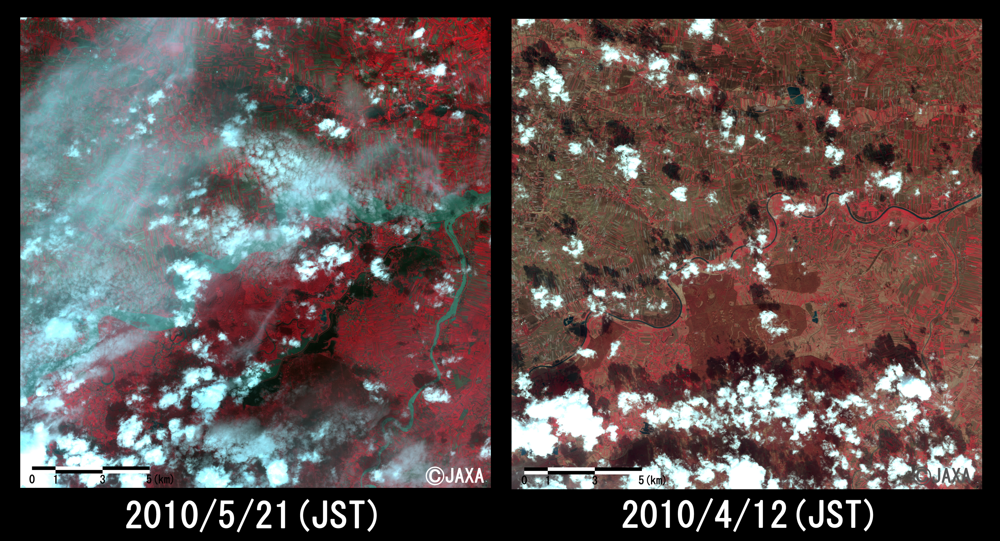
Fig.3: Enlarged image of Vistula River in Nowe Brzesko
(20 kilometers squares, left: May 21,2010; right: April 12, 2010).
(Click to view enlarged image)
Fig. 4 shows the enlarged images in Krakau acquired on May 21, 2010 as after the disaster and on April 26, 2009 as before the disaster. The image after the disaster became clouded. However, in comparison to the image before disaster, the width of Vistula River which is seen between clouds in the image after the disaster increases and the residential area is hanged over by water.
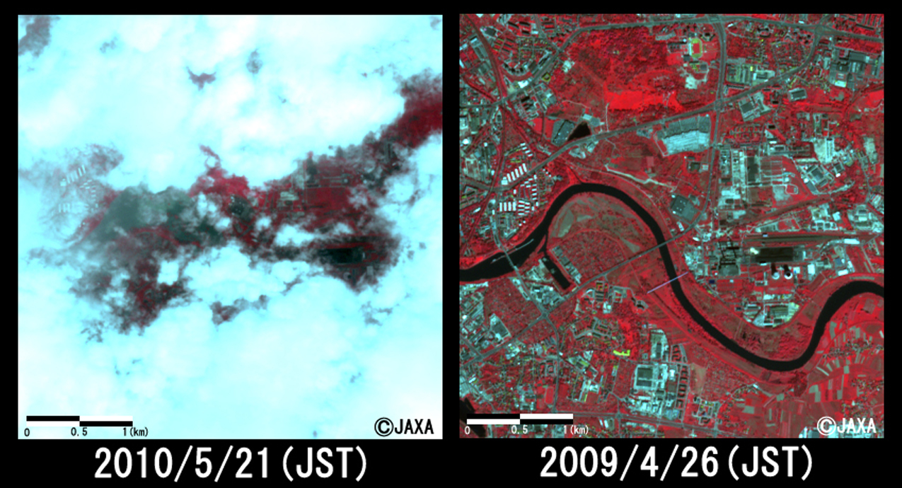
Fig.4: Enlarged image in Krakau (4 kilometers squares, left: May 21, 2010; right: April 26, 2009).
(Click to view enlarged image)
The acquired images were provided to ALOS Data European Node (ADEN).
JAXA plans to observe here continuously.
JAXA EORC