Image Library

Follow-up Observation of the Glacial Lake Outburst Flood (GLOF) Damage in the Andean Cordilleras, Peru by AVNIR-2 onboard "Daichi" (ALOS)

On April 11, 2010, a Glacial Lake Outburst Flood (GLOF) occurred from a glacier lake of Hualcan Glacier in the Andean Cordilleras, Peru, South America. According to local newspapers, the GLOF was occurred by falling an ice gorge or rock onto the lake, which has a size of 500 meters long and 200 meters wide, and generated twenty-three meters height a tsunami on the lake water. The lake water overflowed and the downriver town was damaged by the GLOF. The Japan Aerospace Exploration Agency (JAXA) had performed emergency observations of the Advanced Land Observing Satellite (ALOS, "Daichi") to monitor the state of damage caused by the GLOF on April 16, 2010 (Japan Standard Time, JST) or April 15, 2010 (UTC). The Advanced Visible and Near Infrared Radiometer type 2 (AVNIR-2) onboard the ALOS was activated on 0:35 of May 25, 2010 (JST) to determine the state of recovery there.

Fig. 1 shows an observed image in the Andean Cordilleras, Peru. The Hualcan Glacial Lake in Huascaran National Park is located about thirty-six kilometers north from Huaras in the Ancash.
Fig.1
Fig.1: AVNIR-2 image with 0.0 degree pointing angle acquired on 0:35 of May 25, 2010 (JST). Yellow square shows the location of Fig. 2.
(Click to view enlarged image)
Fig. 2 shows the enlarged images of the overflowed lake by the glacial falling and around the downriver town, Carhuaz, which were acquired on May 25 (JST, left), April 16 (middle), and April 9, 2010 (right) that was just two days before the GLOF. The white color in the images are indicates clouds or snow ice in the right hands side. This mountain is Hualcan Glacier in Huascaran National Park.
Fig.2: Enlarged image of the overflowed lake by the glacial falling and around the downriver town, Carhuaz (eighteen kilometers squares, left: May 25, middle: April 16, and right: April 9, 2010 (JST)).
(Click to view enlarged image)
Fig. 3 shows the enlarged image of the GLOF in Hualcan Glacier. In comparison to the images taken on April 16 that five days after the flood, lake water level on May 25 begins to pile up. Thus, the GLOF happened by the overflow of the natural dam because the end of the dam wasn't broken by this flood. Because the falling trace on a slope of the glacial lake was not appeared, it was supposed to take snow falls after April 16, 2010. However, in comparison to the images taken on April 9, 2010 that before the flood, the water level of the lake slightly lower.
Fig.3
Fig.3: Enlarged image of the lake that occurred the GLOF (six kilometers squares, left: May 25, middle: April 16, and right: April 9, 2010 (JST)).
(Click to view enlarged image)

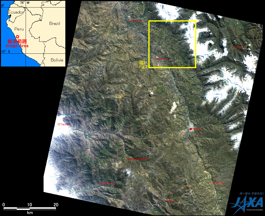
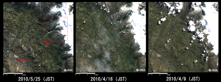
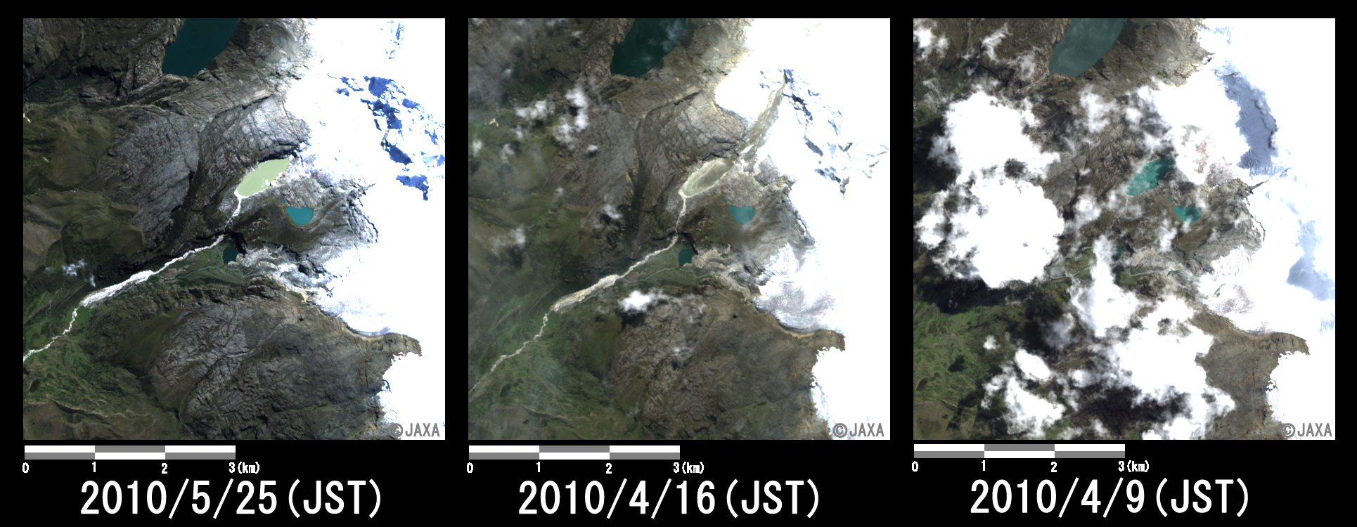
JAXA plans continuous observation of this area.

JAXA EORC