Image Library

Emergency Observation of the Natural Dam Caused by Landslide in Pakistan by AVNIR-2 onboard "Daichi" (ALOS)

A landslide occurred on January 4, 2010 in the Hunza Valley of northern Pakistan, and it blocked the Hunza River and created a dammed lake. According to newspaper, the lake is expanding due to rainfalls and melting snow, and inundating local villages and the principal artery called the Karakoram Highway.

Furthermore, local peoples are concerning an outburst flood due to break the dam.

The Japan Aerospace Exploration Agency (JAXA) had performed an emergency observation of the Advanced Land Observing Satellite (ALOS, "Daichi"). The Advanced Visible and Near Infrared Radiometer type 2 (AVNIR-2) onboard the ALOS was activated on 6:17 of May 30, 2010 (UTC) to monitor the dammed lake.

Fig. 1 shows an observed image in northern Pakistan, which located about 328 km north-east from Islamabad. Fig. 1 is the true colored composite using band 3, 2, 1 of AVNIR-2. The yellow square shows the location of Fig. 2.
Fig.1
Fig.1: AVNIR-2 image with 33.5 degrees pointing angle acquired on 6:17 of May 30, 2010 (UTC). Yellow square shows the location of Fig. 2.
(Click to view enlarged image)
Fig. 2 shows an enlarged image of the dammed lake occurred by the landslide and the Shishkat Village. This is assigned band 4, 3, 2 of AVNIR-2 as the false color composite, therefore vegetation can be seen in red color and water can be seen clear in blue or black colors. The dammed lake can be identified in the left image of Fig. 2 compared with before landslide acquired on Sep. 10, 2009.
Fig.2: Enlarged image of the dammed lake around Shishkat Village. (left: May 30, 2010; right: Sep. 10, 2009; Green squares shows locations of Figs. 3 and 4 , and a arrow shows a point of view for Fig. 5)
(Click to view enlarged image)
Fig. 3 shows an enlarged image of the site of landslide, which indicates by a yellow circle. This is corresponding to the end of the dammed lake.
Fig.3
Fig.3: Enlarged image of the end of the dammed lake corresponds to the site of landslide. (6 km squares, left: May 30, 2010; right: Sep. 10, 2009).
(Click to view enlarged image)
Fig. 4 shows an enlarged image around the Shishkat Village, where was inundated by the dam. Two bridges of the Karakoram Highway were also flooding shown by yellow circles. A part of vegetated area (possibly orchard) in the village also inundated.
Fig. 4
Fig. 4 shows an enlarged image around the Shishkat Village, where was inundated by the dam. Two bridges of the Karakoram Highway were also flooding shown by yellow circles. A part of vegetated area (possibly orchard) in the village also inundated.

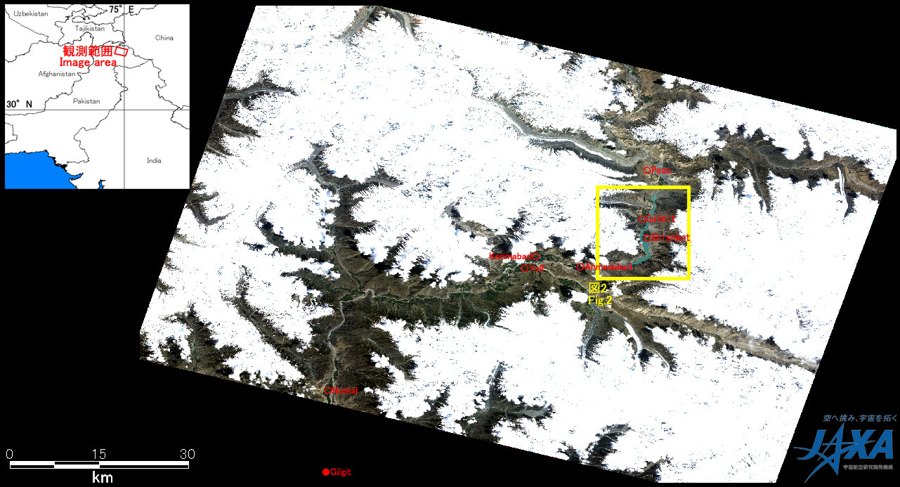
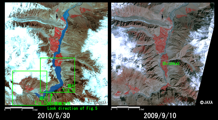
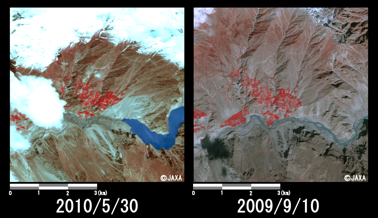
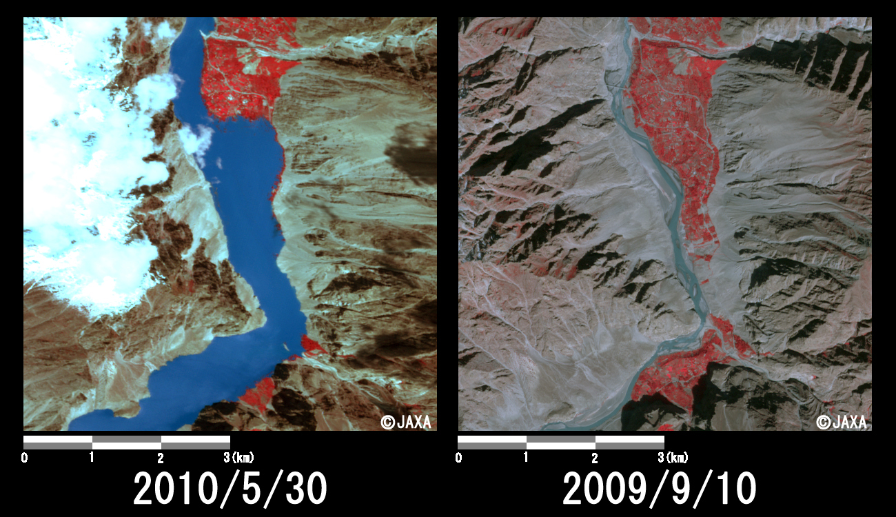
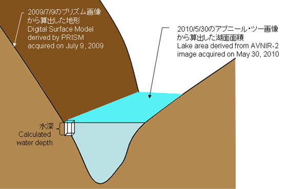
Fig. 5 shows a bird's-eye view of the AVNIR-2 image acquired on May 30, 2010 with the digital elevation model (DEM) generated by PRISM images acquired on July 9, 2009. PRISM is another optical instrument onboard ALOS and can generate precise DEM or digital surface model (DSM).

The area of the lake could be calculated approximately 1,060 hectares from the AVNIR-2 image acquired on May 30, 2010. As explained in Fig. 6, the water volume of the lake could be also estimated combining the area of lake with DSM by PRISM acquired before disaster as approximately 379,114,580 cubic meters (the maximum water depth is 120 meters, and the average 35 meters).
Fig.5
Fig.5: Bird's-eye view of AVNIR-2 using digital elevation model derived by PRISM acquired on July 9, 2009.
Fig.6: The schematic view of the water volume calculation of the dammed lake.

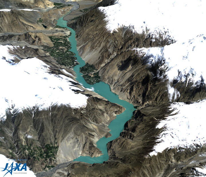
JAXA plans continuous observation of this area.

The acquired images provides to National Disaster Management Authority of Pakistan via. the Asian Disaster Reduction Center (ADRC).

JAXA EORC