Image Library
Emergency observation of concentrated heavy rain in Kinki region by AVNIR-2 onboard "Daichi" (ALOS)
The mudslides occurred in Kinki region of eastern Japan due to the concentrated heavy rain by stagnant rain front. The Japan Aerospace Exploration Agency (JAXA) has decided to observe here by the Advanced Visible and Near Infrared Radiometer type 2 (AVNIR-2)* onboard the Advanced Land Observation Satellite (ALOS, "Daichi") at 10:45 (JST) on Jul. 18, 2010 as an emergency observation.
Fig. 1 shows an observed image of AVNIR-2 at 10:45 (JST) on Jul. 18, 2010. It assigned by channel 3, 2 and 1 for red, green and blue colors as true color composite, therefore white colored areas show clouds.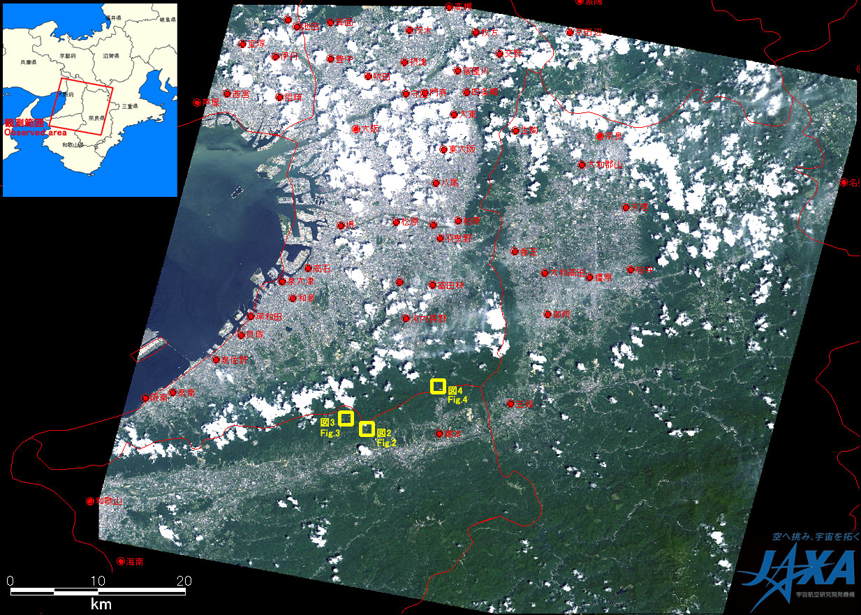
Fig.1: AVNIR-2 image with -8 degrees pointing angle acquired on 10:45 (JST) on Jul. 18, 2010.
Yellow squares show locations of Figs. 2 to 4.
(Click to view enlarged image)
Figs. 2, 3 and 4 show enlarged images around the boarder of Osaka pref. and Wakayama pref., which were taken after disaster on Jul. 18, 2010 (left) and before disaster on May 21, 2010 (right). The images assigned by channel 4, 3 and 2 for red, green, and blue colors as false color composite, therefore red color shows vegetated areas. Comparing the images of before and after the disaster, decreasing of vegetations was found at yellow circles in the image taken on Jul. 18, which might be caused by mudslides.
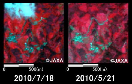
Fig.2: Enlarged images of Mijikano, Katsuragi cho, Ito gun, Wakayama pref.
(1 square kilometer, left: Jul. 18, 2010; right: May 21, 2010).
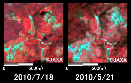
Fig.3: Enlarged images of Higashitani, Katsuragi cho, Ito gun, Wakayama pref.
(1 square kilometer, left: Jul. 18, 2010; right: May 21, 2010).
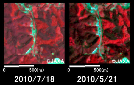
Fig.4: Enlarged images of Amami, Kawachinagano city, Osaka pref.
(1 square kilometer, left: Jul. 18, 2010; right: May 21, 2010).
The acquired images were provided to the followings,
- Cabinet Secretariat
- Cabinet Office
- National Police Agency
- Fire and Disaster Management Agency
- Ministry of Defense
- Ministry of Land, Infrastructure, Transport and Tourism
- National Institute for land and Infrastructure Management
- Geospatial Information Authority of Japan
- Japan Meteorological Agency
- Japan Coast Guard
- Public Works Research Institute
- Wakayama Prefecture
JAXA plans continuous observation of this area.
* Advanced Visible and Near Infrared Radiometer type 2 (AVNIR-2):
AVNIR-2 is a visible and near infrared radiometer for observing land and coastal zones.
It provides 10-m spatial-resolution image and 70-km swath on the ground. The pointing angle of AVNIR-2 is +44 and - 44 degrees. This image was acquired by 8 degrees east.
JAXA EORC