Image Library
Emergency observation of concentrated heavy rain in Hiroshima Prefecture by AVNIR-2 onboard "Daichi" (ALOS) (2)
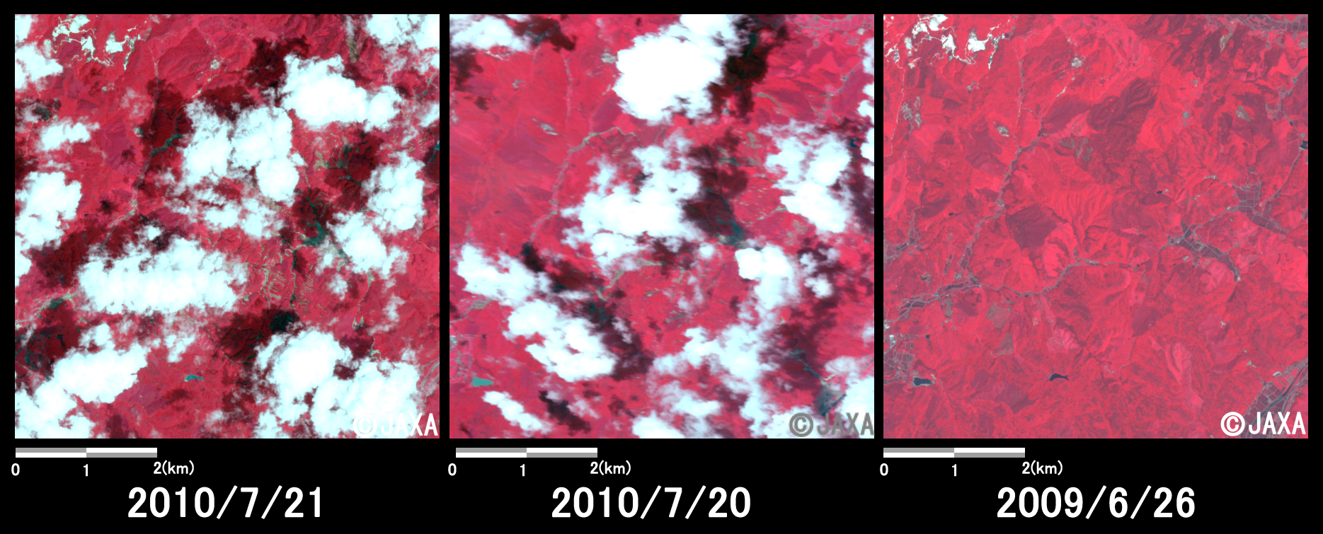
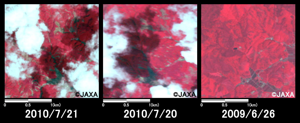
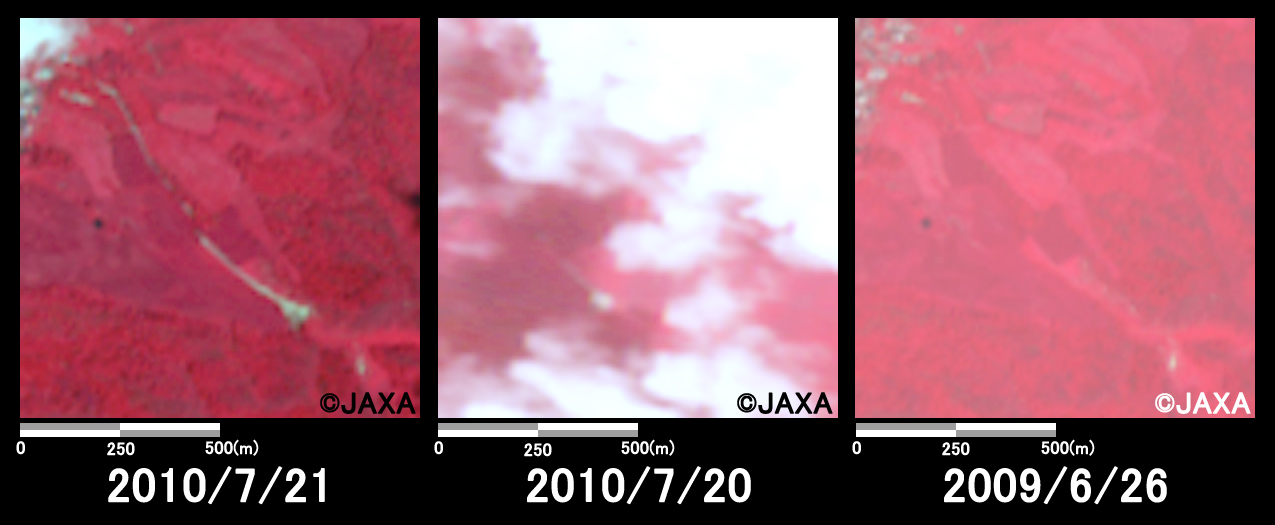
The record-breaking concentrated heavy rain which fell 72-millimeter per hour, occurred at Shobara city in Hiroshima Prefecture on July 16, 2010 (JST), this caused great damage due to floods of river and mudslides.
The Japan Aerospace Exploration Agency (JAXA) has performed the emergency observation to monitor the state of the damage by the Advanced Visible and Near Infrared Radiometer type 2 (AVNIR-2)* onboard the Advanced Land Observing Satellite (ALOS, "Daichi") at 11:09 on July 21, 2010 further to July 19 and 20, 2010 (JST).
Fig. 1 shows an observed image of AVNIR-2 at 11:09 on July 21, 2010 (JST). It is the true colored composite using band 3, 2 and 1 of AVNIR-2. Although there are several clouds, fortunately there is no cloud at the areas of landslide disaster and the ground could be seen.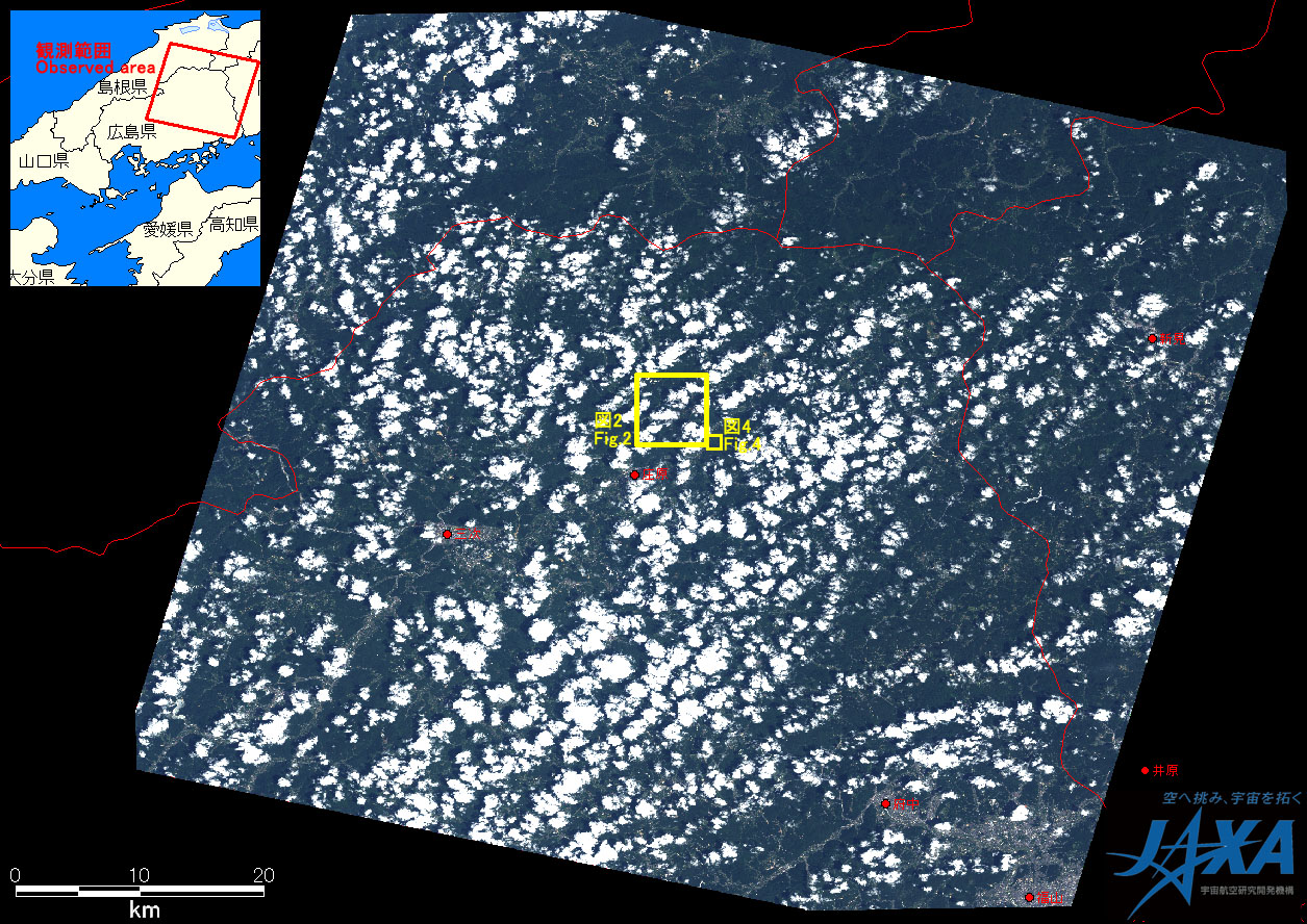
The acquired images were provided to the followings,
- Cabinet Secretariat
- Cabinet Office, Government of Japan
- National Police Agency
- Fire and Disaster Management Agency
- Ministry of Defense
- Ministry of Land, Infrastructure, Transport and Tourism
- Japan Meteorological Agency
- Japan Coast Guard
- Public Works Research Institute
JAXA plans continuous observation of this area.
* Advanced Visible and Near Infrared Radiometer type 2 (AVNIR-2):
AVNIR-2 is a visible and near infrared radiometer for observing land and coastal zones.
It provides 10-m spatial-resolution image and 70-km swath on the ground. The pointing angle of AVNIR-2 is +44 and - 44 degrees. This image was acquired by 15 degrees east.