Image Library
Follow-up Observation of the Magnitude 8.8 Earthquake in Chile, 2010 by AVNIR-2 onboard "Daichi" (ALOS)
At 6:34 (UTC) on February 27, 2010, a magnitude 8.8 earthquake occurred off the coast of middle Chile in the South America. The Japan Aerospace Exploration Agency (JAXA) had performed emergency observations of the Advanced Land Observing Satellite (ALOS, "Daichi") to monitor the state of damage caused by the earthquake (see references) .
The Advanced Visible and Near Infrared Radiometer type 2 (AVNIR-2) onboard the ALOS was activated on 14:51 (UTC) of April 14, 2010 to determine the state of recovery there.
Fig. 1 shows an observed image around the capital city of Santiago in Chile. It assigned channel 3, 2, and 1 for red, green and blue colors as true color composite, therefore white colored areas show snow. Middle image of Fig. 2 shows an observed image on February 27, 2010, which was taken 8 hours after the disaster. In comparison of the images, the middle image indicates black smoke northwestern in Santiago.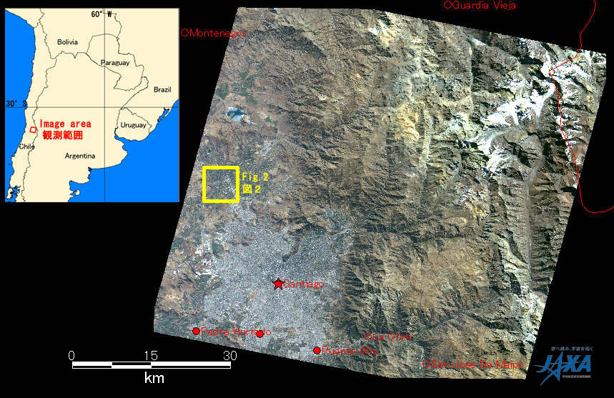
Fig.1: AVNIR-2 image with 0.0 degree pointing angle acquired on 6:32 of April 14, 2010.
Yellow square shows location of Fig. 2.
(Click to view enlarged image)
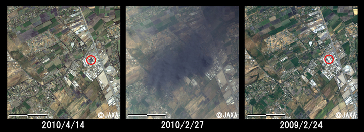
Fig.2: Enlarged image around fire disaster
(6km square, left: April 14, 2010; middle: February 27, 2010 (after disaster); right: February 24, 2009 (before disaster)).
(Click to view enlarged image)
Fig. 2 shows the enlarged images taken by ANIVR-2, where were the darkest smoke area in the image acquired on February 27, 2010 (middle), same one on April 14, 2010 (left) and just before the disaster on February 24, 2009 (right). In comparison to the image before the disaster, the area on April 14, 2010 seemed to be destroyed by fire. Thus, there is likely to be occurred fire disaster at building like factory. However, it is not sure that this fire disaster was concerned with the earthquake.
Reference
JAXA EORC