 |
 |
NASDA,NASA
September 12, 1996

 |
 |
NASDA,NASA
September 12, 1996
Allen Kenitzer
Goddard Space Flight Center, Greenbelt, MD
(Phone: 301/286-2806)
Hideo Hasegawa/Hiroyuki Ikenono
National Space Development Agency of Japan, Tokyo
(Phone: 81-3-5470-4127)
RELEASE: 96-188
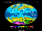
Daily global mapping of the Earth's ozone layer from space has resumed
with
the acquisition of the first image from the U.S. Total Ozone Mapping
Spectrometer
(TOMS) instrument aboard the Japanese Advanced Earth Observing Satellite
(ADEOS) on September 12.
"We are extremely pleased with the quality of this first image" said P.K.
Bhartia, TOMS Project Scientist at NASA's Goddard Space Flight Center,
Greenbelt,
MD. "We're looking forward to continuing our monitoring of the global ozone
situation and especially the upcoming season in the Antarctic."
ADEOS continues the series of TOMS total ozone and volcanic sulfur
dioxide
observations that began with the Nimbus-7 satellite in 1978 and continued
through
the operation of a TOMS on a Russian Meteor-3 satellite, until that
instrument
ceased functioning in December 1994.
Data from another TOMS instrument flying on the recently launched NASA
TOMS-Earth Probe spacecraft complements the global ADEOS data by providing
high-resolution imagery of atmospheric features related to urban pollution,
biomass burning, forest fires, desert dust and small volcanic eruptions, in
addition to ozone measurements.
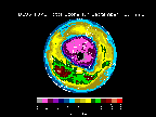
In recent years, the depleting effects of industrial chlorofluorocarbons
(CFCs) on ozone were demonstrated through the sudden appearance of the
Antarctic
ozone hole and other, more gradual losses in global ozone. The principal
mission
of TOMS/ADEOS is to monitor global ozone trends during the period when CFC-
related depletion is predicted to be near its maximum.
"Stratospheric concentrations of chlorine from CFC's are expected to
peak
near the end of the century and then decline as a result of the Montreal
Protocol,
" said Arlin Krueger, Principal Investigator for the TOMS/ADEOS mission.
"TOMS/ADEOS will help us track this prediction. It also will continue to
measure
the concentrations of sulfur dioxide in the atmosphere in the wake of volcanic
eruptions, thus extending the existing database of more than 100 eruptions,
including Mt. Pinatubo in 1991 and El Chichon in 1982."
TOMS complements four of the Japanese instruments on ADEOS. The
Improved Limb Atmospheric Sounder measures the vertical profiles of ozone and
other trace gases in polar regions, while the Interferometric Monitor for
Greenhouse Gases measures ozone beneath the orbital track, and the
Retroreflector
In Space determines trace gas profiles as ADEOS passes over ground-based laser
stations. In addition, TOMS will provide information to help correct data from
the Ocean Color and Temperature Scanner for atmospheric absorption at visible
wavelengths.
ADEOS is an international global change research mission of the
National
Space Development Agency of Japan (NASDA) that includes instruments from the
U.S., Japan, and France, with investigators from many other. The satellite is
a
key part of an international environmental reserch effort that includes NASA's
Mission to Planet Earth (MTPE), a long-term, coordinated research program to
study
the Earth as a global environmental system. The goal of MTPE is to allow
humans
to better understand natural environmental changes and to distinguish between
natural and human-made changes and impacts.
MTPE-related data, which NASA distributes to researchers worldwide, is
essential to helping humans make better informed decisions about their
environment.
During its lifetime on Nimbus-7, TOMS helped make "ozone" a household
word
through its false-color images of the Antarctic ozone hole. Even after 14
years of
operating the instruments, TOMS scientists are testing new concepts such as
the
monitoring of absorbing aerosols that are produced in fires, duststorms, and
volcanic eruptions, estimation of ultraviolet (UV-B) radiation at Earth's
surface,
and detection of volcanic hazards to aviation. TOMS measures ozone by
comparing
the level of ultraviolet light emitted by the Sun to that scattered from the
Earth's atmosphere back to the satellite.
The first TOMS/ADEOS image is available electronically at the
following URL:
The TOMS program is managed by the Goddard Space Flight Center,
Greenbelt, MD, for NASA's Office of Mission to Planet Earth, Washington, DC.
Comments to: adeossupport@eorc.nasda.go.jp
Last Update: 17 September 1996