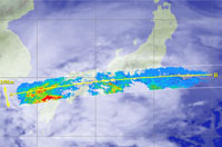
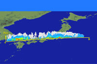
These figures show the horizontal cross section at a height of 2.5km and three-dimensional image acquired by the TRMM Precipitation Radar (PR) which passed over Japan from 03:10 to 03:15 (JST) on Jan.15,1998. The red or yellow horizontal layer indicated by over Chugoku and Kyushu areas is a melting layer where snow melts into rain and much stronger radar reflectivity is observed than from real rain.